GPS: Position, Time and Distance
Receiver position is calculated from the position of satellites and the distances to them. Distance is calculated from the time a radio signal travels between satellite and receiver. But how do we know the satellite’s position and how is travelling time determined? Satellite positioning – I know what it is, I know what it does, but how does GPS work?
How satellites measure distance
Basically, satellite positioning is a trilateration problem. From the known position of three satellites and the measured distances between them and the receiver, coordinates of receiver position can be calculated. The distances are determined by multiplying the travelling time of the radio signals by the speed of light. But how accurate is GPS tracking and how is a continual check to be kept on the positions of satellites? Their orbits are not completely deterministic but fluctuate due to celestial gravity forces. Since radio signals travel at a speed of 300,000km per second, an inaccuracy in time measurement of 1 nanosecond (one billion part of a second or 10-9 second) induces a distance error of 30cm, whilst with geodetic receivers we can achieve accuracy at the centimetre level.
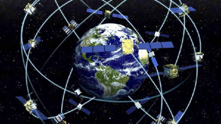
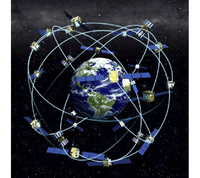
Position and time of GPS Satellites
The ground segment monitors and controls the position of GPS satellites. With a master station at Falcon Air Force Base, Colorado Springs, USA, and remote stations in Hawaii, Ascension Island, Diego Garcia and Kwajalein, the satellites are tracked and monitored for 92% of the time. For two daily windows lasting one-and-a-half hours, each satellite is out of contact with the ground stations. The main station acts as data processing centre for all information, including that collected at the remote stations. Orbit coordinates are continuously determined by triangulation. Comparing the time of the satellites’ four atomic clocks with similar devices on the ground provides information on time errors. When a satellite drifts slightly out of orbit, repositioning is undertaken. The clocks may also be readjusted, but more usually information on time errors is attached to GPS signals as correction factors. The computed corrections, time readjustments and repositioning information are transmitted to the satellites via three uplink stations co-located with the downlink monitoring stations. In this way, all the GPS satellites are able to continuously attach corrections to the parameters they send out, which include ephemeris data, almanac data, satellite health information and clock correction data.
Distance and difference
The travelling time of a radio signal may principally be determined as the difference between arrival time at the receiver and time of transmission by the GPS satellite. As already described, to achieve positional accuracy at centimetre level the time difference has to be determined at sub-nanosecond level. To attain such accuracy would require atomic clocks in both receiver and satellites. Atomic clocks are, however, rather too expensive for the everyday consumer. The solution found by clever engineers is simple and effective. Because they are few, only the satellites are equipped with costly atomic high-precision clocks having an annual drift of just 2 nanoseconds. The GPS receivers are equipped with relatively cheap, quartz clocks accurate up to 10 nanoseconds a day. This accuracy is sufficient to allow it to be assumed that time bias between the receiver clock and those onboard the satellites is the same for all satellites. So that just one time parameter is actually unknown: the time bias. This can be determined by measuring the travelling time of radio signals not to three but to four satellites. Discrepancies among the calculated coordinates of receiver position (which should, of course, be absent, it concerning just one location) provide sufficient information accurately to determine time bias. Every land surveyor knows that for purposes of reliability one should gather more measurement data than is actually needed to solve the unknowns. Therefore all geodetic GPS receivers will require data from at least five satellites before release of coordinates giving receiver location.
How GPS works
As surveyors make use of it every day, it is essential to know how GPS works. We hope this article provided you with some of the basic need-to-know knowledge for geomatics professionals.
This article was contributed by Henk Key and Mathias Lemmens

Value staying current with geomatics?
Stay on the map with our expertly curated newsletters.
We provide educational insights, industry updates, and inspiring stories to help you learn, grow, and reach your full potential in your field. Don't miss out - subscribe today and ensure you're always informed, educated, and inspired.
Choose your newsletter(s)


