How Can Establishing a UAV Fleet Help Your Business Take off?
Best Practices in Drone Mapping
Read this interview with five pioneers in the field for insights into the best ways to introduce drones into your business model.
Unmanned aerial vehicles (UAVs or 'drones') are increasingly becoming the solution of choice and have indeed proven to be a disruptive force across a multitude of industries in the past decade, including for the geospatial surveying profession. But will drones really provide all the answers to your mapping challenges? We interviewed five pioneers in the field to take us beyond the hype, explaining the lessons they have learned from the frontline and sharing their insights on the best ways to introduce UAVs into your business model.
What type of work can UAVs be used for?
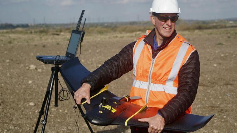
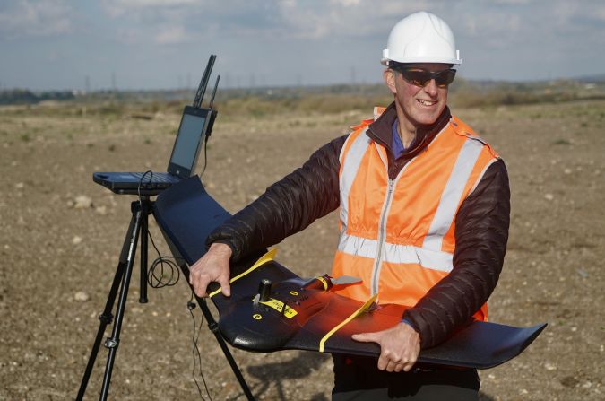
UAVs can serve mapping and surveying professionals in a broad variety of ways. They are useful to collect spatial data like volume numbers as well as for a suite of other end products such as orthophotos, detailed elevation models, contour lines, 3D PDFs or special plans with cut-and-fill areas. They can also be used for projects such as those involving land subdivision, terrain inspection for construction and signalling terrain borders. In the UK Andrew Griffiths, founder of Droneflight, uses “the senseFly eBee for survey work, and a variety of multi-rotor drones for survey and inspection including Aerialtronics’ Zenith, Parrot Bluegrass, DJI M210 and the Flyability Elios”. These devices have proven critical to the success of a number of large infrastructure and development projects including tunnelling, quarries, rail, highways and waste disposal. UAVs have been used to collect data, but also to provide clients with “a better understanding of project progress”. At Lerch Weber SA in Switzerland, a seven-strong team uses drones for volume calculation and orthophoto purposes, whilst SRDP Consulting Inc, a Philippines-based enterprise, also uses drones for infrastructure inspection work as well as topographic mapping. Tom Wren, UAV manager at Plowman Craven, deploys drones for surveying, inspections and building information modelling (BIM), declaring that “UAVs are a real game-changer,” offering more efficiency and a wider range of business opportunities.
Why should you consider incorporating UAVs into your business model?
UAVs are ideal for projects that require a high degree of rigour and detail, since they have the capacity to map individual locations or macrostructures/terrains with great precision. Since UAVs can obtain high-resolution photographs, they make metric orthophotography, vectoral mapping schemes and detailed cartography including hydrographic and topographic maps possible. UAVs are relatively small-scale pieces of equipment and can fly very close to the ground in comparison with manned aircraft. They are nimble, agile and manoeuvrable, capable of hovering and of accessing spaces that are too difficult, hazardous or unsafe for people to reach, which enables observation and recording in previously inaccessible areas. In rail projects, for example, surveys are ideally “conducted with no personnel on the tracks and no need for track closures, and in as short a time as possible to minimize disruption”, making drones the perfect solution for such projects at Plowman Craven. Using UAVs can significantly reduce danger to people and damage to equipment, as well as minimizing disruption in the target environment, thus keeping the overall risk to projects low.

UAVs: saving time and money
The cost-saving aspect of using drones is appealing to a lot of businesses, considering that even the most sophisticated drones cost significantly less than a helicopter or small aircraft. Whilst the initial outlay for a new UAV fleet and associated hardware, software and training might be significant, ultimately it could prove more cost effective, giving your company an advantage. Armin Weber of Lerch Weber SA found that conducting gravel pit surveys conventionally in the past was less economical and the business lost clients, whereas “with drones, we could be very competitive and we won back some of our clients; now, we have even more than before”. All the experts interviewed agreed that investing in drones has been valuable, with Plowman Craven’s Tom Wren stating that his company wins “a lot of projects because of the breadth of deliverables and the timeframes we can deliver in. So from that point of view, [our] investment is constantly being paid back”.
Weber explains some of the efficiencies enabled by drones: “In the past, our fieldwork flow included the setup of the ground control points. It was always very time-consuming. Today more and more drones are RTK/PPK capable, [which] reduces the need of ground control points dramatically”. UAVs can be as steady as ground survey tools, saving time spent re-measuring due to human error. Drones can be deployed more quickly than organizing a helicopter or aeroplane flight, whether your own or contracting someone to do it, plus regularly flown routes can be automated. Hence, UAVs present a clear opportunity for surveying enterprises to save time and money.
Starting can be the hardest part: ‘ready, set, drone’
Weber cautions to “be aware that not everything works right away”. It is important to be open to the idea of testing and refining, considering that the perfect setup might take time, but it is certainly worth pursuing. Griffiths agrees, suggesting that businesses start small, obtaining “a cost-effective drone that can be used for training and experimentation initially”, and then using this process to increase knowledge and start to gain expertise.
When considering UAV fleet size, Weber suggests numerous factors that must be taken into consideration, including:
- Mission size: large or small? Is there a single point of interest?
- Could it be worth flying several drones simultaneously to reduce operation time?
- What about a spare drone in case of a failure?
- What meteorological occurrences need to be taken into account (e.g. like wind, rain or cold weather)?
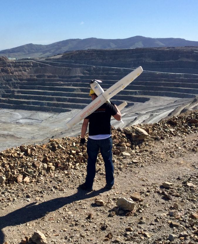
Jakub Karas, director of UAS at UpVision, and Joel Ferrer Cruz, president of SRDP Consulting, both warn that having a backup drone is essential; purchasing at least two of each type will ensure the business is covered should there be complications. Cruz notes that “rotary drones are ideal for mapping areas that have limited space, while fixed wings are more suitable for larger areas”. He recommends leaning towards reliable rotary drones to begin with, as they tend to cost less. Depending on the scope of planned work, Karas would establish a small fleet with a multicopter that has the possibility of changing sensors, a VTOL (vertical take-off or landing) and a smaller drone such as a Phantom 4 Pro. When selecting equipment, it makes sense to avoid drone systems that are unproven or not well reviewed within the industry.
Alternatively you could rent a drone to test it out first, or outsource some drone work to gain a better understanding of a drone before investing in it yourself. “Seeing a competent practitioner working with it, and being able to work with them, is an invaluable qualification tool,” says Griffiths. The more practical and thorough your understanding is, the better your investment is likely to be: “Take small steps and validate the benefits” is his expert advice. The other experts agree, with Wren suggesting that commissioning an experienced consultant to set up your systems is beneficial.
How to choose which UAV to incorporate into your business model
All five experts agree that it is absolutely critical to do a lot of your own research rather than accepting vendor promises at face value. Griffiths emphasizes that a vendor demonstration is never enough to gain true insight into the real-world limitations of a drone. Cruz says he talks to multiple manufacturers directly to get to know and compare their products, including by attending international expos which he sees as a way of staying updated on the latest trends and developments. Weber recommends relying upon established products and asking experienced users for their insights; drone user groups can help with feedback from their experience. Some UAV manufacturers offer webinars, which can be a useful way to collect a lot of intelligence about a range of different devices before committing to a major purchase, but it is even better to invite manufacturers or one of their users to engage with your team on a specific project. Griffiths found that this “enabled us to gain real practical working insight into the unit and the realities of operating it”.
Questions you should be considering include:
- What is the intended use of the drone?
- What are the technical requirements?
- What are the real-world limitations of the drone?
- What are the regulatory requirements (such as aviation and other health & safety issues)?
It is critical to investigate your country’s requirements in depth. In the Philippines, for example, the company, the personnel and each individual drone must be registered with and certified by the country’s civil aviation authority. Complying with regulatory procedures is essential and comes at a cost, so a comprehensive budget that takes into account hardware, software, training, data processing and regulatory requirements is critical. Make sure you get things right before scaling up, too.
To cloud or not to cloud? That is the question…
A drone can be described as ‘just a device’ – one that is being employed to acquire geospatial data. Then it all comes down to how to handle that data. Cloud-based processing for geospatial data has been around for a while. There are pros and cons that need to be weighed up. For example, the cloud is relatively straightforward to adopt for those new to UAV data processing, and can be an interesting option that pays off with a small number of orders. Griffiths considers cloud processing an “excellent entry point” since it simplifies the processing, and teams can obtain good illustrative results even without comprehensive training. However, Tom Wren (Plowman Craven) contends that jobs can be cheap to process in the cloud but take significant time, while turning work around rapidly is often key for clients.
Conversely, in-house processing demands major computing power and memory, and processing several thousand photos can easily take up days of staff time. This said, some clients prefer a comprehensive package with in-house processing included, enabling businesses to take control of the quality, timing and resolution of data collection and providing their own data rather than contracting a third party to do so. Joel Ferrer Cruz notes that once the business starts experiencing more demand, “local image processing software would be more efficient as it gives more capacity and flexibility to the image processing team”. The experts also note that there are limitations to the cloud, with both Griffiths and Weber agreeing that, if UAVs are planned to be part of your long-term business model, the cloud will probably not offer enough sophistication to be able to meet all your needs. As Griffiths says: “Cloud-based solutions don’t have the options to improve the quality of a photogrammetry model, use of GCPs is sketchy at best, and there is usually no ability to merge models together”.
The importance of staff training
It is helpful for operators to have photogrammetry or field survey skills, and due to the expense of a drone fleet (and the accompanying hardware and software) it is important to invest significant time in staff training. Not all training is created equally, though, and some courses focus more on issues such as air law than on drone operation, so understanding the limitations of training is essential. Mishaps can occur, and it is worth investing considerable time to ensure adequate training is provided, drones are taken seriously as a data collection tool, rules are obeyed and the mission checklist is followed closely. As Tom Wren states, “drones make everything easier… as long as you know what you’re doing”.
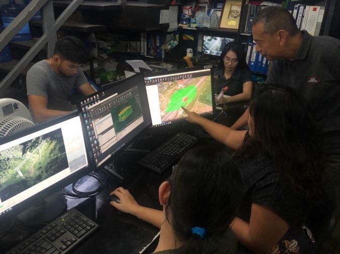
Andrew Griffiths suggests that skilling up dedicated staff to become drone specialists could be a wise decision for the business, and these experts could then “manage the equipment, suppliers and support the use of the drones in the wider organization”. All five experts emphasized how critical comprehensive training is, with Griffiths explaining that his team at Droneflight undertook multiple evaluation exercises of real-world jobs to gain a complete understanding of the potential of the equipment, investing heavily in their drone pilots. This approach of deploying and completing a task from beginning to end gives pilots responsibility for the quality of the project deliverables for clients, which works for the business. Jakub Karas has organized his team in a similar way, finding that it improves the process when pilots and operators have insight into the processing, planning and mapping components of the work. Other experts differ on this, with both Wren and Cruz preferring to maintain employee specializations. They keep the data collection and data processing teams separate but ensure that the data processing specialists are exposed to drone work in order to appreciate the spatial context of the image acquisition component.
The limitations of UAVs
It is important to consider the limitations of drones. Most drones are small, which means a limited payload (i.e. carrying capacity) for critical components like cameras and sensors. Another limitation is that most drones rely on battery technology, meaning fairly short flight times. Whilst longer-lasting batteries can extend flight time, these tend to be heavy, adding to the payload, and data collection activities across large areas are therefore likely to require multiple flights or manned aircraft. Reliance on GPS technology, which is susceptible to interference from various wireless sources, is another challenge.
Cruz reminds us that UAVs are not the answer to every geospatial surveying problem, stating that in his experience they cannot cover all his company’s mapping needs: “For large and difficult areas, we still opt to use manned aircraft. Urban areas and high-wind areas such as mountains are more safely and efficiently mapped using manned aircraft”. It is worth thinking about the ways in which drones could expand the range and increase the quality of the products and services offered by your business as a complementary method rather than seeking to completely replace traditional methods with drones.
Conclusion
Cruz reflects that “drones have become a real game-changer for us”, noting the positive effect they have had on his business in terms of opening up new opportunities and enhancing the products and services delivered to clients. Griffiths notes that “when the use of drones becomes part of the ‘business as usual’ of an organization, the benefits of the technology can really be leveraged”. Thanks to the use of UAVs for surveying projects, the results obtained are likely to be more up to date, detailed and indeed far superior than those obtained with traditional tools. UAVs equipped with remote sensors can offer mapping and surveying companies unprecedented capabilities to achieve precision and accuracy, resulting in cost savings at both the data collection and data analysis levels. The impact that UAV technology is having on the geospatial industry is certainly disruptive, but it is important to navigate regulatory issues, seek expert advice, do your research and consider the challenges as well as the opportunities for your own enterprise.

Value staying current with geomatics?
Stay on the map with our expertly curated newsletters.
We provide educational insights, industry updates, and inspiring stories to help you learn, grow, and reach your full potential in your field. Don't miss out - subscribe today and ensure you're always informed, educated, and inspired.
Choose your newsletter(s)


