Hyperspectral Imaging for Agriculture Ready for Take Off
This article was originally published in Geomatics World.
A German company has developed a lightweight hyperspectral sensor suitable for mounting on a UAV with applications in agriculture, reports Richard Groom.
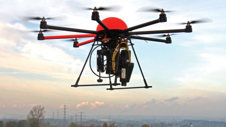
Hyperspectral and multispectral imaging is usually associated with satellite or aircraft imaging platforms, but German company Cubert has developed a sensor that, at 470g, is so light that it can be carried by a UAV. The combined system uses an Octocopter platform and is called Firefly.
Cubert’s UD-185 sensor uses full-frame imaging technology, which captures each frame in a millisecond and avoids the complications introduced when using scanning technologies for digital imagery. The data can be transferred to the ground station during the flight, making it possible to start analysis before leaving the site. It is also possible to view the data as hyperspectral video, in real time.
Each frame is 1000 pixels square and is able to record spectral properties for blocks of 20 × 20 pixels at a spectral resolution of 4 nm in the wavelength range 450 – 950 nm, using 125 channels. The result is what is known as a hyperspectral ‘cube’.
CubeWare has the Answers
The camera is controlled using Cubert’s Cube Ware software. This enables the operator to make all the necessary camera settings and calibrations, control the camera and carry out basic data analysis. It also includes an applications programming interface and source code for Mathlab and Python applications and there are filters enabling data to be output to envi, xls and text files. Operation of the helicopter is through separate controls.
Agricultural Revolution
It is possible to use photogrammetric techniques to produce 3D hyperspectral models from cube data and thence to calculate plant biomass, which is an area of active research for a number of Cubert’s customers. Precision agriculture is the area that holds most potential for this technology and the company sees UAVs as central to development. It enables capture of spectral information over large areas, which gives chemical information about the plants, crops and the soil.
By comparison with aircraft and spacecraft platforms, the combination of high-resolution camera and UAV gives scientists a cheap and especially flexible tool for acquiring hyperspectral data. The data can be used for research projects such as phenotyping, the study of plants, crops and their environment throughout the growing cycle. Cubert foresees that in a few years this will lead to farmers being able to design crops.
Crop Design
For crop design, it will be necessary to monitor frequently, different test breeds of a crop by analysing many test plots and a large number of plant properties, such as chlorophyll, lignin content, growth, water and so on.
In a few years, farmers will be able to order a detailed field analysis, which will give information about soil quality, fertiliser strategies, plant health, plant disease, biomass, yields, irrigation, etc. This analysis will be performed by a specialised service provider and will be cost effective for large agriculture field sizes as well as higher value crops, such as vines and tree nurseries, over smaller areas. First trials are expected to take place next year.
For this technology to become commonplace in the agricultural community, Cubert believes that three points have to be addressed:
- The UAV technology has to become autonomous; ideally a self-working device is needed, which samples data without user interaction.
- Both, the UAV and the hyperspectral technology have to become more affordable.
- Regulation of UAV operation for agricultural use has to be relaxed and permitted.
The company sees great advances in UAV technologies and automation. It is currently being used by pioneers and the cost of the technology will reduce as there is greater take-up and more systems are deployed. Agriculture is a vital field and feeding of the next billion people on earth is one of the world’s greatest challenges. It is not just a question of more mouths to feed, but also there will be competition, due to depletion of oil resources, between growing crops for agriculture and for biofuel. As a result, food prices rise.
Agriculture is already changing and will have to change further to meet these challenges. Cubert believes that the current scheme of UAV regulation is holding agricultural development back: it should be realistic for the actual risks involved.
In summary, agricultural fields will become our new oil fields, so using the available agricultural areas to the maximum is absolutely vital. Cubert believes that they have the right sensing technology for precision farming when it is needed.
High-tech Start-up
Cubert GmbH is a high-tech start-up company which was founded in 2011 as an offshoot from the University of Ulm. Their work on the hyperspectral full-frame imager was done in collaboration with Prof. Bareth and his workgroup from the University Cologne. Spectral imaging is a highly interdisciplinary field so the founders of the company came from very different fields. Rainer Graser has developed the core technology since 2005. Dr René Michels joined the project in 2010 after finishing his PhD studies on scattering influences in spectroscopy and Dr András Jung then joined the team as an expert in remote sensing applications.
This article was published in Geomatics World January/February 2014

Value staying current with geomatics?
Stay on the map with our expertly curated newsletters.
We provide educational insights, industry updates, and inspiring stories to help you learn, grow, and reach your full potential in your field. Don't miss out - subscribe today and ensure you're always informed, educated, and inspired.
Choose your newsletter(s)


