Improving efficiencies with panoramic basemaps
Bringing a new dimension to visualization and analysis
A new basemap combines 360-degree aerial imagery and precise location data, providing an immersive new way to view and experience the built world from every cardinal direction.
Basemap imagery offerings have been relegated to vertical and oblique visualization for decades, but a new basemap now combines 360-degree aerial imagery and precise location data. Providing an immersive new way to view and experience the built world from every cardinal direction, it is garnering considerable attention in the GIS world. Utilizing an immersive basemap allows for an unparalleled level of actionable area familiarization and precise detail for analysis. Moreover, it is the most intuitive way to visualize data.
Aerial imagery is much more than just a picture from above; it provides a different perspective of what can be seen on the ground. Aerial imagery encompasses everything from photographs that were taken from hot-air balloons in the 19th century to modern aerial photography captured from an airborne craft, excluding satellite imagery. Although aerial photography was initially little used because of the high cost and risk, the introduction of powered flight and – more recently – unmanned aerial vehicles (UAVs or ‘drones’) has changed everything. Aerial imagery is now used by almost every industry in some way, shape or form – whether for planning, reconnaissance, mapping, analysis, development and/or education. From a public-sector perspective, aerial imagery is critical for government functions in maintaining civil society and providing economic, social and environmental sustainability.
What is a basemap?
The term ‘basemap’ is commonly used in the geographical information systems (GIS) world and refers to a collection of GIS data and/or ortho-rectified imagery forming the background detail and providing context for a map and its users for orientation purposes. For example, clicking on the ‘satellite’ option on a digital map will display a vertical imagery basemap. From Google Maps to Zillow, many consumer applications leverage basemaps to better acquaint users with their location.
Vertical/orthogonal imagery
The most familiar form of an aerial photograph is vertical photography, such as is used on real-estate websites or in apps so that users can looked at a property from above. They offer the ability to zoom in and out. They can also be scaled, allowing objects and distances to be measured for identification purposes. The images are captured directly over a project or area, whereby the camera lens is perpendicular to the ground (pointing straight down). Vertical images are excellent for making measurements, displaying wide areas of land, street views, detailed analysis and as an overall map substitute. What vertical imagery lacks is height-of-ground perspective which makes it difficult to interpret ground truth of a vertical image – with little or no relief, there will always be a divergence between what can be interpreted from the image and the actual situation on the ground.
Oblique imagery
The use of oblique imagery had become a standard in basemaps in many civil and mapping applications thanks to the ability to easily capture imagery from manned and unmanned aerial vehicles. Oblique imagery is typically collected at an angle of 20-45° to the ground (anything tilted more than three degrees is considered oblique.) This angle allows viewers to see and measure not only the top of an object, but the sides as well. Compared to traditional vertical imagery, oblique views are more associative of what is seen from the ground, thus making it easier for non-expert users to interpret data from the imagery. Oblique photographs are helpful to reveal the topography in relief, which is useful for identifying geological or archaeological features.
There are two distinct types of oblique aerial photographs: high obliques and low obliques. Both types can further be categorized as wide-shot photos or close-up photos. Low obliques are normally taken with a camera slanted at an angle of about 30° from the vertical point. They cover relatively small areas and therefore do not include the horizon. High obliques are normally taken with a camera that is slanted at an angle of approximately 60° from the vertical point. In contrast with vertical photographs, this level of tilt produces much more relief, making it easier to identify natural or manmade features.
360-degree aerial imagery
360° aerial imagery (also known as panoramic imagery, photospheres, VR photography or bubble-oriented imagery) has been around for a little while, but it has only recently gained real traction as a new basemap layer as different industries are realizing the potential it brings to decision-making and overall immersive experiences. With companies such as YouTube, Google (Street View), Apple (Look Around), Facebook and other large brands already leveraging the technology in their platforms, this technology may have staying power.
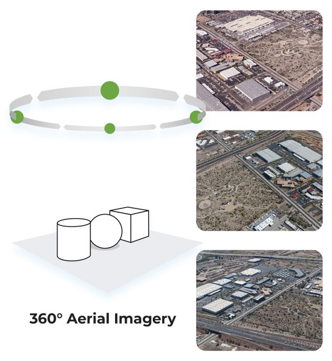
360° aerial imagery allows users to view more than a snapshot of the world below. The common cardinal directions (North, South, East and West) can be surpassed so that users can navigate through the viewer as if they were controlling the aerial camera themselves. 360° aerial imagery can be captured by fixed-wing aircraft, helicopters and UAVs. The sweet spot for this type of imagery collection is about 30m to 915m above ground level (AGL). 360° imagery is both engaging and informative for the end user since it provides new vantage points of the built world as well as providing an exhilarating experience from the new perspectives it affords.
In order for this type of imagery to be useful as a basemap layer, it takes much more than just the 360° imagery; each pixel of the high-resolution 360-degree image must be georectified with extreme precision – and this is where the challenge lies. Georectifying a vertical image or even an oblique is pretty straightforward, since the fixed coordinates can be georeferenced with ground control points (GCPs) in an automated fashion. When dealing with 360° images, however, it is necessary to identify a set of points in each image for which the latitude and longitude coordinates are known, and then use them to ‘warp’ the image into a map projection. Needless to say, this entails a lot of work for an entire city, state, province or country – especially considering that a 360° image has a useful range of roughly 2.4km.
Once georectified and processed, this geoenabled imagery can be paired with digital maps such as Apple, Google or Mapbox. Alternatively, it can be included in cloud-based software such as Esri’s ArcGIS or Autodesk’s BIM360 to collect, process, manage and analyse all types of data in industries such as real estate, retail, construction, insurance, entertainment, travel and others.
Example: award-winning storytelling from above
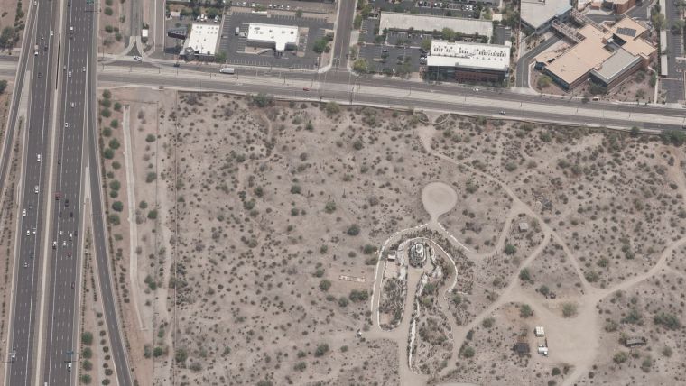
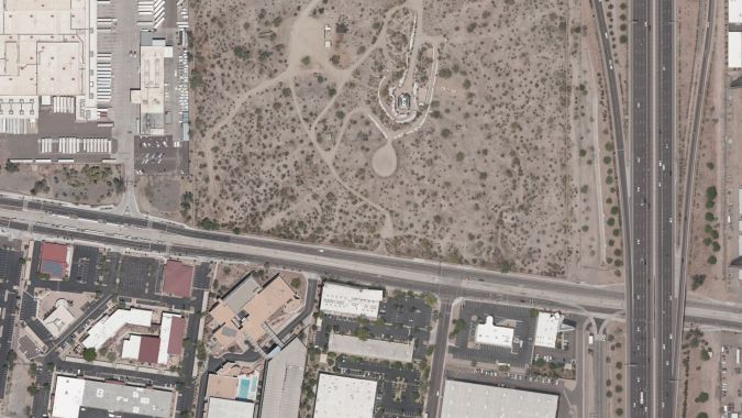
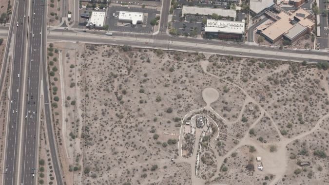
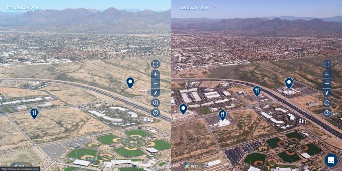
The Maricopa Associations of Governments (MAG) is a regional agency in Arizona, USA, that conducts planning and makes local-government policy decisions that affect the lives of everyone in the greater Phoenix region. The planning area encompasses roughly 17,000km2. For years, MAG has relied on vertical and oblique aerial imagery to make better decisions and create solutions in the areas of transportation and economic development, but has recently started utilizing georectified, 360° imagery from AerialSphere to better analyse, plan and market the cities, towns and counties it supports.
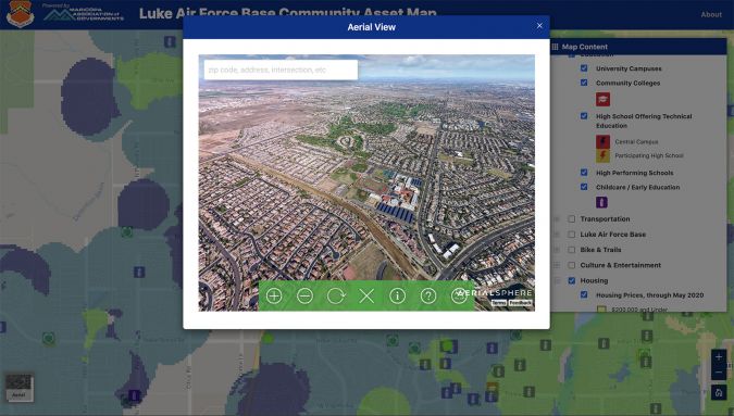
A big portion of MAG’s work revolves around enticing new residents and businesses to help grow local economies. MAG recently integrated 360° imagery into its mission-critical online tool, an interactive map viewer for Luke Air Force Base and its Targeted Growth Management Plan. Luke AFB was recently chosen to be the new training home of the F-35A Lightning II fighter jets, resulting in base personnel growing by an additional 2,234 service members by 2026. The 360° imagery gives users authentic, powerful views of the surrounding area as well as details about workforce, transportation, education and recreation in the West Valley. MAG’s use of 360° imagery as a panoramic basemap layer resulted in it being awarded the 2020 Best Regional Plan Award from the American Planning Association.
Conclusion
360-degree aerial imagery is opening up an entirely new way to explore the built world. Besides creating exciting and engaging experiences, the location data also allows for the imagery to become actionable and highly informative, resulting in an incredibly intuitive way to visualize data. Panoramic basemaps are fuelling a new way for all types of businesses, governments, municipalities and consumers to digitally experience the physical world and have the potential to change how maps will be viewed and used.

Value staying current with geomatics?
Stay on the map with our expertly curated newsletters.
We provide educational insights, industry updates, and inspiring stories to help you learn, grow, and reach your full potential in your field. Don't miss out - subscribe today and ensure you're always informed, educated, and inspired.
Choose your newsletter(s)


