Indoor Mapping Solution with Floor Plan Builder
Orbit GT has released its premiere indoor mapping product with a broad range of functionalities. Indoor Mapping v17 is a solution for point cloud and imagery management, floor plan building and advanced feature extraction. On top of that, it supports all major manufacturers of indoor mapping hardware systems.
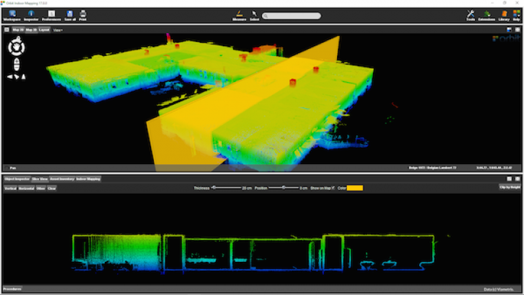
Orbit Indoor Mapping supports Lidar systems such as ViaMetris, TIMMS, NavVis, Vexcel Panther, Pegasus:Two, through a generic import interface. Imagery and point cloud are perfectly aligned, according to Peter Bonne, CEO of Orbit GT. Using Orbit’s extent viewing capabilities, one can easily switch between different views. The standard slice viewer has been further tweaked to make the extraction of a floor plan extremely simple, he added.
Furthermore, manual, semi-automated and advanced feature extraction tools are available integrated within workflow optimised procedures.
For more information on Indoor Mapping v17 see here.

Value staying current with geomatics?
Stay on the map with our expertly curated newsletters.
We provide educational insights, industry updates, and inspiring stories to help you learn, grow, and reach your full potential in your field. Don't miss out - subscribe today and ensure you're always informed, educated, and inspired.
Choose your newsletter(s)


