Intergeo Preview 2011 (2)
Everyone who truly matters in the geomatics and surveying-related business will be travelling to Germany ¨C or more precisely to the Bavarian city of Nuremberg ¨C in the last week of September this year: Intergeo 2011 is being held in the Nuremberg exhibition centre (N¨¹rnbergMesse) from 27th to 29th September. The organisers are expecting some 17,500 visitors from more than 80 countries around the world to attend the trade show, while the associated conference is likely to welcome over 1,500 visitors ¨C and you will probably be among them!
(Continued from Part 1 A - Joseph Attenberger)
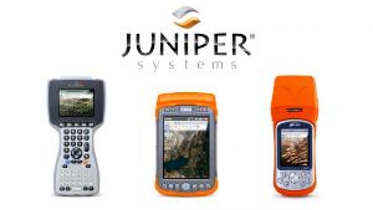
Juniper Systems
Marking its third consecutive year at the event, Juniper Systems will be presenting its full line-up of ultra-rugged geospatial solutions for surveying, mapping and GIS data collection applications. Products on display will include the Allegro MX with GPS, the Archer with the sub-meter XF101 DGPS receiver, and the one-of-a-kind Mesa Rugged Notepad, featuring the largest display available on a Windows Mobile handheld, as well as integrated GPS, camera, and 3G cell modem. Inquiries regarding becoming a Juniper Systems business partner are welcomed. www.junipersys.com
Stand no. 7.A81 GPS handhelds.
Kanq
Kanq product overview.
Founded in May 2001, Kanq Digital is one of the leading surveying and mapping service providers with both GIS software and GNSS hardware products in China. Its hardware products include handheld GIS data collectors V2 and K2, RTK system eFix R2, and the Rock GNSS receiver with high quality and accuracy which will be presented at Intergeo. Information will also be available to visitors and distributors on the new Kanq CORS system for engineering surveys, earthquake monitoring, topographic mapping, etc. www.kanq.com.cn Stand no. 7.E36
Leica Geosystems
Leica Geosystems will present its latest products of the Leica Viva Series, especially the TS15 Robotic Total Station with Image Assisted Surveying. Also, the Zeno GIS series has been considerably enlarged with the GG02 plus SmartAntenna, and the new rugged CS25 TabletPC. This year, two new 3D laser scanners were introduced to the market: the phase-based scanner HDS7000 (1 million points/sec) with increased measurement range, and ScanStation C5 entry-level model. The high-precision Leica TS30, the GeoMoS Monitoring Solution, Reference Station Receivers and Antennas, Leica AT401 CMM for industrial use, and the new Leica 3D Disto complete the product range.
Leica Geosystems will also show its new range of services: SmartNet Germany GNSS RTK Network, Leica Active Assist for online support in the field, and Leica Exchange for fast data exchange between field and office.
For the first time both companies, Leica Geosystems and Z/I Imaging, will present their complementary airborne product portfolio on a common booth. Most of their products were launched this year. And, in line with tradition, some brand-new products will be unveiled when the doors to Intergeo 2011 open. www.leica-geosystems.com Stand no. 7A.C7 TS15 Robotic Total Station.
Logic Instrument
Logic Instrument, a worldwide leading supplier of rugged mobile computer and customised solutions, will present its latest tablet PCs, PDAs and notebooks, designed to face outdoor conditions and to survive the harshest of environments.
Also on the stand will be Logic Instrument's GIS software partner, who runs the latest ESRI software on the company's computer products. Founded in 1987, Logic Instrument offers experience in rugged outdoor computing as well as electronic and mechanical engineering. The company's products are its base for building customised solutions, tailored to its clients' applications. www.logic-instrument.com Stand no. 7A.B63
Designed to face outdoor conditions.
Lorienne
Lorienne will introduce its new suite of cartographic production software: LorikSoftware 3.1. The new release comes with highly advanced features for the most demanding quality contour lines, elevation spots and hill shading. Other new features include cartographic generalisation and a PostNAS format reader (format used for national data in Germany). All enhancements and innovations result in finer tuning and better efficiency for the production of all kind of maps. Lorienne anticipates technology changes and is currently integrating mobile and web mapping solutions. www.lorienne.com Stand no. 7.B13
M.A.P.
New for the aerial survey industry, M.A.P. will be presenting its Eternity archiving system as a cost-effective, safe and permanent way to save digital files for the long term. There are no 100%-safe digital storage systems. If files (images) need to be kept for 10 years, 20 years or even more than 100 years, then the Eternity system is the only option available. The Eternity 105 system uses state-of-the-art RGB lasers to write digital image data onto microfiche-format films - 105 x 148mm. Up to 3.6 GB of data can be written onto one colour microfiche, providing enough storage capacity for saving even the largest digital aerial image formats together with metadata. The creator of the Eternity 105 system, Dr. Daniel Fluck from Pro Archive AG, Switzerland, will be at the M.A.P. stand to discuss the benefits and explain all technical details. www.maginnity.com Stand no. 6.D50
Maptek
Maptek will be presenting its full range of I-Site products. I-Site systems combine highly accurate 3D laser scanning hardware with advanced point cloud processing software which is applicable for all survey applications. Ease of set up, portability, rapid and safe data acquisition, and powerful, in-built processing and modelling tools are all hallmarks of Maptek laser scanners. The I-Site 8800 laser scanner, I-Site studio software and the new I-Site 8400 laser scanner will all be on display, representing the next generation of scanning hardware. www.maptek.com Stand no. 7.B57 Maptek I-Site 8800 laser scanner.
MAVinci
MAVinci offers completely automatic UAVs (Unmanned Aerial Vehicles) for easy and fast acquisition of aerial images, orthophotos and 3D models. Gaining a fast, detailed overview of construction sites, disaster areas, etc. or surveying objects such as development areas or waste disposal sites is easy due to fully automatic take off, landing and flight. The company provides a complete, ready-to-use system (UAV with autopilot, software, camera) that allows everybody to obtain aerial images, orthophotos and 3D models simply. Due to MAVinci's advanced autopilot technology, everybody can learn to control and land the UAV in just a few hours. Besides the complete orthophoto UAS, the company offers variable sensor platform UAS for customer-specific remote sensing data. The customer can mount their own sensors weighing up to 20 kg on board the UAVs. www.mavinci.eu Stand no. 6.A8
Autonomous MAVinci micro airplane. MetaSensing
Proprietary of a high-resolution radar technology developed thanks to many years of experience, MetaSensing is a fast-growing high-tech company offering a wide range of airborne remote sensing services based on the Synthetic Aperture Radar (SAR) technique.
The company's innovative radar sensors are operated by small airplanes, allowing a sensible cut to the high operational costs of traditional airborne campaigns for environmental assessment, homeland security and infrastructure monitoring. MetaSensing will be displaying its range of versatile sensors and added-value mapping services. www.metasensing.com Stand no. 7.E40 Radar interferogram obtained with a MetaSensing sensor operated on board a Cessna 182.
Mettenmeier
Mettenmeier will be presenting its new, ultra-rugged ARMOR X10gx tablet PC. The ARMOR X10gx is the successor to Mettenmeier's ‘Colibri X7 protect' and sets a new standard in survivability and performance. It is also the company's lightest 10-inch tablet ever, at only 2.2 kg including battery. Its ultra-rugged chassis is certified to the MIL-STD 810G and IP 67. The device promises impressive sunlight viewability with an exclusive energy-efficient LCD display which is offered as dual mode (pen and touch input). It also comes with a 2 MP camera and SSD technology. www.robust-pc.com www.mettenmeier.de Stand no. 7A.D16
PC ARMOR X10gx tablet.
Microsoft
With its operations based in Graz, Austria, and sales and support teams in North America, Microsoft's UltraCam Group unit brings more than two decades of photogrammetry expertise to Microsoft's Bing Maps business unit. The division is responsible for the highly successful line of UltraCam digital aerial mapping systems that include the UltraCamLp, UltraCamXp and UltraCamXp Wide Angle and the recently announced UltraCam Eagle digital photogrammetric sensors. Rounding out the UltraCam mapping systems offering is the UltraMap workflow software system that provides an automated project-based colour balancing module and additional quality control tools. The Microsoft team will be demonstrating the company's products, including the new UltraCam Eagle, during the event. www.microsoft.com/ultracam Stand no. 7.A61
The new UltraCam Eagle ‘ultra-large' format digital aerial camera.
Mitsubishi Electric Corporation
Mitsubishi MMS-X, with maximum configuration of six cameras, four laser scanners and three GPS antennas, can measure the entire perimeter from the vehicle. The absolute accuracy of the laser point is 10 cm (rms or ‘root mean square') and the relative accuracy is 1cm (rms).
Because of its consistently high accuracy, the Geospatial Information Authority of Japan has singled out Mitsubishi MMS as the only company authorised to make 1:500 scale road maps in the whole of Japan. The number of Mitsubishi MMS in Japan already totals more than 50 vehicles and it has realised a paradigm shift in the survey field. www.mitsubishielectric.com Stand no. 7.D96
Mitsubishi MMS-X640. Myzox
1-Inch mini-prism, MG-1000SP.
Myzox Co., Ltd., under the brand name Myzox, is an all-round Japanese manufacturer of products for surveying, civil engineering and construction. Founded in 1950, it was the first manufacturer to develop and launch all-aluminium-made levelling staves in the world. The company's main product line comprises a wide range of prisms, aluminium levelling staves, tripods, surveying instrument accessories and GPS accessories, rotating lasers and line lasers. All Myzox products are manufactured under strict company quality control and are currently exported to 38 countries. www.myzoxjapan.com Stand no. 7.F16 NAV Group
NAV Group is a high-tech enterprise, specialised in the development of both inertial navigation systems (based on FOG, RLG and MEMS) and professional satellite navigation products (GPS/GLONASS/BD-II receiver). With its dedication to the core technology of inertial/satellite navigation, NAV Group has the capability to fulfil various requirements in the field of navigation systems. Thanks to many years of hard work, NAV Group has become a leading company in the domestic navigation industry and even reached the first-class level of technology providers in the world. www.nav.cn Stand no. 7.H21
NAVKA
NAVKA is a GNSS-supported low-cost multi-sensor system for mobile platform navigation and object-georeferencing. This joint R&D project of the SatNav MIT BW forum (www.galileo-bw.de) is supported by the Ministry MFW and industry of Baden-Württemberg, Germany. The central research institution IAF/HSKA develops robust algorithms for low-cost GNSS-supported and autonomous multi-sensor MEMS design-optimised platforms for precise navigation. The validation of the algorithms, working in a deep coupling of the redundant raw sensor data, is based on the simulation software SIMA. The algorithms and navigation platform developments are focused on air/water/land UAV and robotic systems, orientation-giving and mobile object-georeferencing systems, as well as seamless outdoor and indoor navigation (e.g. with smartphones). www.navka.de Stand no. 6.D37 and 6.B80
Nexteq
Nexteq Navigation Corp. specialises in Global Navigation Satellite System (GNSS) technology and product development. Nexteq believes that single point GNSS positioning still has room for improvement through the use of Precise Point Positioning (PPP) technologies. Such improvements in accuracy and reliability will have significant benefits for numerous commercial products and applications. Consequently, Nexteq's development efforts have led to its software, licensing and data service to benefit both partners and end users. By partnering with GNSS manufacturers, Nexteq also provides affordable devices with simplicity and precision ideal for field work. www.nexteqnav.com Stand no. 7.A2 Optech
Optech is the world leader in the development, manufacture and support of advanced Lidar and imaging-based survey instruments. With operations and staff worldwide, Optech offers both standalone and fully integrated Lidar and camera solutions in airborne terrestrial mapping, airborne laser bathymetry, mobile mapping, mine cavity monitoring and industrial process control, as well as space-proven sensors.
Optech delivers rugged Lidar and camera systems with reliable support and service - anywhere, anytime - backed by the industry's leading global 24/7 support. www.optech.com Stand no. 7.C47
Optech's Lynx Mobile Mapper. OrthoGraph
OrthoGraph has just announced the latest version of its floor plan surveying software that is now compatible with the iPad. In addition to supporting the iPad platform, it has several other new features including intelligent ArchiCAD wall support, freehand sketching and a 3D preview of the measurements on site, enabling rapid transition from 2D on-site sketching to a 3D BIM (Building Information Model) on a computer. All measurements are reflected graphically on the fly, and assisted measurements take care of fully measured drawings. Results can be printed or exported to AutoCAD/Revit, ArchiCAD or SketchUp directly, achieving new levels of ease and speed in building surveys. The OrthoGraph team will be providing interactive demonstrations on the stand. www.orthograph.net Stand no. 7.E60
OrthoGraph for iPad. OxTS Inertial+.
OxTS presents the Inertial+, a compact inertial navigation system specifically designed to make survey applications more accurate, reliable, and quicker. The cost-effective Inertial+ is designed to deliver continuous, jump-free position data even in the most difficult GPS conditions. The turnkey Inertial+ system can also measure roll, pitch and heading which is useful for correcting camera data or Lidar, making it the perfect solution for all land-based and airborne mapping or surveying projects. All INS+GPS solutions from OxTS are easy to use, simple to operate and deliver precise, high-rate, low-latency, real-time data to rely on. www.oxts.com Stand no. 7.A71
Pacific Crest
Pacific Crest radios provide wireless data links for RTK positioning and remote sensing. These broad spectrum transceivers offer up to 35W of power and over-the-air link rates as high as 19,200 bps. Pacific Crest is a leader in high-performance data links for the geomatics industry. It will be presenting the latest addition to its radio family, ADL Uplink. Positioning the ADL Uplink on the edge of internet access enables surveying to continue in cellular shadow zones and is the most reliable way to extend the range and reliability of internet-based RTK corrections. www.pacificcrest.com Stand no. 7.A105
The latest addition to the radio family, ADL Uplink.
Penmap.com
Penmap.com will be launching three new products. With its new Stonex S9 GNSS II, Penmap will show the world's most intuitive GNSS system, tracking GPS+GLONASS+Galileo satellites using Trimble's latest GNSS technology. This technology is keenly priced to maximise its appeal to new users. Meanwhile, the new Stonex R9 robotic total station aims to redefine robotic optical surveying, making total station surveying more intuitive and productive. Both instruments are powered by the latest version of Penmap encore Mobile Geodata software, running on Windows Mobile PDAs and Windows 7 tablet PCs. www.penmap.com Stand no. 7A.F49 and 7A.F61
Phenix Suokaya
Phenix Suokaya is an affiliated company of Phenix Optical Group which was founded in 1965 and is the largest comprehensive producer of optical instruments in China. With the help of advanced processing and testing instruments, Phenix Suokaya covers the complete range of surveying instruments, including total stations, theodolites, autolevels, laser plumb aligners, surveying accessories, etc. The technology of the company's products is not only based on the Phenix Optical Group's 40 years of experience in surveying technology but also includes input from technologists from Japan. www.phenixsky.com.cn Stand no. 7A.D20 Pitney Bowes
Pitney Bowes Business Insight (PBBI) aspires to be the vendor of choice for enterprise and public sector organisations who are seeking to enable lifetime relationships with their customers or citizens. The company's software and services are designed to increase the value of every customer communication while also delivering operational efficiencies in order to build lifetime customer value and profitability.
Optimum business performance requires organisations to be Location Intelligent. The MapInfo Professional product line provides dynamic and flexible tools to combine location-based data sets with the ability to map and visualise location-based data. The result is actionable intelligence which can improve an organisation in a variety of ways. Examples include: improving operations (such as site location), improving marketing, understanding risk and strategic planning. Representing a faster, easier way to create, share and use maps, the world's premier desktop mapping application can be tried for free. www.pbinsight.eu Stand no. 7.E51
MapInfo Professional screenshot.
Point Grey
Point Grey will be featuring the Ladybug family of spherical cameras. Using six 2MP CCD sensors, the Ladybug3 collects video for up to 80% of the full sphere at up to 1600 x 1200 pixels with each of its six sensors. This makes the Ladybug3 ideal for high-resolution 360° visual coverage for applications such as GIS visualisation, street-level viewing, geographical mapping and other location-based visualisations. Each Ladybug system comes with a feature-rich SDK offering real-time image acquisition, processing, stitching and correction necessary to integrate multiple camera images into full-resolution digital spherical and panoramic videos. www.ptgrey.com Stand no. 7.A56 Ladybug3: high resolution spherical video camera systems. proNIVO Ranger 3 studio front 441 antenna SurveyPro.
Thanks to the StepDrive motor control, the robotic total station Focus 30 of SpectraPrecision makes taking measurements quicker and more precise. Now with its new controller: Ranger 3.
The Ranger 3 features a 5-megapixel camera to take pictures of the survey points. The software ‘Survey Pro' saves and links them to the measured points.
Another innovation is the included GPS which is compatible with the ‘Geolock' function of Focus 30. The GPS can also be used independently of the Focus 30. Having an accuracy of about 1 m, it is ideal for GIS measurements, enabling avoidance of the costs of data services (GSM module integrated). www.pronivo.de Stand no. 7.D31
Pythagoras
Pythagoras is a state-of-the-art CAD and GIS software application for land management, road design, civil engineering and land surveying. It is one of the most powerful and intuitive CAD and GIS applications ever designed. Powerful tools allow users to quickly design projects in a user-friendly way. Constant research and development guarantees that Pythagoras meets the requirements of the fast-changing CAD and GIS market. www.pythagoras.net Stand no. 7A.G16 RapidEye
RapidEye is a provider of high-quality, high-resolution satellite imagery and derived geoinformation products. With a constellation of five EO satellites, RapidEye images over 4 million km2 of Earth every day, and has amassed over 2 billion km2 of imagery in just over two years of commercial operation. With an unprecedented combination of wide area repetitive coverage and five metre pixel size multi-spectral imagery, RapidEye is a natural choice for many industries and government agencies. www.rapideye.de Stand no. 7A.C51 RapidEye satellite image of irrigation fields in Saudi Arabia.
RICS
RICS (Royal Institution of Chartered Surveyors) is the largest organisation for professionals in property, land, construction and related environmental issues worldwide. The organisation promotes best practice, regulation and consumer protection to business and the public. With 120,000 members in over 100 countries, RICS is the leading source of property-related knowledge, providing independent and impartial advice to governments and global organisations.
RICS offers the only truly internationally recognised professional qualification for surveyors and has offices around the world. RICS Europe represents over 4,000 professional members across the EU and beyond, and offers a cross-border qualification which can be used to compliment local professional licenses and professional membership. Over 3,000 of our members specialise in the geomatics sector, either as professional or technical members. RICS offers the chartered designations of Land, Hydrographic and Engineering Surveyor within the geomatics profession. www.rics.org Stand no. 6.D13
RIEGL
RIEGL will present the latest developments in its VMX-series: the VMX-250 mobile scanning system now with a completely new design. The system using two RIEGL VQ-250 ‘Full-Circle' laser scanners is packed into a new, compact housing, providing excellent aerodynamics and protection for cables and connectors. Also launched is the VMX-450, providing a significant increase in measurement performance.
In addition, the high resolution, high precision 3D terrestrial laser scanner RIEGL VZ-4000, providing an extremely long range of up to 4,000 m, will also be introduced. www.riegl.com Stand no. 7.C13
The newly designed VMX-250. Safe Software
Safe Software will be displaying its FME solution for spatial data transformation, enabling data to be used and shared. Staff will be on hand to discuss visitors' data challenges, demonstrating how FME can enable them to overcome a wide range of interoperability challenges across 250+ supported formats, and advising attendees on how FME can make it easier to achieve INSPIRE compliance. www.safe.com Stand no. 7A.C39
Scalypso
The engineering company Dr. König from Potsdam, Germany, develops the software Scalypso. Scalypso is an innovative software application with tools for the rapid reconstruction and documentation of terrestrial 3D-laser scanning data.
The main aim is to develop tools for large-scale support of existing scanner hardware and the connection to practice-relevant CAD interfaces. The reconstructed CAD data will be transformed - in real time - to Microstation or AutoCAD.
The different Scalypso modules are:
- The Scantra module: allows registration of 3D scan data automatically without any targets.
- The Pipe module: enables reconstruction of technical buildings. The data can be transferred to AutoCAD / Microstation and/or as 3D .xml data for further application (e.g. isomet, Aveva).
- The BIM module (Building Information Modeling): allows detection and reconstruction of building geometries. www.scalypso.de Stand no. 7.C10
Scandinavian Laser Survey
SLS has downsized the aerial Lidar concept to offer low set-up costs yet high-quality data, making aerial Lidar scanning an attractive alternative in places and projects where it was previously too expensive. In the downsizing process, every aspect of traditional aerial Lidar surveying has been reviewed. The result is a portable system that can be carried by ultra-light airplanes or helicopters. The ultra-light solution including aircraft weighs less than 150 kg, enabling it to be transported in standard suitcases onboard airlines or in the back of a car. www.lasersurvey.org Stand no. 7.A71
senseFly
senseFly is a Swiss company developing, producing and distributing small unmanned aerial vehicles for independent remote sensing. With its swinglet CAM, senseFly is revolutionising GIS practices by providing a complete solution, from image capture to automated creation of orthomosaics and DEMs.
From take-off to landing, the swinglet CAM is fully autonomous. The artificial intelligence incorporated in the senseFly autopilot continuously analyses data from the onboard inertial sensors and GPS while taking care of all aspects of the flight mission. senseFly will present its new and innovative mini-drone solution for mapping and GIS applications. www.sensefly.com Stand no. 7.H14 Swinglet CAM. SETL
The Tianjin SETL Survey Equipment Co., LTD. is one of the biggest manufacturers of surveying instruments and accessories in China. The company produces various auto levels, electronic theodolites, laser theodolites and surveying accessories. This year, the company is particularly promoting its latest laser theodolite design. www.setlsurvey.com Stand no. 7.C61
SJDJ theodolite. S+H Systemtechnik
S+H Systemtechnik is the main Trimble distributor in Germany for mapping & GIS and marine products, and the Trimble Competence Center for survey products. The company is specialised in the distribution of geodetic systems, 3D scanner and GIS data logging systems. Customers include trading and industrial companies as well as public authorities and schools. The main business focus ranges from consulting, training and support to the point of service, special applications and individual programming. S+H Systemtechnik prides itself on offering qualified service to ensure promptness and reliability, and its team of qualified specialists is on hand to answer questions concerning the right equipment or to provide corresponding know-how. www.sh-systemtechnik.de Stand no. 7.A94 SimActive
SimActive is the developer of Correlator3D software, a patented end-to-end photogrammetry solution for the generation of high-quality geospatial data from satellite and aerial imagery. Correlator3D produces precise digital surface models (DSM), digital terrain models (DTM) and orthomosaics. Powered by GPU technology, Correlator3D accelerates the project completion timeframe. SimActive will be showcasing its new 3D feature extraction module. The technology allows the semi-automatic vectorisation of objects such as buildings from DSM. 3D features can be extracted in minimum time and with limited user input, leading to a highly simplified process. Visitors will be able to see live demonstrations of Correlator3D on the stand. www.simactive.com Stand no. 7.F1
Complex 3D building features extracted semi-automatically. SPAR Point Group/SPAR Europe
SPAR Point Group's annual conferences in Europe, Japan and the United States attract professionals hungry for new 3D imaging and processing solutions that drive efficiency, boost productivity, increase safety and mitigate project risk for engineering, construction, manufacturing and security. SPAR Europe will take place 8th-9th November 2011 in The Hague (The Netherlands). The event will include keynoters Blaine Tookey from BP and Ed Lantz from Vortex Immersion Media and over 40 additional presenters, as well as mobile mapping demonstrations, user meetings, technical seminars, FIATECH meeting, exhibits and much more. Visitors to the SPAR Point Group stand will be able to register for the event at a considerably discounted rate. www.sparpointgroup.com/europe Stand no. 7A.D63 Spheron SceneCenter screenshot.
Spheron-VR, regarded as a global pioneer in HDR (High Dynamic Range) camera technology, will be demonstrating its HDR camera system and SceneWorks Framework visual content management software. The camera automatically captures 360º spherical HDR imagery in a single scan and, together with the software, offers the production of onsite scene documentation. SceneWorks includes tailored solutions for areas such as crime scene documentation, security, critical infrastructure as well as industrial industries such as plant, construction and other facility management applications. Meanwhile, SceneCenter documentation allows virtual access to a scene or site from anywhere, at any time. The technology allows clients to connect spherical imagery, take 3D photogrammetric measurements and interconnect other digital asset information. www.spheron.com Stand no. 6.D11
Surveyors Express
Surveyors Express is known as one of the largest second-hand tachymeter (total stations) dealers in the European Union, but has more to offer: it will be displaying its range of patented prism poles, GPS pole systems and prisms of German manufacture. Since 1995, Surveyors Express has sold more than 2,200 metal prisms in Germany alone. The KTR-SE prism of Zeiss and Trimble and, from 2004 onwards, the GPR-SE prism from Leica are unique due to their full metal construction and the favourable price. The used materials (aluminium, stainless steel, brass) do not rust at all nor are they susceptible to cracks and fractures, which is a common problem for plastic prisms. www.vermessen.de Stand no. 7.B74
GPR-SE metal prism.
Taxus SI
Taxus SI is a computer company focused on the development of information systems for the forestry and environmental protection sectors and GIS services. Its unmanned aerial vehicle is called AVI. The basic system elements are: AVI-1 airplane, composite structure, fully mechanical wing (flaps), electric engine, wing span of 3.5 m, autopilot, with equipment including two compact cameras or 1 LSR camera. Flight endurance is one hour and one flight area is four to five sq km. WebGIS software is available in the web browser, allowing users to access digital maps and databases from any location. In Poland, WebGIS has been implemented as the central WebGIS system for Polish State Forests. WebGIS is mainly based on open-source technology. www.taxussi.com.pl Stand no. 6.D52
The AVI unmanned aerial vehicle. Terrasolid Terrasolid combines mobile and airborne Lidar to deliver accurate 3D city models.
TerraScan, TerraModeler, TerraMatch and TerraPhoto form a fully integrated software family to process airborne and mobile laser data (Lidar) and images enabling read-in, 3D view, calibration and classification of the points. Images and laser points support each other during the process. Final delivery products are classified point clouds, ground surfaces, contours, transmission lines, 3D city models and true-orthos. www.terrasolid.fi Stand no. 7.C46
Trimble
Trimble will be showcasing its complete portfolio of positioning solutions for land surveying , deformation monitoring, architecture, cadastre, roads and tunnels, railway, seismic, spatial imaging, GNSS infrastructure, mapping and GIS, mobile data capture, aerial mapping and photogrammetry, positioning services and more.
This year's theme - Success Found Here - will focus on three principal components that help organisations establish and secure a pathway to continued success:
- Collect: systems for locating, capturing and storing information.
- Share: instant connections between the field, the office and clients.
- Deliver: complete solutions to interpret data and pass on meaningful information.
Visit Trimble, along with Applanix, Pacific Crest, HHK, OmniSTAR and distribution partners, to find everything
needed for success in the field of geomatics www.trimble.com Stand no. 7.A105
Trimble will be showcasing its complete portfolio. UniStrong
UniStrong is focused on the GNSS industry and is the leading GPS manufacturer and total solution provider in China. UniStrong has R&D, production, engineering, sales and service facilities. UniStrong's products and solutions cover various GNSS receivers, including multi-system navigation and positioning, high-accuracy surveying, mobile GIS, LBS, system integration and engineering as well as consumer products. www.unistrong.com Stand no. 6.D58 UVM Systems Using CityGRID for high-performance visualisation of a new railway line.
UVM (Urban Visualisation & Management) Systems develops and markets the CityGRID software suite, which is an efficient and cost-effective solution for the management and visualisation of 3D city models. UVM fulfils a wide range of needs, whether rapid modelling tools, data processing and editing, high-performance 3D visualisation, offering customers an end-to-end service utilising the company's expertise in data capture and modelling, and including the company's CityGRID software solutions which can be adapted to specific client requirements. www.uvmsystems.com Stand no. 7A.D45
VIAMETRIS
VIAMETRIS will be presenting its innovative software solution associated with mobile mapping systems called MAGELAAN: MApping, GEodesic data Localisation & Automatic ANalysis. Many aspects of the raw data taken from Lidar and camera sensors during a typical MMS survey can be processed automatically, saving huge amounts of time and money normally managed by post-process operators. It can automatically identify and locate a tag, such as road signs, road markings and other specific markings on the road, as well as being able to identify traffic barriers, bollards, post boxes, phone boxes, trees, road curvature, road widths, slopes (camber), sight distance and clearance. It allows for the absolute precision of 3D point localisation post processing. www.viametris.fr Stand no. 7.A20 VIASAT
Ever since it was founded in 1991, VIASAT GeoTechnologies has been delivering consulting and software engineering services that harness the power of geoinformation technology. VIASAT GeoTechnologies bases its success on the quality of its services, on the skills and growth of its personnel and on technological innovation. Its ability to build innovative solutions and conduct large-scale projects sets it apart. VIASAT GeoTechnologies relies on a team of 110 employees, forming one of the largest concentrations of multidisciplinary skills in the Canadian geomatics sector. The company's team of professionals comprises GIS and remote sensing specialists, engineers, IT specialists, surveyors, geographers and geologists. Its technical team specialises in geomatics, cartography, geodetics and electronics. www.viasat-geo.com Stand no. 7A.C51 VisionMap
VisionMap will be presenting its next-generation airborne mapping camera. The A3 Edge camera, with an exceptional footprint of 80,000 pixels, has by far the largest footprint in the industry. A3 Edge further improves A3's renowned imagery collection efficiency and in addition improves image quality. Along with the A3 Edge, VisionMap will present the new A3 LightSpeed automatic processing system, an end-to-end photogrammetric workflow that provides the fastest processing technology in the industry. A3 LightSpeed performs everything from aerial triangulation to final orthophoto production within a short time frame, providing an efficient solution for processing very large areas in high resolution. In addition, A3 LightSpeed is designed to support rapid response applications. www.visionmap.com Stand no. 7.C68
Waldinfoplan
Waldinfoplan is an ArcGIS server-based platform designed to support forest owner associations in Germany in wood logistics and forest management. The platform is operated by Genossenschaft für Waldwirtschaft eG, formed in 2009 by forest owner associations and other relevant organisations in the sector. It builds on an innovative user-driven business model and is supported by professional partners such as ESRI Germany. A solution supporting wood logistics and management of framework contracts bundling smallholder timber supply on a regional level is now operational. A forest management solution for operational planning including GIS-CRM services is to be released in early 2012. Waldinfoplan helps forest owner associations to improve the quality of their services, strengthen regional networks and partnerships and service their customers better through a consistent, workflow-oriented management of geospatial and attribute data. www.waldinfoplan.de Stand no. 7A.41
Use of Waldinfoplan outdoors.
Weatherdock The easyTERLOC.
Weatherdock, with its registered office in Nuremberg (Germany), is presenting a new, portable VHF locator which is totally independent of any GSM network and free of charge to use. The easyTERLOC (terrestrial locator) is specially developed for requirements in areas such as surface mining or local public transport to manage permanent object tracking. Weatherdock is specialised in manufacturing electronic security systems and navigation systems in the field of HF technology and is leading in the maritime sector. www.easyais.de Stand no. 7.A75
WUDA
WUDA Geoinformatics Co., Ltd. (WUDA-Geo) is the only high-tech company in China which can provide services covering the entire life-cycle of spatial data from fast acquisition through production and management to publishing and sharing. The company's innovative software products, namely GeoStar, GeoGlobe and GeoOne, are gaining in popularity worldwide. The company will be launching a new GeoOne module at the event: GeoCityModeling, an AutoCAD-based software for fast construction of highly detailed and measurable 3D city models from aerial and satellite images. www.geostar.com.cn Stand no. 7A.G20
Z_GIS
UNIGIS is the world's premier distance education initiative aiming at continuing professional development for GIS practitioners and individuals keen to embark on a career in this rapidly evolving and highly attractive discipline. UNIGIS MSc degrees and university diplomas are recognised throughout the GIS community where alumni are well established across technologies and industries. Online distance learning now is a tried-and-tested approach to combining lifelong learning with social and professional obligations. UNIGIS is the academic programme of choice for the highly motivated, hardworking and upwardly mobile future leaders in geospatial professions. www.unigis.net Stand no. 6.D72
Z/I Imaging
Hexagon Geosystems' newly formed Geospatial Solutions Division has brought together Z/I Imaging and Leica Geosystems Airborne Sensors. Both companies are renowned as the innovation drivers for the airborne sensor market and will display their complementary solutions for the first time on a common booth at Intergeo 2011. Their product portfolio includes the complete DMC II camera family and covers a range of new products with unique features, such as the recently released Z/I DMC II 250, the world's largest monolithic frame CCD sensor. www.ziimaging.com Stand no. 7A.C7
New Z/I Imaging DMC II 250 digital camera - including the world's largest monolithic frame CCD sensor.

Value staying current with geomatics?
Stay on the map with our expertly curated newsletters.
We provide educational insights, industry updates, and inspiring stories to help you learn, grow, and reach your full potential in your field. Don't miss out - subscribe today and ensure you're always informed, educated, and inspired.
Choose your newsletter(s)


