Interoperability Requires Sustainable Choices
Where the LADM and LandInfra Standards Meet
After many years of indecision about the right way forward with respect to LandInfra/LADM alignment, it is time to re-open the debate on the development of standardization in the domains of land surveying, land administration and infrastructure, according to the authors of this article.
The Land Administration Domain Model (LADM) is a conceptual standard developed by ISO. LandInfra is a conceptional standard with an encoding in GML (InfraGML) developed by the Open Geospatial Consortium (OGC). The two standards have partly complementary but also partly overlapping functionalities. Apart from InfraGML, there are several other implementation standards. This article is an attempt to re-open the debate on the development of standardization with future-proof choices in the domains of land surveying, land administration and infrastructure.
Land administration is by its very definition distributed among a host of different units. Efficient administration calls for the interoperability of information exchange, e.g. to implement the once-only principle of public information sharing. Usable standards reduce data exchange costs.
Distributed Responsibilities
Main land administration units include land registries and cadastres – linked to conveyors and surveyors, respectively. Improvement efforts may, roughly speaking, take two directions. The first is cooperation between institutions to achieve better services without changing the mandates, and the second is the merging of institutions – maybe with different professionals – under one umbrella. The latter has been known, but is often hampered by conflicting interests and traditions. The first direction is very feasible and has already been implemented in several countries under local standards. It allows a model for reaching out to other units of land administration – local government, environmental, infrastructure, spatial planning and taxation agencies – and utilities, as well as to the construction sector and the actors of the real estate market.
LADM Operationalization
The first edition of the LADM was published in 2012. Country profiles have been developed and are now being implemented in many countries, such as Colombia, Indonesia, Malaysia, Uganda and Scotland. LADM has been used quite widely and there are now about 30 countries known to be implementing or exploring the implementation of its parts (prototypes, etc.). However, LADM is just a generic conceptual model. Faster implementation also requires a methodology to develop country profiles and technical models (and the various implementations will continue to be quite diverse).The LADM has the functionality to distinguish the different institutions’ tasks and mandates and to align them with each other, all on a conceptual level. The second multipart edition of LADM is presently being developed and the draft consists of the following: 1) fundamentals, 2) land registration, 3) marine space, 4) land valuation, and 5) spatial planning. This will likely be supplemented with 6) implementation, as the intention is that LADM Edition II will also include the encodings and technical models towards LADM implementation and operationalization (e.g. a further integration with BIM/IFC, Land XML, CityGML, LandInfra, IndoorGML, RDF/linked data or GeoJSON). This is quite a serious effort. But is all this really necessary? This is being discussed in joint meetings of the OGC Domain Working Groups on Land Administration and on Land and Infrastructure. Effectiveness and efficiency of land administration systems can be improved by optimizing the use of the open standards from ISO (LADM) and the OGC (LandInfra).
LandXML
Throughout the entire life cycle of built assets, open standards are needed for civil engineering (e.g. road and rail), surveying of infrastructure and property boundaries, and facility and asset management. In the early 2000s, volunteer organizations and individuals contributed to the development of LandXML, an XML-based, open data model for representing civil engineering and survey measurement data via LandXML.org. As of 2009, over 70 registered software products supported LandXML. LandInfra has a rich and comprehensive functionality in support of land surveying, and its land administration functionality relates to parcels, buildings and condominiums.
LandInfra/InfraGML
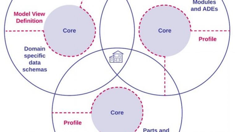
In the period from 2009-2013, no development of LandXML was observed. Moreover, the fact that it was not recognized as an official standard by any standards organizations such as OGC, Building Smart International (bSI) or ISO created confusion in the marketplace concerning the standard’s future. Therefore, a fresh OGC standard was developed (LandInfra) based on a subset of LandXML functionality. It was supported by a UML conceptual model, and was released in 2016. The encoding of LandInfra (InfraGML) was released in 2017. Like LADM, InfraGML is published in parts: 0) LandInfra Core; 1) LandInfra LandFeatures; 2) LandInfra Facilities and Projects; 3) LandInfra Alignments; 4) LandInfra Roads; 5) LandInfra Railways; 6) LandInfra Survey; and 7) LandInfra LandDivision. LandInfra is new and not yet widely used. However, investigations explored whether LandInfra could act as a link between building information modelling (BIM) and GIS, informed by use cases on 3D cadastres, subsurface geological modelling, and surveying (see Figure 1). LandInfra/InfraGML is a suitable implementation model for LADM.
Debate
LandXML is in widespread use by a large user community. The bSI and OGC recently formed a joint working group for the Integrated Digital Built Environment (IDBE) to achieve better software interoperability and data integration in the geospatial and built-environment domains. By coordinating activities, they aim to stimulate the use of the new, international standards such as LandInfra to replace the existing ones such as LandXML. That working group recently released a discussion paper which stated, among other things, the need for a publicly available and shared vocabulary of terms used in the standards. For the domain of land administration, such a tool is available in the shape of the Cadastre and Land Administration Thesaurus (CaLAThe), the fourth version of which is hosted at the OGC Definitions Service. IFC and CityGML are also relevant from the LADM perspective, especially in the context of 3D cadastres (see Figure 2).
Concluding Remarks
The LandInfra/LADM alignment needs to be on the agendas of ISO/TC 211, where the second edition of LADM is being developed, and of the joint meetings of OGC’s Domain Working Groups on Land Administration and on Land and Infrastructure. Part 6 of the second edition of LADM should include LandInfra/InfraGML (and maybe others) as an implementation standard. Land registry recording of condominiums is being used as proof of concept. Then the world will finally be able to benefit from this joint effort, after many years of indecision about the right way forward.
Further Reading
- ISO 19152:2012(en) Geographic Information — Land Administration Domain Model (LADM) https://www.iso.org/obp/ui/#iso:std:iso:19152:ed-1:v1:en
- Kavisha Kumar, Anna Labetski, Ken Arroyo Ohori, Hugo Ledoux& Jantien Stoter (2019) The LandInfra standard and its role in solving the BIM-GIS quagmire. Open Geospatial Data, Software and Standards https://doi.org/10.1186/s40965-019-0065-z
- OGC LandInfra/InfraGML https://www.ogc.org/standards/infragml
- OGC & buildingSMART International (2020) Built environment data standards and their integration: an analysis of IFC, CityGML and LandInfra https://portal.ogc.org/files/?artifact_id=92634
- Cadastre and Land Administration Thesaurus (CaLAThe) http://www.cadastralvocabulary.org/

Value staying current with geomatics?
Stay on the map with our expertly curated newsletters.
We provide educational insights, industry updates, and inspiring stories to help you learn, grow, and reach your full potential in your field. Don't miss out - subscribe today and ensure you're always informed, educated, and inspired.
Choose your newsletter(s)


