Launch of the Second SpaceDataHighway Satellite Scheduled
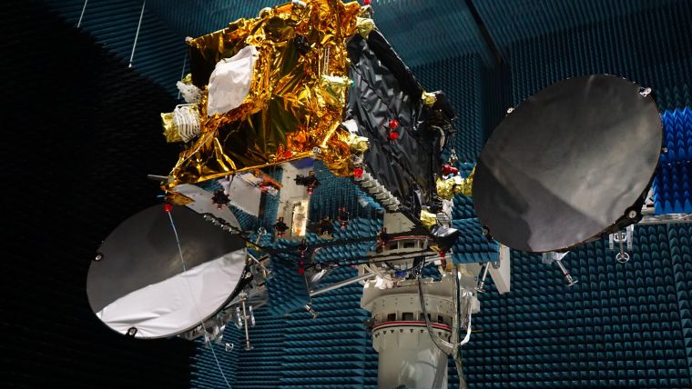
The EDRS-C satellite, the second node of the SpaceDataHighway network (also known as EDRS), will be launched into geostationary orbit at 31° East on 24 July 2019 by an Ariane 5 launcher. Once positioned above Europe, it will provide redundant back-up for the SpaceDataHighway system, double transmission capacity and be able to relay the data from two observation satellites simultaneously.
This second satellite will be joining EDRS-A which transmits on a daily basis the images of Earth acquired by the Copernicus programme’s four Sentinel observation satellites. Since it entered service in late 2016, it has achieved more than 20,000 laser connections. The reliability rate has reached 99.5%, and these successful connections have downloaded more than 1 petabyte of data.
Laser connection
“This milestone in the SpaceDataHighway represents a significant step forward in terms of capability. It’s an exciting time to see the next generation of secure connectivity develop,” said Evert Dudok, head of communications, Intelligence & Security at Airbus Defence and Space.
The SpaceDataHighway is the world’s first ‘optical fibre’ network in the sky based on cutting-edge laser technology. It is a unique network of geostationary satellites permanently fixed over a network of ground stations that can transmit data at a rate of 1.8Gbit/s.
SpaceDataHighway satellites can connect to low-orbiting observation satellites at a distance up to 45,000km, intelligence UAVs or mission aircraft via laser. From its position in geostationary orbit, the SpaceDataHighway system relays data collected by observation satellites to Earth in near real time, a process that would normally take several hours. It thus enables the quantity of image and video data transmitted by observation satellites to be tripled and their mission plan to be reprogrammed at any time and in just a few minutes.
A third communication node is to be positioned over the Asia-Pacific region by around 2024. Equipped with three laser terminals, EDRS-D will significantly increase the system’s communication capacity and considerably expand its coverage.
International Space Station
From 2021, the Pleiades Neo Earth observation satellites will begin to use the SpaceDataHighway. As of 2019, the system will also provide a fully European broadband communication service to the Columbus module of the International Space Station (ISS).
The SpaceDataHighway is a public-private partnership between the European Space Agency (ESA) and Airbus, with the laser terminals developed by Tesat-Spacecom and the DLR German Space Administration. Airbus owns, operates and provides commercial services for the SpaceDataHighway. The EDRS-C satellite platform supplied by OHB System AG will also be carrying a payload from Avanti Communications.

Value staying current with geomatics?
Stay on the map with our expertly curated newsletters.
We provide educational insights, industry updates, and inspiring stories to help you learn, grow, and reach your full potential in your field. Don't miss out - subscribe today and ensure you're always informed, educated, and inspired.
Choose your newsletter(s)


