Lidar Online: Analysing Earthquake Damage
Online Availability of Information is Invaluable After Natural Disasters
On 11th May 2011, two earthquakes with their epicentres in Lorca caused significant damaged in the region of Murcia, Spain. A new flight was carried out in the region three days after the earthquake to obtain more accurate Lidar data to supplement the data that was already available thanks to the PNOA project from 2009. The new Lidar data was also made available to anyone who needed it, allowing the damage to be assessed quickly and efficiently. In the case of a natural disaster, releasing data obtained both from flights beforehand and afterwards allows relevant users to create an inventory of the damage and detect any changes quickly and accurately using the appropriate tools.
Aware of the importance of high-level geospatial information for territorial knowledge, Spain's IGN (National Geographic Institute) collaborates in the PNOA project (Aerial Orthophoto National Plan) which produces complete coverage of Spain with submeter orthophotos every 2 years in collaboration with national and regional governments.
The PNOA project was created to obtain high-accuracy coverage in order to fulfil the objectives according to INSPIRE (annex II, subsection 3), whilst at the same time serving cartographic bases to create inventories (accomplishing annex I, II and III from INSPIRE). In the same way, a digital elevation model of the entire country was also required, having dual functionality: helping to both support the orthoprojection and to comply with subsection 1 from annex II of INSPIRE. The technical specifications of PNOA dictate a DEM of 5x5 m but, while it is accurate enough for orthoprojection, this is insufficient to generate the high degree of accuracy required for the SNCZI (National Cartography System for flooding areas). Because of such needs, Lidar data has been incorporated to improve the accuracy since 2009. Aware of available resources, PNOA decided that 0.5 points per square metre of density would satisfy the majority of Lidar applications at a sustainable cost for national coverage.
Assessing The Damage
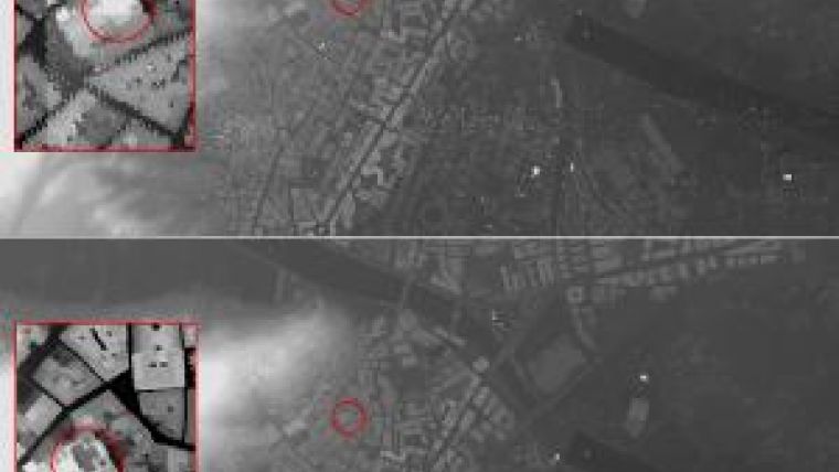
On 11th May 2011, two earthquakes occurred in the space of two hours, both centred around Lorca, Spain, and the second one with a magnitude of 5.1 Mw. The quakes caused seven deaths and significant damage in the Region of Murcia. Due to its proximity to the Eurasian and African plates, this city of 60,000 inhabitants is located in one of Spain's most seismologically high-risk areas.
Once the magnitude of the disaster was known, the regional government led the entire recovery programme, working quickly and efficiently. In the cartographic area, a georeferencing of damaged buildings and their subsequent integration and treatment in GIS was deemed necessary.
Knowing that Lidar data from the PNOA project was already available, a new flight was carried out in the region just three days after the earthquake to obtain more accurate Lidar data in order to assess the damage caused by the earthquake (2008, Chen et al.) and make highly accurate data available for future studies of the area. Thanks to the ‘soLidarity' of the Valencian Cartographic Institute (ICV) and Heligràfics fotogrametría S.L, the new flight took place on 14th May 2011, obtaining Lidar data with a density of 12 points per square metre (2008, Anderson et al.).
Accessibility
The next step was to make this information available to anybody who would find it useful. In the modern-day information society, people are increasingly becoming aware of the benefits of, and hence demanding, geospatial data, from simple GPS locations or routes to specialised and complex information addressing various topics, including natural disasters. Making both pre-disaster and post-disaster information publicly available can help people - ranging from concerned citizens and journalists to insurance companies and governments - to learn about and evaluate the situation for themselves.
Original Lidar data is a data source which allows highly accurate information to be compiled about the area of interest. However, the problem is that most people do not know about Lidar or how to interpret the results obtained from this data source. By making coherent pre-disaster and post-disaster data and tools for interpreting it widely available online, any user will be able to obtain accurate and reliable information. This in turn makes future prevention, recovery and/or damage assessment easier, as well as helping to increase the general level of awareness throughout society as a whole.
Online
The objective of releasing and managing Lidar data online presented two main problems: how to help visitors interpret the information, and how to make it available to all the potential users. To solve these problems, Dielmo 3D S.L. created a Lidar web service to manage Lorca's earthquake data, based on Dielmo Server Technology. The technology enables visualisation of the Lidar point cloud before and after the disaster through WMS protocols, and provides free tools for visualising the information in 3D or setting up profiles so that users can classify the data in different categories and/or take measurements (height, distance, slope, etc.). The capabilities of this technology contributed to Dielmo Server Technology being chosen by Spain's IGN to publish Lidar data about the entire country on the internet.
Data from the PNOA Project 2009 and from the post-disaster flight of 14th May will soon be available to any users who may be interested in using it, and more than one user can access the information simultaneously.
Whole of Spain
As a result, the PNOA project is planning to fly the entire length and breadth of Spain with Lidar. Thanks to Dielmo Server Technology, all data will be made available on the internet. Notably, by the end of 2011, information about more than 137,000 square kilometres of Spain (approx. 28% of the country) will be published online. This is intended to promote the use of Lidar data among any users, whether they are ‘experts' or not, and for any projects needing accurate data about Spanish territory.
Projects such as PNOA help people from all walks of life to improve their knowledge of their territory. At the same time, by opening up new possibilities to both expert and non-expert users, improved access to this kind of information increases the overall number of users of this data. Natural hazards and environmental changes are likely to be better understood and managed if society has the tools to explore and evaluate what has happened.
Further Reading
- Andersen, H.-E., Reutebuch, S.E. and McGaughey, R.J., 2006b. A rigorous assessment of tree height measurements obtained using airborne Lidar and conventional field methods. Canadian Journal of Remote Sensing, 32(5): 355-366.
- Lohani, B. and Singh, R., 2008. Effect of data density, scan angle, and flying height on the accuracy of building extraction using Lidar data. Geocarto International, 23(2): 81-94. Chen, L.-C., Tee, T.-A., Kuo, C.-Y. and Rau, J.-Y., 2008. Shaping polyhedral buildings by the fusion of vector maps and Lidar point clouds. Photogrammetric Engineering and Remote Sensing, 74(9): 1,147-1,157.
Public data and tools
By logging in to www.iderm.es, users will gain online access to:
Lidar data from the 2009 PNOA project and from the flight of 14th May 2011, including the possibility to visualise the data through WMS services or manipulate the original point cloud by using the open source tools included in the web service.
Orthophotos obtained from the 2009 PNOA project and from the flight of 14th May 2011, including the possibility to visualise them through WMS services.
Vector layers containing information relating to changes in the damaged areas, provided through WMS services.
Users will be able to:
Visualise Lidar data and aerial images on the map of the Lorca area before and after the earthquake.
Analyse accurate information by using the tool of the temporary profiles. By doing so, when creating a profile of the information, users will obtain the required data within an intuitive environment which will allow them to compare temporary changes between two dates and also to conduct measurements and classify the information.
Visualise requested regions online in three dimensions, including the possibility to change the visualisation mode (intensity, height, classification, RGB, etc.)
Obtain information from each point represented on the map.
Obtain Lidar data by region or by profile, using HTTP requests with the region of interest and a coordinate system. Dielmo's web service is able to create a new file containing only the information relevant to the selected region.
Obtain accurate data from Lidar in other standard formats as shp, dfx, img, kml, etc., opening up new possibilities for experts in other subjects who are not yet familiar with Lidar.

Value staying current with geomatics?
Stay on the map with our expertly curated newsletters.
We provide educational insights, industry updates, and inspiring stories to help you learn, grow, and reach your full potential in your field. Don't miss out - subscribe today and ensure you're always informed, educated, and inspired.
Choose your newsletter(s)


