Mapping the Middle East
Vision
Owned and operated in the United Arab Emirates, Vision, which was launched at Map Middle East in May 2009, has invested significant resources in expanding its regional aerial-survey and digital-mapping capabilities. Formerly known as Pictometry Middle East, Vision combines diverse aerial survey capabilities with local experience to offer end-to-end mapping solutions for projects of any size in the Middle East and North Africa.<P>
Simple Goal
In creating Vision the goal was simple: the company would serve as a reliable one-stop provider of cost-effective geospatial information customised to meet individual client needs. Headquartered at Dubai Airport, Vision understands that every infrastructure project begins with a map, but the need for high-quality geospatial datasets extends beyond engineering and construction. The company has carefully assembled a collection of aerial-mapping cameras and sensors designed to handle the demands of virtually any type of infrastructure project, including hydrocarbon exploration, natural-resource management, and municipal planning.
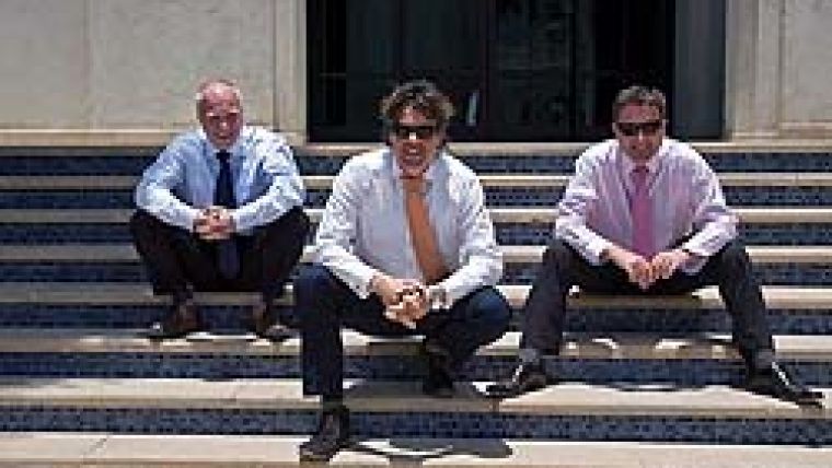
Local Operation
Vision executive staff direct all sales, marketing and customer service functions from headquarters. The new management team of David Critchley, Pieter Franken and Greg Simmons (Figure 1) have many years’ experience and achievements between them, all of which they hope to bring to the MENA region. Mission planning and flight operations are carried out at the nearby Umm Al Quwain Airport, where company aircraft are based. Vision has established a remote sales office in Riyadh and positioned its sales force and support personnel to provide customised service to clients in Saudi Arabia, Yemen, Qatar, UAE, Bahrain and Kuwait. All North African countries also lie within service territory. Vision currently employs 25 people, and is still growing. Airborne initiatives are supported by a digital mapping facility in Dubai, where products are generated, quality-checked and delivered to time. Local operation is the key to producing a quality product, and demonstrates Vision’s commitment to long-term business relationships with clients in the Middle East and North Africa.
Aerial Resources
The Vision team has several years’ flight operations and mapping experience in the region. Flight operations are directed by Colonel Abdullah Al Sheri (Ret.), an ex-Saudi Air Force officer who understands the challenges of seeking and obtaining the necessary approval to get an aerial-mapping project airborne in countries throughout the Middle East. Colonel Al Sheri is also well versed in meeting the mapping specifications of military survey departments in the region. To ensure reliable and uninterrupted flight activities Vision purchased two new Partenavia P68 twin-engine aircraft from Vulcanair of Italy. Both have been modified to carry aerial imaging cameras and sensor suites. In addition, Vision has arranged for several aircraft leases, both long-term and seasonal, to accommodate the changing demands for acquisition services at all stages of the flying year.
Mapping Tools
The company has adopted the Pictometry oblique imaging system as the cornerstone of its assortment of digital cameras and Lidar sensors, each chosen with specific end-user applications in mind. Vision’s aerial mapping capabilities can serve virtually every major geo-information market in the Middle East and North Africa.
Imaging Services
The company is exclusive licensee of the oblique aerial imaging services developed and licensed by US Pictometry International, the Pictometry system comprising a suite of five high-resolution digital cameras, one pointing straight down and the other four at oblique angles to the Earth’s surface. These cameras acquire images simultaneously, so that every feature on the ground is photographed from multiple directions. Sophisticated software processes the collected data to create geo-referenced images of ground features from all sides.
Embedded Software
The processed oblique images are delivered to the client with embedded viewing software that runs on adesktop computer, enabling the end user to examine the images of ground features from any direction or angle; the software has built-in measurement tools to accurately determine distance and area between and among features onscreen from any viewing angle. This means the user can measure the height of a vertical building as easily as calculate the surface area of a flat car-park. Vision has completed an oblique mapping project of two cities on behalf of two Saudi Arabian local government authorities which are using them in event management and emergency planning.
Digital Camera
To perform cadastral and other mapping projects covering large areas, especially in an urban environment, Vision uses the UltraCamX large-format digital camera from Microsoft Vexcel. This 196-megapixel camera acquires images with 3-cm spatial resolution, ideal for orthorectification and extraction of high-quality digital elevation models. The UltraCam sensors are capable of rapidly mapping large areas with high-spatial detail from a fixed-wing aircraft. The result is a cost-effective, orthorectified image that can be used for economically creating new maps and updating existing ones used in engineering design, construction planning and infrastructure monitoring
Lidar Systems
Vision plans to employ three different Lidar systems. The first is the TopEye Lidar developed by SAAB Aerospace specifically for elevation mapping in long, narrow corridors. Flying aboard a helicopter, the TopEye is ideal for capturing survey data for the creation of Digital Terrain Models (DTM) of railway and roadway corridors, as well as utility rights of way containing power or pipelines. The accuracy of the generated DTM is sufficient to support engineering-grade planning, vertical accuracy being 2cm and nominal swath width 120m. For the widespread elevation mapping that usually precedes major development projects covering hundreds of square kilometres the company has acquired a second Lidar system designed to fly at higher altitudes on a fixed-wing aircraft. While this instrument collects elevation values with less dense point spacing, it still boasts vertical accuracy of 5cm, and the higher service altitude mean swath width of 250 to 500m.
Bathymetric Services
Vision also aims to provide bathymetric Lidar services, operating at a wavelength capable of penetrating shallow water so that the laser signal bounces off the bottom and returns to the sensor, resulting in collection of Z values for the seabed itself. Penetration is typically limited to about 30m, depending on water clarity, and this is ideal for bathymetric mapping of near-shore coastal environments. Sub-surface mapping for cable placement and navigation charting will be major applications in these near-shore areas. The seafloor mapping system will also be used in near-shore hydrocarbon exploration and environmental monitoring projects.
Open Opportunities
Vision is now open for business. Providing geo-information and geospatial solutions in the Middle East and Africa, Vision is large enough to meet the mapping demands of mega-projects, but agile enough to deliver customised results to every client in the region.
Email: dcri...@vision-me.com

Value staying current with geomatics?
Stay on the map with our expertly curated newsletters.
We provide educational insights, industry updates, and inspiring stories to help you learn, grow, and reach your full potential in your field. Don't miss out - subscribe today and ensure you're always informed, educated, and inspired.
Choose your newsletter(s)


