Maptek Releases I-Site Studio 6 Point Cloud Modelling Tools
This article was originally published in Geomatics World.
The latest I-Site point cloud processing tools from Maptek focus on the everyday needs of mine surveyors for fast and accurate volumes, conformance reporting, geotechnical analysis and CAD design. I-Site Studio software offers an expanding range of applications with increasing sophistication. I-Site Studio 6, released earlier this month, provides various new tools and requested enhancements.
New CAD design tools include user-friendly preferences for snapping to angles and points. Other in-demand items include auto registration and alignment of scans, complex surface modelling, waviness analysis for geotechnical modelling and analysis.
Surveyors are under pressure from all departments to quickly and safely survey active mining areas. This is on top of recurrent stockpile volumes and active mining face updates, said Jason Richards, global business development manager for Laser Imaging Solutions at Maptek. With I-Site Studio 6 they have access to geotechnical analysis, conformance reporting, CAD and geology tools in one package. Surveyors can respond to virtually any request, with accurate results and timely reports that are used by all mining departments to meet operational objectives, he added.
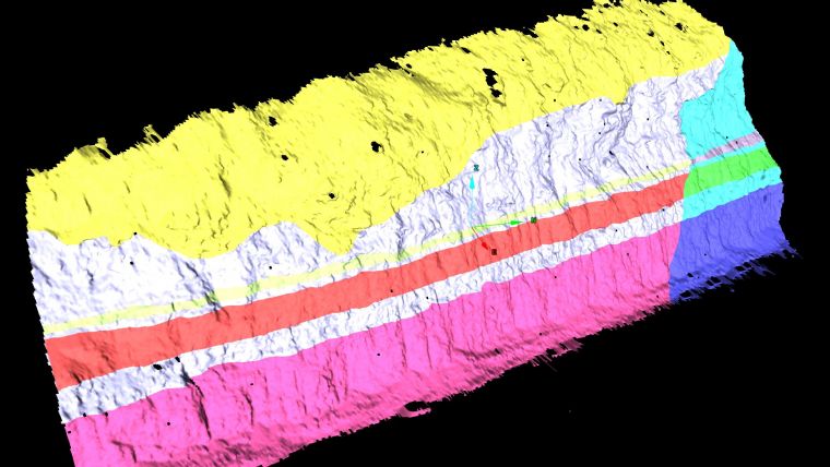
Geotechnical options
Survey data plays a vital role in safety management programs. Accurate information is mandatory for identifying areas of structural weakness that can affect mine planning and operational decisions. New and enhanced geotechnical options in I-Site Studio 6 provide powerful analysis tools for understanding structural relationships. Creating solids from discontinuities helps determine wedge shape, size and volume. Dynamic adjustment extends discontinuities to assess the potential persistence across pits or structural domains.
Stereonet improvements include new tools, preferences and workflows. A direct link between the interactive stereonet and 3D views allows users to select discontinuities in the 3D view window in order to highlight them on the stereonet.
Kinematic analysis has been overhauled in I-Site Studio 6. Defaults for failure types have been added, and failure zones are automatically shaded to highlight areas of potential failure on the stereonet. Dragging and dropping the discontinuity of the slope face onto the kinematic slope orientation fields automatically displays failure zones.
CAD Tools
New CAD tools allow users to create CAD design outlines direct from 3D point cloud data, streamlining everyday survey and engineering tasks. Jason Richards commented snapping preferences streamline CAD workflow and allow users to digitise from real world to CAD environment. It’s easy to draft haul roads and ROM pad layouts, add strings for stockpile shadow zones and create CAD footprints of structures on site.
3D Surface
A new 3D complex surface modelling tool produces a 3D surface that honours the original point cloud data, conforming around walls, curves and tunnels, as well as creating another surface by averaging the point set. I-Site Studio 6 contains intuitive new tools for defining geological contacts direct from 3D point cloud data. Options such as applying patterns and fills to geological domains streamline mapping workflow.
I-Site Studio makes the most of the output from up-to-date terrestrial scanning instrumentation and faster survey processes. Mining professionals can generate reliable, repeatable, high-quality reports. Customisable templates allow images and documents to be added so that one click generates a report that can be passed to production.
A new volume reporting tool applies a base surface, stockpile surfaces and polygons to generate volumes for multiple regions in one pass. Design conformance reporting allows users to compare a design surface to as-built and other surfaces, summarising sections, underdig, overdig, and percentage of volume variance.
Surveyors are under increasing pressure to hand off results that are accurate and easy to understand, and they are being asked to do so with shorter turn-around. So the quicker they can compile accurate and meaningful reports the better.
More information about the release can be found here

Value staying current with geomatics?
Stay on the map with our expertly curated newsletters.
We provide educational insights, industry updates, and inspiring stories to help you learn, grow, and reach your full potential in your field. Don't miss out - subscribe today and ensure you're always informed, educated, and inspired.
Choose your newsletter(s)


