National Mapping Organisations - Cambridge Conference 2017
This article was originally published in Geomatics World.
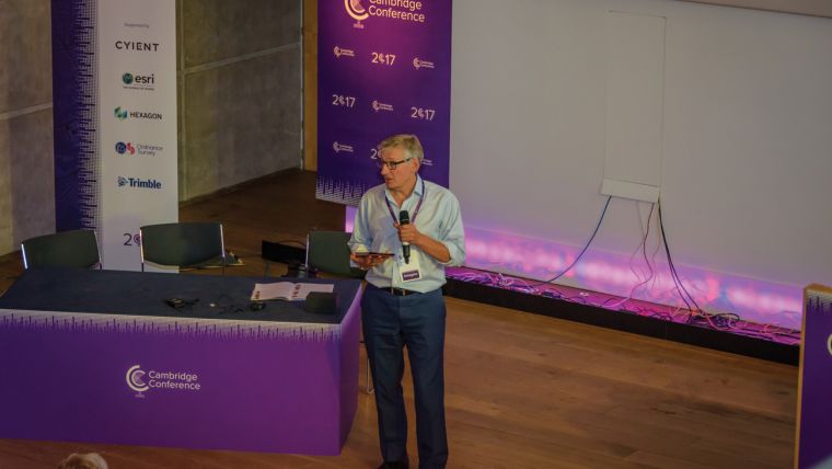
The Cambridge Conference is held every four years by Ordnance Survey. The 2017 conference brought together directors and senior managers involved in mapping and use of geospatial data from 33 countries. The event guide describes the meeting as a unique opportunity for leaders in the field of mapping and geospatial information to discuss issues of mutual interest and global importance.
The theme of the conference was 'Mapping Nations: The Next Decades', and the first day concentrated on resilience and challenges. Nigel Clifford, CEO of Ordnance Survey, opened proceedings and emphasised what are now familiar themes in discussion of geospatial data: big data, the importance of visualisation, machine learning and the move to better, faster and cheaper data as a fundamental component of the digital economy. These themes were taken up by Sir Mark Walport, Government Chief Scientific Advisor who stressed 'The Inexorable Rise of the Machines'. Sarah Davidson from the Scottish Government followed by discussing how cross-government Integration can serve the citizen, this is helped by the fact that digital government means open government, but a change of culture is needed and this needs planning. Andrew Trigg from the Land Registry also emphasised the need for joined-up government and how this can be used, for example, to tackle fraud and anticipate paperwork by identifying change of ownership.
A very interesting talk was given by Nick Chrissos, from Cisco UK and Ireland, on CityVerve in Manchester, which he claims genuinely links everything together and delivers real benefits. He gave the example of encouraging people to be healthier by walking to the next bus stop and getting a free ride; and the use of sensors to monitor and manage air quality. A major challenge for smart cities is keeping the data up-to-date. Ordnance Survey is mapping the test area in Manchester in great detail.
International Perspective
The international perspective of the day’s presentations was covered in a number of ways. Rohan Richards, from the Ministry of Water, Land, Environment & Climate Change in Jamaica showed how his organisiation had to manage environmental change, and develop resilience to global problems like population growth, deforestation and hurricanes. Once again the importance of using geospatial data to plan for disasters through the integration of data and a common operational platform was stressed. Stefan Schweinfest, Director of the UN Statistic Division, and Gregg Scott, Inter-regional Advisor for UN-GGIM, spoke by video link about UN-GGIM and the role of geospatial data in achieving the UN Sustainable Development Goals. Ebisintei Awudu, Surveyor General of the Federation, Federal Surveys of Nigeria brought the discussion down to earth by talking about the urgent need for training and equipment in developing countries.
Open Data
One of the most animated sessions was on open data. Sir Nigel Shadbolt, Chairman of the Open Data Institute, opined that open data creates more revenue than by restricting data, and he gave the example of Tesla; the geospatial community is aware of the case of Landsat and of Citymap which gives information about moving about London, based on data from Transport for London, but he pointed out that the data released must be engineered in order to achieve this, and most importantly, the case has to be made to the finance department. Professor Paul Longley, Professor of Geographic Information Science at University College London, noted that data is the world's most valuable resource and gave examples from involuntary crowd-sourced data - that is consumer data collected from traces of credit cards, oyster, smart meters, online shopping etc.
Conclusion
The first day of the conference highlighted key issues facing producers and users of geospatial data and generated animated discussion during the presentations and in the margins. The remaining days looked at new technology and how national mapping agencies can contribute to society.
This article was published in Geomatics World September/October 2017

Value staying current with geomatics?
Stay on the map with our expertly curated newsletters.
We provide educational insights, industry updates, and inspiring stories to help you learn, grow, and reach your full potential in your field. Don't miss out - subscribe today and ensure you're always informed, educated, and inspired.
Choose your newsletter(s)


