New 3D Map Solution Covering Norway
Norkart
Worldwide, most municipalities are still making regular 2D maps for online publication, including maps for zoning plans, municipal plans, property borders as well as approved sites for new construction projects. However, the ‘man on the street’ has little or no knowledge of how to read such maps. Norkart in Norway has now launched a brand-new 3D map solution, Kommunekart 3D, which covers the whole country and has the potential to revolutionise map use.
(By Kenneth Øyen-Eriksen, project leader and GIS consultant at Norkart, Norway)
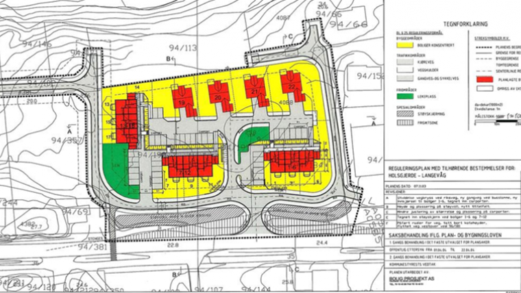
The key aims of 3D visualisation are more simplicity, greater equality and better understanding. People outside the geomatics business often perceive maps and map data as complicated, but the usage of 3D enables everything from zoning plans (see Figure 1) to major road and public transport developments to be visualised easily (see Figures 2 and 3). This gives both internal and external target groups new insights into the geography of their municipality, neighbourhood or surroundings.
Challenging Google
The new Kommunekart 3D 3D map solution could give the Norwegians a more accurate and detailed model than Google can offer. Providing useful, informative and easily understandable maps to the Norwegian people is one of Norkart’s main tasks. The firm has a close partnership with the Norwegian Mapping Authority and distributes software to handle all kinds of geomatics-related data. This partnership brings a common map database containing the most precise vector data from all municipalities. (e.g. Figure 4). This data is used for map production, case management, engineering and geographic analysis as well as in creating the 3D buildings at level of detail 2 (LoD2) for the map solution. This solution will provide completely new application possibilities, partly because it depicts all the country’s buildings with excellent elevation models and a sun/shade functionality.
Tailored maps
The municipalities are able to provide useful and valuable information to the public, and can tailor parts of the maps with their own data, e.g. adapted for their own citizens. Specifically, they can use the solution to add 3D buildings, oblique photos, textures or similar data of their own to give an even more realistic point of view, and approach level of detail 3 (LoD3) or even 4 (LoD4). For example, a proposed new building could easily be fitted into an existing 3D model (Figure 5). This combination of geographical data and 3D mapping solutions will create substantial value and gains.
Behind the scenes
Since last autumn, Norkart has been working in cooperation with the Swedish company Agency9. The synergies from this cooperation have resulted in two advancements: the addition of CityPlanner software (editing, publishing, and planning assistance) to the portfolio and the application programming interface (API) to develop new programs/solutions based on a well-founded platform. The API is known as 3D Maps SDK. Developers from both companies have worked together to prepare the new 3D map solution and are now continuously evolving it with new and easy-to-understand content in support of the above-mentioned key aims of 3D visualisation.
First steps
A number of prerequisites are involved in ensuring that a new solution functions perfectly anywhere, anytime, on all platforms. Data has to be simple yet contain enough information. Data reading has to be fast. Firewalls must be opened. The API has to be repeatedly tweaked. Kommunekart 3D started with the idea of developing a useful 3D client which could reuse accurate data, provide new opportunities, be fast, be functional and, last but not least, be easy to use. It also had to be dynamic to work well on all platforms: smartphones and tablets as well as desktops. Improvements were made to the data enhancement, data flow, processing data, reading data and other elements affecting the 3D map solution. The official version of Kommunekart 3D was released on 9 March 2016 during the Norwegian Geomatics Days. In the current evolution, rooftops will be changed from grey to a light red colour to create even more distinction between walls and rooftops (Figure 6).
New developments
Many general improvements have already been made to the 3D model and more will follow continuously in the future. At the top of the agenda is an easier dataflow, and a solution seems to be just around the corner. Too many data processing steps currently hamper the progress, and a fully automatic pipeline would be best. In the next release, a ’Help’ button is planned and there will also be a new button to adjust time and date for sun/shade analysis. Another element that will probably be implemented in the next release is Get Feature Info (GFI) which allows users to click anywhere on the map or on a building to obtain information about that exact point and area – anything ranging from zoning information such as statutory data and applicable provisions to a direct URL link to the website of the nearest cinema.
Route planner
A route planner with fly-through mode will be implemented in a release in the near future. Many people like to see where they are going beforehand and a 3D visualisation will offer a much better experience. There are plans to make it possible to incorporate intermediate stops if desired, i.e. to plan a route from A to B via C, D and E. For the longer term, the company is considering route-planning ideas relating to road, rail and air travel, as well as pedestrians, water flows, buildings during the construction period, changing zoning plans over a period of time, in combination with live data from e.g. traffic, FlightRadar24, social media and much more.
Acknowledgements
Thanks to the people who contributed to this project from Norkart (Frederic Dumont Kristiansen, developer, Rune Aasgård, developer, Gløer Winsvold, production manager, Stein Mjaaland, GIS specialist, and Aksel Olsen, head of development department) and from Agency9 (Tomas Karlsson, head developer).
Biography of the Author
Kenneth Øyen-Eriksen is project leader and GIS consultant/specialist at Norkart. Kenneth holds a bachelor in geomatics from the University of Oslo, Norway, with one additional year at the Norwegian Joint Staff Engineering College. Before joining Norkart, he previously spent seven years working at Terratec, an aerial survey company, and close to ten years in the GIS/geomatics business. He has expertise and knowledge in 3D modelling and mapping, topographic mapping, oblique photography, volume estimations and digitising. Email: kenneth.oyen@norkart.no
Websites
- Kommunekart (2D): kommunekart.com
- Kommunekart 3D: kommunekart.com/Clients
- CityGML: opengeospatial.org/standards/citygml
- About PostgreSQL: postgresql.org

Value staying current with geomatics?
Stay on the map with our expertly curated newsletters.
We provide educational insights, industry updates, and inspiring stories to help you learn, grow, and reach your full potential in your field. Don't miss out - subscribe today and ensure you're always informed, educated, and inspired.
Choose your newsletter(s)


