OGC Publishes Results of International Arctic Spatial Data Pilot
The Open Geospatial Consortium has published the results from the Arctic Spatial Data Pilot (Arctic SDP). The results, including reports, demonstration videos, and interviews, are available at the consortium’s website. Additionally, the OGC is now exploring options for the next phase of the Pilot.
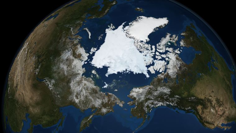
The Arctic SDP, an 18 month project, was initiated to demonstrate the diversity, richness, and value of providing geospatial data using international standards in support of seamless spatial data exchange with application to a range of Arctic topics. Eight scenarios were used to demonstrate a solution to a key aspect of environmental and resource management in the Arctic: from permafrost melt, to shipping routes, from search & rescue, to food security, and more.
The Pilot successfully showed how standards help stakeholders gain new perspectives into social, economic, and environmental issues by providing an online network of resources that improves the sharing, integration, and use of information tied to geographic locations across the Arctic.
Organised by OGC, the Pilot was sponsored by the United States Geological Survey (USGS) and Natural Resources Canada (NRCan). The Pilot supports United States and Canadian domestic priorities around open standards and interoperability. The Pilot supports the strategic goals of the Arctic Spatial Data Infrastructure (Arctic SDI), a cooperative voluntary, multilateral activity between the 8 Arctic Countries' National Mapping Agencies (including USGS and NRCan).
Standards-based approach
The Arctic is naturally a very complex area: encompassing 8 nations, with significant sources of data in many locations, and a wide variety of technologies that are in use today, with more to come in the future, said Mark Reichardt, president and CEO of OGC. Standards are absolutely critical as a way to bring all of these data and tools together in a seamless way. Without a standards-based approach, it would not be possible to efficiently collaborate to understand the Arctic and act responsibly in the region, Reichardt added.
The OGC standards particularly for geospatial data are essential for ensuring that data comes together in a way that is meaningful, authoritative, and accessible in real-time, said Kevin T. Gallagher, associate director, Core Science Systems, USGS. His hope is that they continue to make more datasets available to allow mash-ups to occur based on applications that haven’t been expected, and cannot quite anticipate, limited only by the imagination of the scientists and stakeholders using the data.
Critical objectives
The Arctic SDP will serve some critical objectives: first, it will help establish a foundation upon which we can build facts, information, and knowledge, not just in Canada, but across the Arctic region, and among partners in the Arctic, said Prashant Shukle, director general, Canada Centre for Mapping and Earth Observation, NRCan. Second, the project will also ensure that the facts we collect, and their data formats, are interoperable and can be shared from local to global partners in a seamless way. To date, there’s been no such effort to do this, and this project is, for the Arctic, a game-changer.
The project was executed in two phases: the first phase, an OGC concept development study, was completed in May 2016; the second phase, an OGC pilot activity, was completed in March 2017.
Data intensive scenarios
During the Pilot activity, 12 OGC member organisations worked together to create case studies, implementations, reports, and videos that demonstrate the value of an SDI for the Arctic, and help form a holistic view of a unique environment. These also serve as a useful pattern for other organisations to implement the technologies in their own environments.
Arctic scenarios were developed with assistance from stakeholders including the Inuit Circumpolar Council (Alaska) and Arctic Council’s Conservation of Arctic Flora and Fauna working group. Data intensive scenarios covering sea ice evolution, caribou migration analysis, effects of new shipping routes in the Arctic, food security, and landslide susceptibility mapping using spatial data infrastructure components were tested and implemented.
The results of both phases, including demonstration videos, reports, and interviews, are available for free.
Further follow-on work is currently in the planning phase and OGC is looking for interested sponsors. If you’d like to learn more about how becoming a sponsor can benefit your organisation, visit www.opengeospatial.org/ogc/programs/ip.

Value staying current with geomatics?
Stay on the map with our expertly curated newsletters.
We provide educational insights, industry updates, and inspiring stories to help you learn, grow, and reach your full potential in your field. Don't miss out - subscribe today and ensure you're always informed, educated, and inspired.
Choose your newsletter(s)


