OS Heading Towards Real-time Mapping - Joint OS/RICS CPD Day 2017
This article was originally published in Geomatics World.
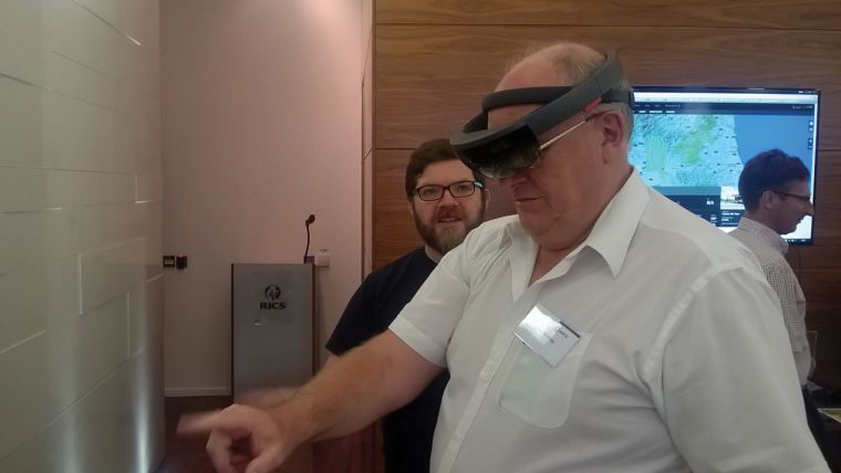
The RICS hosted an event with the snappy title ‘Joint OS/RICS CPD day’ at St George Street in July. Not too many clues in the title but within the packaging was an insight into strategy and innovation at the OS.
Innovation was approached from several angles. In a view that was reflected later by Alex Wrottesley, from the GeoVation Hub, Neil Ackroyd, Chief Operating Officer, spoke of a future when OS will be mapping almost in real time. As Wrottesley put it, the time between data capture and use could be reduced from months to seconds. “Change is our currency,” said Ackroyd, and it is accelerating almost out of control.
Sensing the Environment
The result will be ever increasing data volumes. The OS currently holds 4 Petabytes of structured data and Ackroyd foresees the organisation having to handle 20 to 30 TB per day. Data collection will involve sensing the environment without a view of the product and using automated software tools to structure and interpret the data. Paul Cruddace’s enviable job involves looking at all the technical possibilities ranging from satellite remote sensing to photogrammetry using photos taken with a mobile phone from a moving vehicle. The OS product is authoritative mapping so crowd-sourcing from anyone will be out of the question, but data from an ‘informed’ crowd will be a key element. The existing data model cannot be scaled up, so there will be a new data model in the next five to ten years. Alex Wrottesley said that collaboration is essential for innovation and so is calculated risk.
Not All Tech
But it wasn’t all about technology. Duncan Moss spoke about the International Land Measurement Standard (ILMS). GW will have more on this in the autumn. The speakers stressed that we are in the centre of a geo-revolution with geo at the core of almost every new high-tech business. These should be the best of times. We need to let those who need us, know what we can offer.
David Tucker spoke about the link between the OS and the RICS when it comes to promoting professional qualifications and the importance of the apprenticeships in making this happen.
OS Overseas
To help pay for the geo revolution, OS is expanding its work overseas and John Kedar, Head of International Policy and Engagement spoke of how OS is selling the expertise it has gained in GB in overseas territories. The organisation’s reputation is central. He pointed to the fact that in many commonwealth countries, the most up-to-date national mapping is still work produced by the Directorate of Overseas Surveys (DoS) in the 1950s and 60s. Many countries are being held back by their lack of appreciation of geospatial data at ministerial level. He gave as an example the recognition that mapping is needed to measure the progress towards the UN Sustainable Development Goals, but not that it is needed to plan and implement the measures needed to reach those goals. Having said that, geospatial professionals in those countries are eager to progress and OS could help them do so.
For this overseas work to succeed in contributing to OS coffers, it has to be paid for and the fact, expressed by Kedar several times, that few are willing to pay, was not lost on this member of the audience.
This was an excellent day which was full of CPD and networking between the OS and other delegates. For early-birds (who miss the traffic), the RICS members Business Centre opens at 7am (and closes at 8pm) – a welcome alternative to killing in time in a coffee shop chain.
This article was published in Geomatics World September/October 2017

Value staying current with geomatics?
Stay on the map with our expertly curated newsletters.
We provide educational insights, industry updates, and inspiring stories to help you learn, grow, and reach your full potential in your field. Don't miss out - subscribe today and ensure you're always informed, educated, and inspired.
Choose your newsletter(s)


