
Post-processing Lidar data is no longer the norm
Aerial Precision is ready for take-off
The Dutch startup Aerial Precision recently demonstrated its first two sensors with integrated artificial intelligence software. Over the past few years, the company’s innovation efforts have resulted in products that make Lidar cheaper and easier to use. For example, thanks to real-time point cloud registration, the 3D data is ready as soon as scanning is completed. Two investors – Dutch and Belgian – came on board. There are plans to rapidly add more functionalities.
“Based on our ambition to dramatically improve the way information is extracted from point clouds, in 2018 we founded Aerial Precision and started to design artificial intelligence-driven Lidar systems. These can be mounted on commercial drones, mobile vehicles or operated as handheld devices by humans or robots. We want to offer a better option than photogrammetry: much faster, easier and cheaper,” said Vicente Payo-Ollero, CEO and founder, to clarify the company’s goal. This provided context for their demo day, which was organized at DronePort St.Truiden in Belgium in December 2022.
With his background in electronics engineering and specialized in sensor fusion, guidance, navigation and control of uncrewed aerial vehicles (UAVs or ‘drones’), Payo-Ollero has been active in the development of high-end drone systems, using photogrammetry and Lidar, all around the world. This includes for the production of the seventh season of Game of Thrones, the latest Mission Impossible movie and numerous geophysical surveys. “There is an important need to generate 3D maps, but the way they are produced is inefficient. So I started to focus on making a next-generation Lidar system that can be used with any iOS device and generates point clouds within minutes,” he continued. “There will still be situations in which photogrammetry is the best solution, but in many cases our sensors with built-in artificial intelligence (AI) will be the smarter choice. It is still a case of ‘work in progress’, but at Aerial Precision we’re focused on delivering information that is ready for use.”
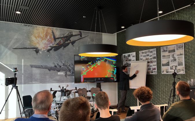
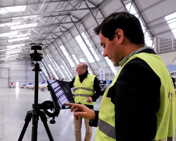
Demo day
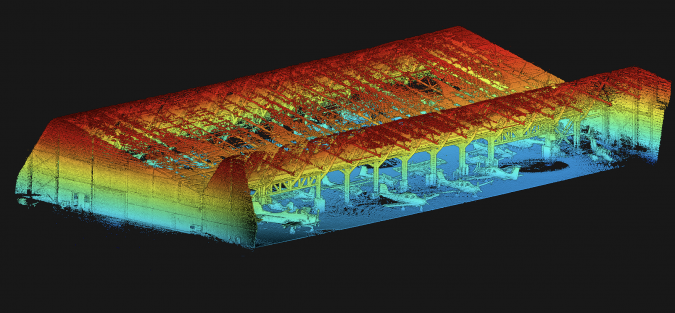
Visitors to the demo day at the airfield saw how the sensor was affixed to the mount – in this case a tripod – before a hangar of aeroplanes and helicopters was scanned by walking up and down once. Then it was connected to an Apple tablet and the 3D colour point cloud was generated within minutes so that the model could be used for measuring purposes. The same principle was applied for mapping DronePort itself. The lightweight sensor was clicked under a commercially available drone: a DJI M300. No post-processing was necessary, because the processing is done in real time as the Lidar data is collected. “Of course, you still have to ask the authorities for permission to use the drone, but the promise of offering a real, fast alternative is solid,” commented Payo-Ollero. “You plan the flight in advance on your tablet, you go to the site, you conduct the flight and by the time you get inside again, the information is there.”
“Depending on the sensor/artificial intelligence combination, you can register 720,000 to 1.3 million points per second with approximately 2cm or 5cm accuracy,” he explained. “There is an Ouster OS1 with 32 or 64 laser beams or a Livox AVIA sensor. A double payload is possible on most of the drones used these days, so you can combine other sensors in the same flight if you need other spectra.” In that case, some post-processing will be needed to match the two image sources, but most professionals should be able to handle that, since the data is recorded on the external SD card as LAS files – the standard industry format for optical remote sensor data.
During the demonstration, the positioning was based exclusively on simultaneous localization and mapping (SLAM) algorithms, so the spatial accuracy was relative. SLAM is fine when you need to know the volume of your stock every day, or the distance between powerlines and vegetation, or which areas of your agricultural crop have problems. However, absolute location precision is needed in many other applications. Payo-Ollero assured the attendees that RTK georeferencing will be ready at the beginning of 2023 and will be part of the basic version. The data can be used with any GIS software for further analysis.
In the current Aerial Precision images, different kinds of objects cannot be visualized in different colours. “The colours you see are based on adjustable height differences. In the near future, classification and colourization will also be integrated in the AI software possibilities. I expect that will be ready in the first half of 2023,” he added. That will broaden the applications to automated mutation detection, for instance.
Financial support
Aerial Precision’s head office is in Maastricht, a Dutch city located very close to the border with Belgium. The startup has secured financial support from two investors, one on each side of the border. Between them, the Belgian firm LRM and the Dutch company LIOF have invested €760,000 to expand the company’s product range, protect its technology and further develop the commercial side. Both investors are keen to support the growth ambitions of innovative startups to reinforce the technologically innovative position of this Euroregion.
Aerial Precision has dedicated its early years to research and development. Payo-Ollero: “The goal was to produce a 3D sensing system that would not only offer a level of accuracy that is acceptable to most potential users, but would also substantially reduce costs compared with the existing solutions. This makes the technology attractive for a wide range of uses, including urban mapping projects, construction, forestry and agriculture, telecommunications and energy, as well as for utilization by the police force and the cultural sector. We are now ready for our first customers. We expect to reach break-even point in 2024.” Currently, Aerial Precision employs five people but the team is expected to have increased to eight by 2024. There are no limitations to the geographical sales scope.

Value staying current with geomatics?
Stay on the map with our expertly curated newsletters.
We provide educational insights, industry updates, and inspiring stories to help you learn, grow, and reach your full potential in your field. Don't miss out - subscribe today and ensure you're always informed, educated, and inspired.
Choose your newsletter(s)


