Powerful and Multilateral UN-GGIM is Rescuing the SDGs
Key Takeaways from the Twelfth UN-GGIM Session in New York
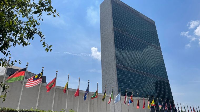
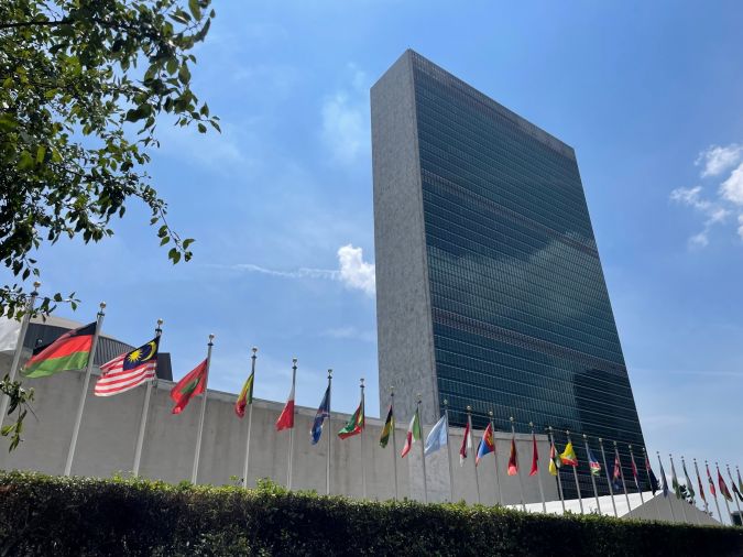
The twelfth session of the United Nations Committee of Experts on Global Geospatial Information Management (UN-GGIM) was held from 1-5 August 2022 at the United Nations headquarters in New York, USA. This year’s session drew delegates from 73 Member States, amounting to a total of 256 official representatives from all over the globe. A further 105 delegates attended the session as official observers to the UN-GGIM initiative, and an unknown number of viewers followed the sessions online. Over the past 12 years, UN-GGIM has established itself as the most overarching and multilateral body overseeing the implementation of geoinformation right at the heart of policymaking. Geoinformation will be key in achieving the Sustainable Development Goals, especially in the current times in which the Member States are facing numerous crises, including wars, economic uncertainty, climate change and the need to accelerate the energy transition.
Side Events
The 12th session of the UN-GGIM Committee of Experts was divided into two parts. The first part of the week was packed with side events, such as meetings of the regional committees including UN-GGIM Europe, Arab States, Americas and Asia and the Pacific. There were also meetings for special interest groups, which included ‘Women in Geospatial’, ‘Bringing Land and Sea Together’, ‘Mobilizing Sustainable Funding’ and ‘Digital Twin: Best Practices and Recommendations to Governments and Industry’. The side event on ‘The Future Geospatial Information Ecosystem’ generated a particular buzz, introducing the ‘Geoverse’ as the all-encompassing system that could be even bigger than the Metaverse.
Formal Frameworks
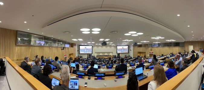
The formal part of the 12th session started on the Wednesday and set out to cover 19 items in the space of three days. Co-chairs Ingrid Vanden Berghe (Belgium), Tulu Besha Bedada (Ethiopia) and Paloma Merodio Gómez (Mexico), helped by the wonderful staff from the UN-GGIM Secretariat, kept progress through the agenda items running smoothly and efficiently. The Integrated Geospatial Information Framework (IGIF) is one of the key initiatives of the UN-GGIM. This framework, when implemented at country level, is an ambitious and forward-looking directive for Member States. UN-GGIM concluded that the IGIF continuously needs to be communicated to promote the positive outcomes and impacts that implementation of the framework will have at country level. An extensive library of IGIF case studies will help this process. On the technical side, the Global Geodetic Reference Frame (GGRF) has been on the agenda for many of the past sessions. This has led to the plan to establish a Global Geodetic Centre of Excellence at the United Nations Campus in Bonn, Germany. This centre will be instrumental in addressing the needs of the international community in sustaining the GGRF. Relevant technical experts in Member States were urged to contribute to the centre in Germany in any way they can. Another framework developed by UN-GGIM, the Global Statistical Geospatial Framework (GSGF), has already been implemented in several Member States. Several delegates shared their experiences during the 12th session in New York, stating that the GSGF has been helpful in, for instance, their national census planning. One noteworthy plan came from the Working Group on Marine Geospatial Information, which is keen to address issues relating to the land/sea interface and coastal zones by integrating the maritime, terrestrial and cadastral domains.
The ‘Where’
UN-GGIM is essentially about the ‘where’ of it all, and location was especially significant this year because it was the first time in three years that the delegates could gather again in person at the UN headquarters. Besides being a very productive meeting, the 12th session of the UN-GGIM Committee of Experts was therefore also a reunion of familiar faces – proof once again that while online meetings are good, ‘in-real-life’ ones are even better. The social aspect obviously plays an important role at the fringes of every conference and formal gathering, and the UN-GGIM is no exception. Both the Industry Reception and the Welcome Reception were very well attended and a nice way to conclude a day of knowledge-sharing and debate.
Future
The UN-GGIM had clearly listened to the Secretary-General of the United Nations, who earlier this year called on the international community to rescue the Sustainable Development Goals (SDGs) and make them a top priority in these uncertain times of pandemic, war and economic insecurity. The transformational role of geospatial information in overcoming data gaps and data (un)availability was repeatedly mentioned in the debates. Member States were urged to implement the frameworks that UN-GGIM has been developing over the last few years, not only to meet national priorities but also to measure and monitor the SDGs. In that sense, it is fitting that the government of India is hosting the Second United Nations World Geospatial Information Congress, based around the theme of ‘Geo-enabling the Global Village: No one should be left behind’, from 10-14 October in Hyderabad. The 13th session of the UN-GGIM will be held at the UN headquarters in New York in early August 2023.
It is unfortunately not possible to report on all 19 agenda items here. To read more details about all the topics covered during the 12th session of UN-GGIM, go to: https://ggim.un.org/
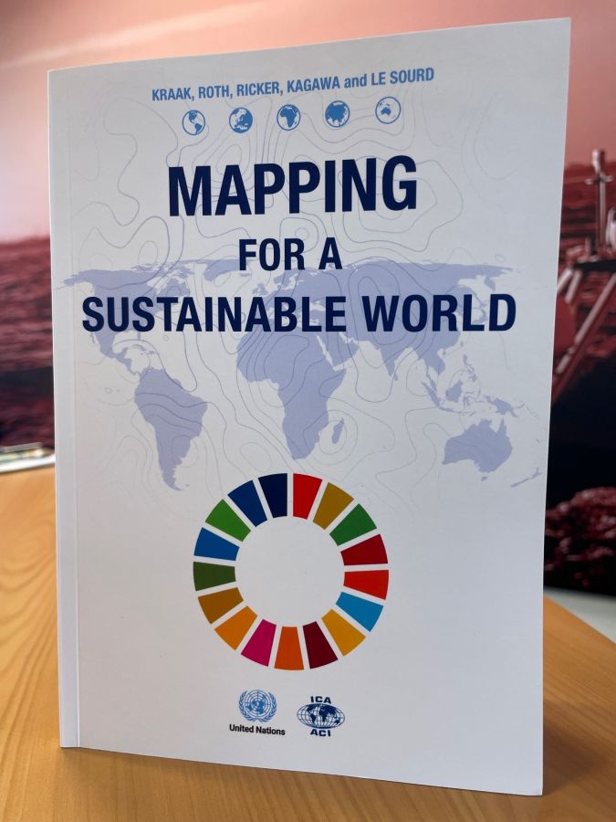
Mapping for a Sustainable World
The book titled Mapping for a Sustainable World, written by Menno Jan-Kraak, Robert Roth, Britta Ricker, Ayako Kagawa and Guillaume Le Sourd, and jointly published by the International Cartographic Association and United Nations, was introduced during the 12th Session of UN-GGIM. It offers guidelines for mapping cartographic datasets related to the Sustainable Development Goals. It introduces basic principles of map design and use, best practices and conventions, all with the aim of supporting understanding of the SDGs. The book, which contains almost 150 pages, is heavily illustrated with helpful examples of maps. It is divided into four sections: on SDGs and Geospatial Data, Map Design Considerations, Maps & Diagrams, and Map Use Environments. This publication is intended as a reference work for everybody in the field of making or using SDG-related maps to help create a sustainable world. The book was distributed in printed format during the UN-GGIM session, and is available as a download

Value staying current with geomatics?
Stay on the map with our expertly curated newsletters.
We provide educational insights, industry updates, and inspiring stories to help you learn, grow, and reach your full potential in your field. Don't miss out - subscribe today and ensure you're always informed, educated, and inspired.
Choose your newsletter(s)


