Professional Adventurers Celebrate 100th Anniversary
Underhill Geomatics
This year, Underhill Geomatics Ltd. celebrates 100 years of providing engineering, geomatics and land survey services in Western and Northern Canada. As it passes this significant milestone, the company looks back on its development over the past century. It has grown through early development and adoption of new geomatics technologies and services, and this remains one of the hallmarks of the business to this day.
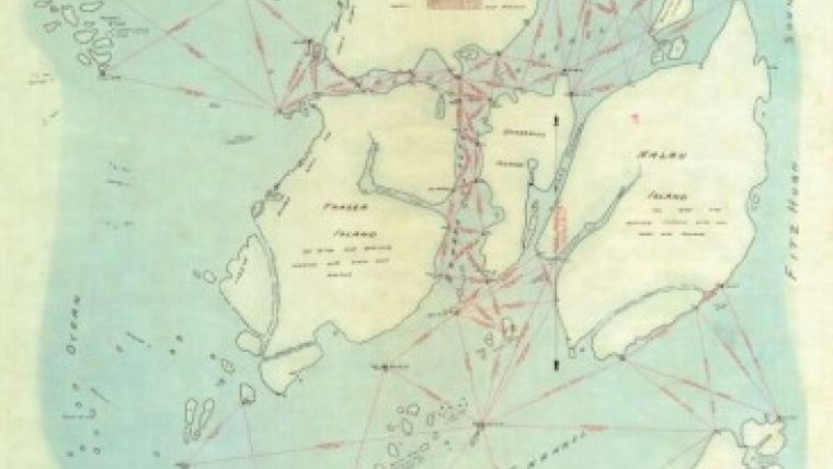
| Underhill Island triangulation survey by Jim Underhill, 1921.
|
The company was founded in 1913 by brothers Clare and Jim Underhill as Underhill & Underhill, a partnership of British Columbia Land Surveyors, in Vancouver, British Columbia (BC). The firm was one of the pioneering enterprises in the early development of the West Coast region of Canada. Shortly after they started the business, war broke out in Europe. The company was shut down during the war while the brothers served overseas, with business resuming after the war had ended.
The BC region of Canada is largely a mountainous wilderness. Most survey activity outside of the urban centres was in support of resource development. Principal modes of transportation in the province included steamship, rail and horseback. It would often take weeks of travel by pack train, over mountains, ice fields and rivers, to reach an area to be surveyed. Surveys could take up to six months to complete. In the 1920s, Clare Underhill would often travel on horseback to Atlin in northern BC to spend the summer working with their new partner, Horace Fraser, on mineral claim surveys.
After WWI, Underhill was heavily involved in geodetic triangulation and mapping surveys for the Province of BC. Coastal triangulation and mapping supported the development of early navigational charts. BC’s surveyor general instructed the surveyors of the day to give names to geographic features. Jim Underhill did just that, and to this day many of BC's geographic features carry names associated with the Underhill family or with the other members of the survey parties.
This was the era before the advent of aerial photogrammetry. Mapping of mountains and valleys was accomplished via triangulation and stadia. Mountains would often have to be climbed many times before weather conditions were such that measurements could be made. Consequently, survey crews were credited with the first ascent of many of the mountains in BC.
On one of these mountain valley surveys in 1927, the surveyor general instructed Jim Underhill to triangulate and trigonometrically determine the height of a mountain in the coastal range that was creating quite a buzz in the mountaineering community. Jim did so during his survey and reported back his findings to the surveyor general. At 13,260 feet (4,042 metres) the ‘Mystery Mountain’, as it was then known, was the highest mountain identified within BC. It was soon renamed Mt. Waddington, and to this day is still the highest peak within BC. They were truly ‘professional adventurers’.
During the Great Depression of the 1930s, clients often paid for surveys in land, canned fish or penny mining stocks. The land was eventually
| Turning angles and taking notes on a BC coastal triangulation survey, 1922.
|
worth some money, and the food helped to feed the Underhill families, but most of the stock was worthless and would just end up as wallpaper for the office. The company survived the Great Depression to find itself virtually shutting down during WWII. This time, it was their sons and staff who served in the war. The effort of the partners (Jim , Clare and Horace) primarily focused on coastal defence and survey efforts related to the war.
The period after WWII was one of great expansion and prosperity. Technologies such as electronic distance measurement (EDM), computers, helicopters and photogrammetry were rapidly changing the fields of surveying and mapping. The Underhill company led the way in this region with many of these technologies. Early EDM and vacuum tube computers facilitated the surveying of thousands of kilometres of electrical transmission corridors in the province.
In 1970, the company's long experience in the north of the country led it to open an office in Whitehorse, Yukon. In the 1980s, the advent of the microprocessor led to an explosion in technologies that continues to this day. The late 1980s also saw the start of the First Nations Land Claim surveys in Northern Canada (Yukon, North West Territories and Nunavut). These were the largest and most extensive legal surveys in Canada since the creation of the township system in the Prairie provinces in the 1800s. From 1987 to 2012, Underhill completed more than 40% of all of the Land Claim surveys in Northern Canada including those closest to the North Pole on Ellesmere Island.
| The current Underhill partners and their families at the first 100 year celebration in Whitehorse, Yukon.
|
Underhill conducted some of the first GPS geodetic surveys in the region in the late 1980s and was involved in the geodetic control surveys for BC's digital mapping programme (TRIM). The TRIM mapping programme, one of the first of its kind, provided numerous BC surveying and mapping firms with new skills that could be marketed internationally. Underhill, along with many other BC firms, formed a consortium called IGS to pursue this type of work, and IGS subsequently provided surveying and mapping consulting services in Europe, Asia and South America. Additionally, Underhill became involved in GPS positioning for gravity surveys throughout the world with MWH GeoSurveys.
In the 1990s, Underhill entered the field of GIS mapping through Underhill Geographic Systems Ltd. (UGSL). UGSL mapped the electrical distribution system for BC Hydro for the most populated regions of the province (Vancouver Island and Greater Vancouver). GIS mapping projects were also completed in Miami (Florida) and Phoenix (Arizona). Underhill developed utility GIS field mapping software that was successfully utilised throughout BC and the USA.
Today, the firm has five partners and over 100 employees with offices in Vancouver, Whitehorse and Kamloops, BC. Technology continues to be a driving force, with recent forays into terrestrial laser scanning and 3D modelling for industrial, commercial and shipbuilding applications. Development of services around digital close-range photogrammetry and aerial UAV mapping are currently being pursued. One hundred years on, the Underhill ‘adventure’ continues...

Value staying current with geomatics?
Stay on the map with our expertly curated newsletters.
We provide educational insights, industry updates, and inspiring stories to help you learn, grow, and reach your full potential in your field. Don't miss out - subscribe today and ensure you're always informed, educated, and inspired.
Choose your newsletter(s)


