Reality capture trends shaping an autonomous future
Population growth, urbanization and rapid digitalization all represent global challenges, but they also offer opportunities for the geospatial industry, because reality capture technology is an essential part of the puzzle to solve them. With the barriers to adoption getting lower every year due to various technological advancements, we are moving ever closer to autonomous reality capture, paving the way for smart digital realities.
On 15 November 2022, the global population hit eight billion, and experts project the number of people on this planet to reach ten billion by 2050. This population growth will require us to manage the increased pressure on natural resources and infrastructure as well as the expanding demand for individual mobility. The fact that more and more of the world’s population are living in urban areas – predicted to reach more than 70% by 2050 – is driving demand for new infrastructure and building construction, necessitating the refurbishment and improved maintenance of existing buildings. Meanwhile, rapid digitalization means an exponential increase in the volume of data we create daily, with virtually every aspect of life being captured and stored in digital form. We need to ensure we create value from all the data we collect.
These three megatrends – population growth, urbanization and digitalization – clearly represent challenges, but also offer opportunities to find innovative ways to address them. Reality capture technology is an essential part of the puzzle.
Taking digital twins to the next level
To appreciate the importance of reality capture, you need to understand the concept and impact of digital twins, i.e. digital representations of the real world. Digital twins allow you to conduct tests in the virtual environment to derive valuable insights before money is spent or resources are wasted. They have actually been around since the 1960s when NASA created digital twins to run simulations. These were a lot more efficient than risking the destruction of spaceships and onboard technology.
Today, we use different types of sensors to capture reality and deploy advanced software to create 3D digital models. However, the digital twin is a snapshot. Its next iteration – what we in Hexagon’s Geosystems Division refer to as the ‘Smart Digital Reality’ – fuses the digital world with the real world to create one frequently updated, data-enriched and AI-enhanced reality. Consider a building construction project. As part of building information modelling (BIM), you create and constantly update a replica of the current state of your construction project. You can compare the model to the design to check whether the as-built situation corresponds to the plans and whether the project is progressing as scheduled. Such information enables project leaders to react in a timely manner and correct errors, adjust schedules and manage material flows based on the actual on-site situation. The adjustments are then tracked again within the digital model. This results in a continuous feedback loop between the virtual world and the real world.
Putting data to work
Smart digital realities move reality and its digital twins closer together and put data to work in ways that go far beyond what was ever thought possible. They represent one reality, consisting of two closely connected worlds, where processes become more autonomous. These augmented digital realities allow you to automate the process outlined above. For example, a robot moves autonomously through a building and sends up-to-date data to the cloud, where artificial intelligence (AI) analyses and labels the data for use in the real world.
The information exchange between the virtual and the digital worlds could take place, for example, in the form of augmented reality that places a layer of information on the real environment. You may see information displayed in the real world that tells you where specific items are located or where you need to move. Going beyond individual buildings, you can create digital twins of cities and even nations. You can then simulate how new buildings will affect the airflow or how development measures will affect traffic, for instance, plus much more.
The technology behind digital reality capture
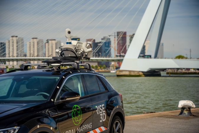
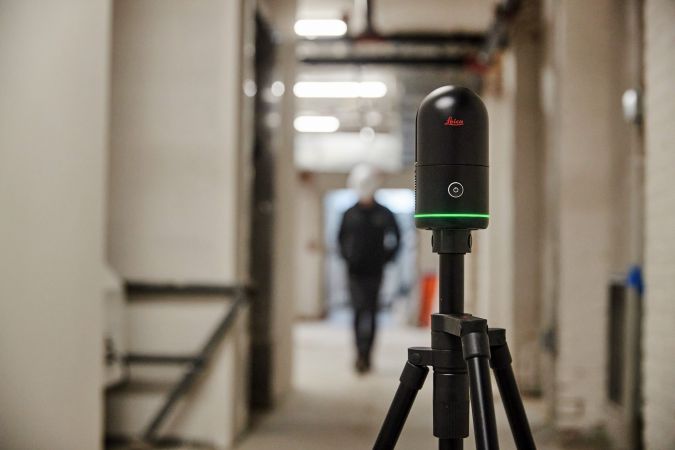
Reality capture technology has become more intuitive and user-friendly, so the barriers to adoption are getting lower every year. 3D laser scanning is one of reality capture’s core technologies. Over the years, two technologies for laser distance measurements have become especially important: long-range, high-accuracy pulse scanners, and short-range, ultra-high-speed phase scanners. As scanning technology continues to mature, these two technologies have merged into 3D laser scanners that now combine the best characteristics of the technologies. At the same time, they have become smaller, lighter, more portable and easier to use. A broad range of products – from static terrestrial laser scanners to mobile scanners and even handheld, scanners – makes the technology suitable for a variety of different requirements.
A number of technological innovations are putting reality capture within reach for an even larger range of professionals. Simultaneous localization and mapping (SLAM) technology makes it possible to map large outdoor areas while keeping track of the location within that area. SLAM allows surveyors to capture large and complex areas quickly using autonomous robots, aerial laser scanners or vehicles. The technology is highly versatile; for example, the video game developer iRacing currently uses mobile mapping systems to capture NASCAR race tracks in 3D. It feeds the 3D data into simulation software that helps racing drivers familiarize themselves with the track, just like a pilot practicing in a flight simulator. The same mobile mapping systems can capture long stretches of highway to simulate autonomous driving behaviour.
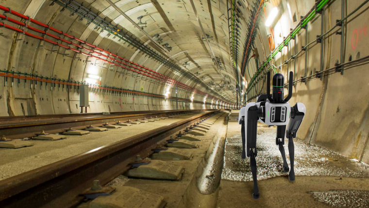
The latest sensors in the industry combine laser-based distance measurement technology with camera-based imaging technology. In the future, the data-capturing process will likely become less linear. Professionals will use a combination of different sensors to create visual representations – perhaps using a handheld imaging laser scanner to capture the interior of a building as they walk, a 3D laser scanner or an aerial laser scanner to capture its exterior, and then merging the collected data within one 3D model. Humans might operate some sensors while autonomous robots may cover areas that are difficult or dangerous to access such as, for example, nuclear power plants.
Bridging the data leverage gap
3D laser scanning devices collect a large amount of data within a very short time. Artificial intelligence is now being used to close the data leverage gap so that unprocessed data is transformed into valuable and accessible information. AI applications help to clean datasets, to make sense of the data and to extract relevant information from images and point clouds. AI-enhanced software can automatically recognize, classify and label objects, which is a significant first step towards automating the entire modelling process.
Three characteristic results of reality capture innovations make the technology attractive for new users:
- Completeness: The latest reality capture technologies enable professionals to capture complex environments in their entirety with high accuracy to facilitate the mapping of areas that were previously impossible to map.
- Speed: Capturing environments at high speed does not merely lead to enhanced productivity but, in some environments, also enables professionals to record details of a scene more safely.
- Visualization: Reality capture deliverables facilitate intuitive representations and enable immersive experiences that help non-experts grasp crucial information intuitively.
Moving from automation to autonomy
The next big step will be automating the entire process, from capturing through preparing and analysing to presenting the data. Autonomous reality capture will rest on robotic carriers, laser-based sensors and AI-based software. Technology that combines the benefits of laser-based technology with imaging to allow for the automatic positioning and autonomous movement of robotic carriers will be crucial. Collaboration platforms which provide access to cloud-based storage and visualize reality capture and geospatial data are central to fulfilling these autonomous capabilities.
After connecting the physical world to the virtual world, the next step will be linking the smart digital reality to the metaverse. Although the metaverse is popularly known as a virtual environment for social interaction, in Hexagon’s Geosystems Division we see it more broadly as the next evolutionary step of the internet towards a universal and immersive virtual world that connects people to real places, people and things. What may seem like science fiction today will likely become a reality sooner than we think.

Value staying current with geomatics?
Stay on the map with our expertly curated newsletters.
We provide educational insights, industry updates, and inspiring stories to help you learn, grow, and reach your full potential in your field. Don't miss out - subscribe today and ensure you're always informed, educated, and inspired.
Choose your newsletter(s)


