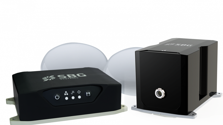
SBG Systems Launches New IMU to Complete Navsight Land/Air Solution
During the International LiDAR Mapping Forum in Denver, USA, SBG Systems released the Horizon IMU, a FOG-based high-performance inertial measurement unit (IMU) designed for highly demanding surveying applications including high-altitude data collection and mobile mapping in very dense areas such as urban canyons. Navsight Land/Air Solution consists of a ready-to-use inertial navigation solution dedicated to surveyors for mobile data collection. It is available at different levels of accuracy to meet the various application requirements and can be connected to a range of external equipment such as odometers, Lidar, etc.
Horizon IMU to complete the product range
Navsight Land/Air Solution already offered two levels of performance with the Ekinox and Apogee IMUs. These MEMS-based IMUs address most of surveying markets for camera or Lidar motion compensation and data geo-referencing. The new Horizon IMU allows our customer to bring the Navsight technology to the most demanding environment such as high-altitude surveying and highly dense areas as well as application where only a single antenna can be used. Horizon IMU is based on a closed-loop FOG technology which enables ultra-low bias and noise levels.
Automated installation process
Navsight solution is easy to install, as the sensor alignment and lever arms are automatically estimated and validated. Once connected to the Navsight processing unit, the web interface guides the user to configure the solution. A 3D view of the vehicle shows the entered parameters so that the user can check the installation. By choosing the vehicle, a plane or a car for example, the inner algorithms are automatically adjusted to the application. The Navsight unit also integrates led indicators for satellite availability, RTK corrections, and power.
Full INS/GNSS post-processing software
Completing the Navsight offer, Qinertia, the SBG post-processing software gives access to offline RTK corrections from more than 7,000 base stations located in 164 countries. The software delivers the highest level of accuracy without having to set up a base station. Trajectory and orientation are then greatly improved by processing inertial data and raw GNSS observables in forward and backward directions.

Value staying current with geomatics?
Stay on the map with our expertly curated newsletters.
We provide educational insights, industry updates, and inspiring stories to help you learn, grow, and reach your full potential in your field. Don't miss out - subscribe today and ensure you're always informed, educated, and inspired.
Choose your newsletter(s)


