150 European 3D City Maps Licenced for Navigation
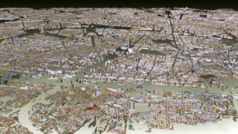
GTA Geoinformatik GmbH (Germany) has delivered the first bundle of 150 European 3D city maps to customers dealing in navigation services. The 3D city maps are high-quality, detailed data in level of detail 2 (LOD 2) with generalised roof and wall textures and a very large coverage with an average of 30 sqkm per city. The 150 3D city maps were produced automatically from aerial imagery using the software tridiconTM ROOF which was developed by GTA.
Several established producers of navigation software and devices already count on GTA's 3D solution. GTA produces 3D city maps of 900 European cities which will be the basis for one of the largest commercial databases of 3D city maps worldwide. From now on the database "Europe 3D" is available for potential customers at advantageous conditions. Also planned and drafted is a database of 300 cities for the US market.
The 3D city models are also suitable for other purposes than navigation and location-based services like solar radiation analysis, urban planning, radiowave and noise propagation and others.
GTA Geoinformatik GmbH has already compiled more than ten million buildings and produced more than 200 digital 3D city maps for European, North American and Asian capitals and major cities. Since the starting of 3D business, GTA has also produced more than 4.700 digital 3D landmarks.

Value staying current with geomatics?
Stay on the map with our expertly curated newsletters.
We provide educational insights, industry updates, and inspiring stories to help you learn, grow, and reach your full potential in your field. Don't miss out - subscribe today and ensure you're always informed, educated, and inspired.
Choose your newsletter(s)


