3D City Model and Augmented Reality in Munich
Munich as Innovation Leader in Visualizing the Future
The city of Munich launched an innovation competition and provided developmental support to the winner, Holo-Light. This ultimately resulted in the development of an award-winning augmented reality-based 3D city model of the Bavarian capital in conjunction with GeodatenService München (Geodata Service Munich). This underlines the pioneering work of this German city in using state-of-the-art technology to visualize the future.
The city of Munich launched an innovation competition in March 2018 and the winners were announced in July of that year. Participants in the innovation competition were tasked with visualizing and virtually modelling the future development in Munich’s new district of Freiham using GeodatenService München’s digital 3D data. The first winner in the augmented reality category was the company Holo-Light. That solution was subsequently developed under the leadership of GeodatenService München, together with Holo-Light itself and the city of Munich’s IT Department and the Department of Urban Planning and Building Regulations. It was presented to the public at the end of February 2019.
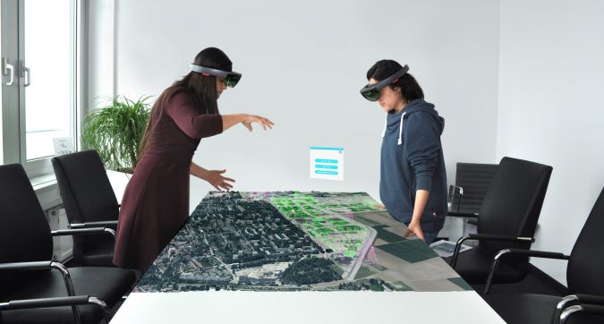
RoomScale – Visualization for Meetings
The Holo-Light solution currently includes two different modes: RoomScale and WorldScale. In RoomScale mode, the photorealistic 3D city model is displayed virtually and supplemented by the future development based on the legally binding development plan.
RoomScale mode is used, for instance, in the context of committee and city council meetings or public events. The virtual version of Munich can be viewed simultaneously by up to 12 people. Wearing Microsoft's mixed-reality headsets, they can see further information such as street names or floor numbers of the individual buildings. Furthermore, viewers can interactively adapt virtual objects and, among other things, change the height of a selected building by altering the number of floors. During the meetings, the participants can also discuss the extent to which the planned buildings fit into the cityscape. Changes and variations are visualized immediately. This supports better coordination of development plans.
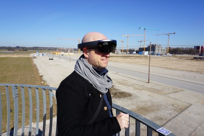
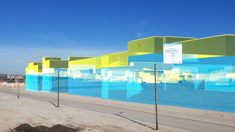
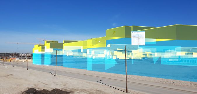
WorldScale – On-site Visualization
WorldScale mode enables virtual 3D data to be added to the real world on site. This takes stakeholders away from the drawing board and the meeting room and out into the city itself. By standing on a viewing platform, for instance, users can get an impression of the actual dimensions of the planned buildings.
In WorldScale mode, it is also possible that several people look at the virtual buildings at the same time. Additional information is displayed, and interactive adjustments can be made. It is believed that Munich was the first city in the world to take this approach.
Use in Practice
Use of the solution in practice showed that extending the reality with virtual information works and is accepted by the users. After successful implementation of the solution, numerous people in Munich – ranging from politicians and urban planners to citizens – were able to get a first impression. In this context, the technology was not of the utmost relevance. Instead, the users directly started discussing the information they could see. This was a very positive result for the usability of augmented reality.
Leading Innovation in Augmented Reality
The highly innovative approach of this augmented reality solution for 3D city modelling was officially recognized when Holo-Light received the German Innovation Award in May 2019. It provides very transparent planning support for city councils, urban planners as well as decision-makers within the authorities. In addition, the solution offers new possibilities in terms of the communication of urban planning projects to the citizens of Munich.
GeodatenService München continues to pursue the use of augmented reality for the purposes of the Bavarian capital. This is currently implemented as part of the funding project for the creation of a digital twin of the city of Munich, which was launched on 1 January 2019 and is funded by the Federal Ministry of Transport and Digital Infrastructure. The aim of this project is to create a complete digital three-dimensional representation (3D city model) of Munich which also contains extensive information and real-time data. The goal is to improve the foundation for urban planning, for example by modelling what-if scenarios. Last but not least, augmented reality will play a vital role in visualization.

Value staying current with geomatics?
Stay on the map with our expertly curated newsletters.
We provide educational insights, industry updates, and inspiring stories to help you learn, grow, and reach your full potential in your field. Don't miss out - subscribe today and ensure you're always informed, educated, and inspired.
Choose your newsletter(s)


