7 Awe-inspiring UAS Surveys
Nowadays, it’s hard to imagine the geomatics industry without unmanned aerial vehicles (UAVs) – and yet they only arrived on the scene around five years ago. When the very first versions of the small commercial drones were unveiled at trade fairs like Intergeo, they were dismissed by some as a hype. Nothing could have been further from the truth! Today, unmanned aerial systems have firmly established themselves as valuable tools in the data collection process. In fact, they are already achieving impressive results! We put together an overview of seven awe-inspiring UAV surveys as an example of just what they are capable of.
Christ the Redeemer statue, Rio de Janeiro
The famous statue of Christ the Redeemer in Rio de Janeiro has been reconstructed in 3D using a UAV. Challenging weather conditions and the sheer size of the monument meant that careful planning was required to complete the project and maintain safety. Thousands of pictures were captured around the statue and processed to create a large and accurate point cloud and a textured mesh. Christ the Redeemer Reconstructed in 3D
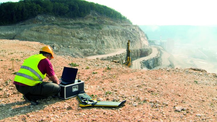
Mining industry, Andalusia, Spain
A growing number of mining companies are employing unmanned aerial vehicles (UAVs). Equipped with digital cameras, such remote-controlled small aircraft generate high-resolution aerial imagery which can be further processed to produce highly precise orthophotos, point clouds and 3D models. Surveyors and engineers can use this data to make statements and forecasts about the development of the mine, document changes as well as calculate volumes of spoil and stockpiles. In mines with both aboveground and underground areas, UAVs can provide important information about the state of the aboveground area, thus improving the safety of the workers underground. This was practised in an 80-hectare area of the Mina de Aguas Teñidas in Andalusia, Spain.Unmanned Aerial Vehicles in the Mining Industry
Easter Island, Chile
Unmanned aerial systems (UASs) can be easily transported and this beneficial feature is ideal for photogrammetric surveys of remote spaces. Rapa Nui, the most isolated inhabited place on the planet, took UAS photogrammetry to the limit because of cloud cover, windy weather conditions and the vast size of the island. The resulting orthoimagery and digital surface models will support archaeological documentation and research. The archaeological features will be archived in a single, detailed database. The authors discuss this exciting and challenging adventure. UAS Survey of Easter Island
Chuquicamata Mine, Andes, Chile
In mining, the determination of volume changes over time is an important surveying task. However, harsh environments can make gathering precise and up-to-date geodata challenging. Traditional land surveying and terrestrial laser scanning are faced with many hurdles when used in remote open pit mines. UAS provides an alternative without compromising accuracy. Here, the authors present UAS surveys carried out high in the Andes. UAS in the Andes
Prague Castle, Czech Republic
In a recent project to obtain detailed and accurate orthoimages and 3D models to support technical staff in maintaining Prague Castle in the Czech Republic, the site was captured by UAS photogrammetry. Videos and georeferenced panoramic images were also taken as a service to documentalists and to provide the basis for virtual tours for tourists. Prague Castle and its surroundings are heavily secured sites and special permission was required to conduct the air survey. Modelling Prague Castle with a UAS
Benin
When conducting surveys in countries near the equator, environmental conditions can be harsh. Heat, dust and humidity may disrupt sensitive equipment, while distrustful locals may obstruct the undertaking. Read on to learn about the experiences during a UAS survey on the savannah of Benin, West Africa. UAS Experiences in Africa: Heat, Dust and Distrustful Locals
Salar de Coposa, Chile
Edáfica, a Chilean environmental consulting company which owns an sUAS Stardust II, was hired by Collahuasi mining company to conduct a survey of biophysics and ecotypes. The aim of the survey was to explain the conservation status of the species Frankenia triandra growing in Salar de Coposa under governmental protection. UAS Conducts Survey at 4,300m above Sea Level

Value staying current with geomatics?
Stay on the map with our expertly curated newsletters.
We provide educational insights, industry updates, and inspiring stories to help you learn, grow, and reach your full potential in your field. Don't miss out - subscribe today and ensure you're always informed, educated, and inspired.
Choose your newsletter(s)


