Accurate Position Information for Mobile CAD and GIS Software
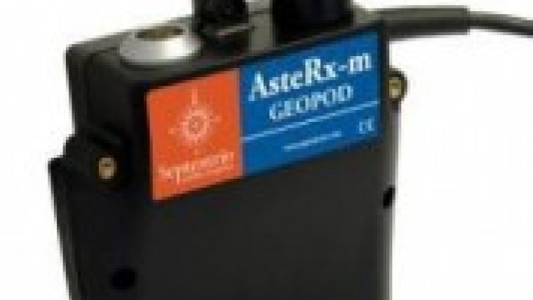
Septentrio jointly announced with Pythagoras, developer of CAD and GIS software, that they have integrated key components to propose a complete solution which is ready for geospatial applications. The solution combines the Pythagoras software with a highly accurate GNSS device called AsteRx-m GeoPod that enables accurate position measurements up to 1cm level.
Supported within Pythagoras, this RTK-capable solution removes the necessity of using traditional professional GNSS equipment; field operators can perform sub-metre accurate positioning with ordinary and familiar user-friendly tools. Centimetre-level accuracy is achieved by connecting an external survey grade antenna to the receiver. The AsteRx-m GeoPod integrates seamlessly with Pythagoras thanks to the suite of GUI utilities RxTools and the configuration module RxAssistant, also included in the solution.
Septentrio is excited to work together with Pythagoras to offer a fully integrated solution that is readily useable for geospatial applications, said Peter Grognard, Septentrio’s founder and CEO. It is a new example of how to generate value by closely cooperating with CAD-GIS software developers.
Becoming a Septentrio partner offers the chance to develop client-specific apps that combine Pythagoras CAD & GIS tools with geospatial information, said Jan Van Looy, commercial director and co-founder of Pythagoras. The combination with the AsteRx-m GeoPod fills this need.
The new solution is interesting for field crews, who get the tools to easily locate assets, to accurately measure and to commit changes into the company databases. The solution can be used by any operators; it becomes easy for anyone to record georeferenced information in the field. The IT department has the full flexibility to select the mobile devices that suit the applications best; it operates seamlessly on any professional tablet.

Value staying current with geomatics?
Stay on the map with our expertly curated newsletters.
We provide educational insights, industry updates, and inspiring stories to help you learn, grow, and reach your full potential in your field. Don't miss out - subscribe today and ensure you're always informed, educated, and inspired.
Choose your newsletter(s)


