An Awakening in India
GIM International Interviews Bharat Lohani
Since this issue of GIM International is dedicated to Lidar point clouds, it should come as no surprise that it contains an interview with a leading expert on this exciting aspect of the geomatics spectrum. Dr Bharat Lohani, who is leading the Lidar teaching and research group at the renowned Indian institute of IIT Kanpur and is a member of this magazine’s editorial board, was a logical candidate. In this interview he talks about India's role in the industry, his company Geokno, developments within Lidar technology and the geomatics programme at IIT Kanpur.
You have a background in academia. What was your incentive for helping to found a mapping company?
I learnt about Lidar technology during my PhD at the University of Reading, UK. Lidar was very much still in its infancy at that time but I realised that the technology could help India to leapfrog in its growth trajectory. This belief made me want to continue working in that area when I returned to India and joined IIT Kanpur. I interacted a lot with government and industry regarding the implementation of Lidar technology in India, but I realised that, despite a large market potential, technology adoption was surprisingly slow. That’s when I, along with my student Mr Balaji Nagarajan, decided to make a start. Furthermore, I believe that research should not remain within the bounds of universities but should instead help industry and thus society. Founding the company was an opportunity for us to take our research to market.
Some of the world’s largest geospatial service providers were born in and operate from India. There are also many small, local surveying companies. How do you position Geokno in this competitive environment?
The business model of the majority of geospatial companies in India is based on outsourced jobs. There are also many smaller surveying companies which primarily focus on providing land surveying-based solutions to government and industry. Geokno does not belong to either of these categories. At Geokno, we focus on the niche market of Lidar data capture, processing and solution development by employing technical experts of high calibre. We see scope for a company like this which is capable of delivering end-to-end solutions for the growing Indian geospatial market. Being a GMR group company now, Geokno has the capability to scale up its operations in this highly investment-intensive business.
Is it Geokno's vision to specialise in services on the Indian market, or do you plan to offer services internationally as well? And if so, what would be Geokno’s competitive advantage over current service providers?
Geokno’s first priority is to provide services in India. However, we are also very keen to target overseas high-resolution data capture and processing opportunities. We do not see many players in this domain, both in India and on the subcontinent in general. Besides technical expertise in Lidar and allied technologies, Geokno has the unique and added benefit of having access to GMR’s aviation facilities and experience. Geokno will always have a cost advantage over the Lidar operators coming to India from Europe or the US.
Geokno claims to be the first company to operate aerial, mobile and terrestrial scanners in India. What is the advantage of having this combination in-house?
It is true that Geokno possesses capabilities in all three of those Lidar technologies, and that is part of our strategy to become the ‘Lidar company of India’. We want to address data capture and solutions for a large range of applications, which is only possible by having the necessary expertise and facilities in-house. India has excellent map products at small scale from the Survey of India. However, large-scale products are now becoming increasingly necessary too, and these are severely lacking in India. Our ability to provide these products at varied accuracies, scales and resolutions will help our clients. Furthermore, all these three forms of technologies are complementary in nature.
General survey equipment can nowadays be sourced from many companies around the world. Lidar instruments, however, are mostly produced in Europe and North America. Do you see a development where Indian companies are starting to produce this kind of equipment as well?
Currently, the Indian manufacturing industry is not capable of producing surveying hardware including Lidar instruments, and I do not see this changing in the short term. However, it is very feasible that equipment like mobile mapping systems could be built in India. Any such system is in fact an integration of a large number of off-the-shelf sensors. The intellectual property that forms the basis for this integration is of prime importance. I am very positive that we will see such integration taking place in India in the near future. Some attempts have already been made in this direction, and I expect the Indian government to support these developments as they have the potential to increase foreign exchange.
Lidar technology is not new – it was developed over 40 years ago – and yet there is still a lot of innovation in Lidar technology. What do you regard as the most interesting developments?
Reducing the form factor of laser scanners/Lidar systems so that they can be carried on unmanned aerial vehicles (UAVs), multiple time around technologies which can increase data density from higher elevations, GPU-based data processing, point cloud processing algorithms for automation, integration of camera and laser scanners – these will all be interesting developments to watch.
Given your dual role in business and academia, you must be keen on transferring innovations from the university into practical applications. Can you give us any examples of recent success stories?
IIT Kanpur has a very strong academic and research tradition, and more importantly it attracts the best students in India. This provides fertile ground for innovation. I would like to mention one such invention – currently the de facto standard is that laser scanning can only be performed from mobile or terrestrial platforms if the objects being scanned are stationary. We have invented a method of motion correction whereby we can scan a mobile object from such platforms and generate correct 3D geometry. This has been transferred to the defence industry where it is being used for a specific application.
You are also involved in cultural heritage mapping. What have been your most recent experiences with laser scanning of archaeological sites, and which major developments do you foresee with regard to heritage mapping?
We have done a few pilot projects for modelling cultural heritage at IIT Kanpur, and at Geokno we have completed some extensive projects. I see an awakening in India and elsewhere in this area now, and more and more such opportunities are appearing. Scanning and documenting cultural heritage are important aspects. However, a lot still needs to be done on data processing and 3D model dissemination. The data should not merely be archived, it should be shared with students, scientists and tourists. In my view the major advancement in this area would be on developing technologies that facilitate seamless and efficient dissemination of data and models via the internet.
How do you prepare students at your university for the ever-increasing role of big datasets such as point clouds in geomatics?
I am offering a course on Lidar technology and photogrammetry where students learn techniques for point cloud generation and processing. We emphasise basic algorithms and data structure for point cloud archiving, retrieval, segmentation, classification, etc. Fortunately, there are a few good libraries like PCL and LAStools that help students develop their own codes for data processing. Geokno also has a library and LASViewer software that is used by our students for developing data processing systems. Our students are also exposed to commercial software for Lidar data processing. In addition to this classroom-based teaching, our students learn a lot during the year they spend on their thesis work.
On average, how many students graduate from your geomatics programme each year? And where do those students end up working?
On average, around 12 to 14 postgraduate students graduate every year from our Geoinformatics Laboratory. While the majority of these students graduate with a master’s degree, a few also earn their PhD. We plan to hire more faculty members in GPS, GIS, point cloud and remote sensing, which will then increase these numbers. All our undergraduate students (around 100 every year) are also exposed to geomatics through compulsory and optional courses and also through their BTech projects. Our master’s students mostly opt for higher education but a few join industry and government in India, and the same is true for our undergraduate students.
If students from your university planned to start their own company, what would you advise them?
With its incubation centre, which provides technical mentoring, laboratory facilities and the necessary logistics, our institute very much encourages students to start their own ventures and I strongly support that approach. My advice to students would be to (i) first assess if they have passion for entrepreneurship, (ii) be ready for the initial ‘blues’ that are associated with entrepreneurship, (iii) form a team with complementary skill sets, (iv) study the market and assess the latest developments to understand the potential of their idea, and (v) network with the right people who can help. On the technical side, I see geomatics as an excellent area for entrepreneurship at the moment. This is especially the case in India and developing countries which require a large amount of geospatial data and solutions for their current development needs, as there is a lack of high-quality data and solutions.
What will be India's biggest geomatics-related challenge in the foreseeable future? And how do you think universities and companies can contribute to tackling it?
The coming decade will see multifold growth in infrastructure development in India. In the recent national elections, people have placed their faith in the idea of development, and now politicians and governments have to cater to these aspirations. Furthermore, in the recent past the country has witnessed some severe disasters which caused huge losses of life and property. There have also been some success stories in which the use of technology helped to minimise the losses. Overall the government in particular, and others in general, have realised the potential that geomatics technology can hold for national development. Considering this, the major geomatics-related challenges in the next few years in India will be (i) realising national GIS, (ii) realising a national digital elevation model (DEM), (iii) realising a nationwide Geoid model, (iv) capacity building, and (v) creating a research and development environment and success stories. I see universities playing a crucial role in all of these, most importantly in capacity building and research and development which will pave the way for other challenges.
BIOGRAPHY
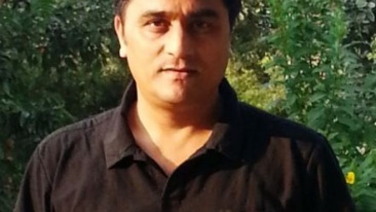
Dr Bharat Lohani earned his PhD from the University of Reading, UK, in 1999 and subsequently pursued an academic career at IIT Kanpur, where he leads the Lidar teaching and research group. He has over 100 publications to his name in various journals and conference proceedings, including many popular articles on Lidar, and has delivered around 35 invited lectures. Dr Lohani incubated Geokno India at IIT Kanpur and the company is now a subsidiary of infrastructure giant GMR, operating out of Bangalore. Dr Lohani is a fellow of the Institution of Surveyors, co-chair at ISPRS WG V/2 and executive member of ISRS council. He recently received the ‘National Award for Geospatial Excellence’ from ISRS.

Value staying current with geomatics?
Stay on the map with our expertly curated newsletters.
We provide educational insights, industry updates, and inspiring stories to help you learn, grow, and reach your full potential in your field. Don't miss out - subscribe today and ensure you're always informed, educated, and inspired.
Choose your newsletter(s)


