Cloud Solution for Collaborative Urban Planning
Agency9, known for its technology in large scale streaming and 3D visualisation solutions, announces the release of free global 3D terrain and buildings in CityPlanner – its cloud solution for collaborative urban planning on the web.
Agency9 currently serves many customers with web-based 3D visualisation tools in CityPlanner. With the release of the free global 3D world in CityPlanner, the company aims to further stimulate users transition to 3D using modern planning paradigms – as well as lower the financial hurdle of adopting such services. Bundling free 3D data with the service allows any city in the world to start using CityPlanner instantly, without the lead time of acquiring data, said Håkan Engman, CEO of the Swedish company.
Smart cities
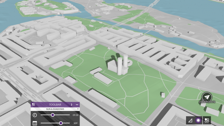
CityPlanner represents a new generation of 3D tools for the preparation of plans, project communication, and citizen dialogue in smart cities. CityPlanner is presently used by many cities for urban planning, promotion, GIS presentation, and crowdsourcing. The free global 3D model has a terrain based on open satellite data and LOD1 buildings generated dynamically from OpenStreetMap building data. Buildings are currently available for the Nordics, expanding globally throughout the year.
Later this year Agency9 will add large scale paid 3D premium content on a region, national, and continental basis. This further supports market adoption with easy access to 3D data and services.
Check out 3D data in CityPlanner

Value staying current with geomatics?
Stay on the map with our expertly curated newsletters.
We provide educational insights, industry updates, and inspiring stories to help you learn, grow, and reach your full potential in your field. Don't miss out - subscribe today and ensure you're always informed, educated, and inspired.
Choose your newsletter(s)


