Connecting New Geoinformation Technologies to Wide-ranging Applications
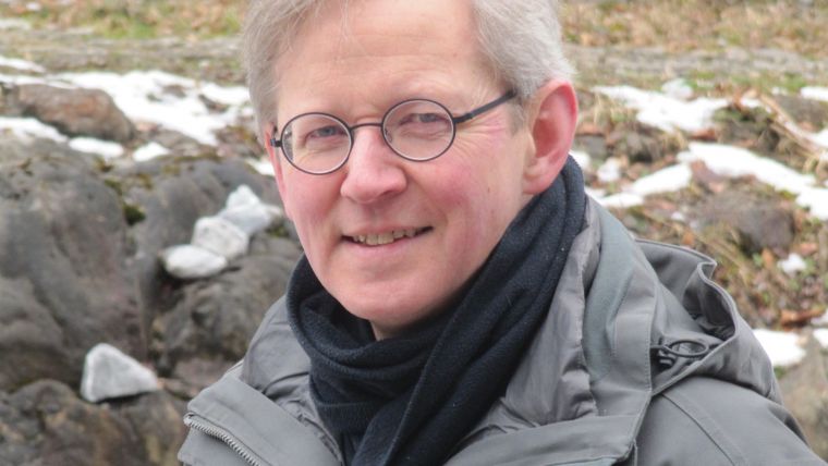
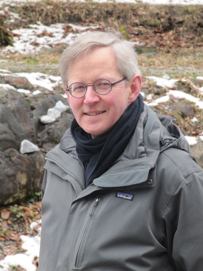
GIM International Interviews George Vosselman, ISPRS Geospatial Week 2019
Preparations are in full swing for the ISPRS Geospatial Week 2019, which will be held from 10-14 June in the Dutch city of Enschede. As an event partner, 'GIM International' caught up with George Vosselman, chair of the organizing committee, to hear how things are progressing and what delegates can expect of this year’s Geospatial Week. One thing is for sure: photogrammetry and remote sensing are definitely on the programme.
Why was Enschede chosen as the venue for the ISPRS Geospatial Week 2019?
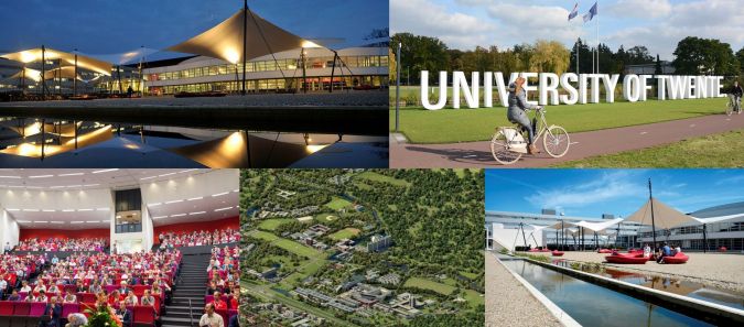
Enschede is the hometown of the University of Twente’s ITC Faculty, one of the world’s largest geospatial knowledge hubs. ITC has been focusing on capacity development in the field of geoinformation and Earth observation for nearly 70 years. Organizing events aimed at sharing the latest knowledge is perfectly aligned with this mission. Besides that, the University of Twente campus is a great location to host a conference. It is a pleasant environment with modern facilities in green surroundings, with a suitable outdoor area for UAV [unmanned aerial vehicle or ‘drone’, Ed.] flight demonstrations. Furthermore Enschede is easily accessible, not least thanks to a direct train connection from Amsterdam Airport Schiphol which is the gateway to over 300 destinations.
You must be very busy with the preparations for the ISPRS Geospatial Week. What are you looking forward to most?
That’s true, organizing this event is taking up a lot of my time. But it’s also fun and I consider myself lucky to be surrounded by excellent colleagues, all of whom are dedicated to making the ISPRS Geospatial Week a big success. I’m most looking forward to the opening session, because by that time all the preparations will be complete and we will be able to welcome our colleagues and friends to enjoy the event. I’m also looking forward to the opening keynote by Edward Anderson from The World Bank. His organization is supporting many interesting community mapping projects. One of them – which I’m sure he will mention – is the Tanzania Urban Resilience Programme which is training local communities to use drones for acquiring images all over Dar es Salaam and creating high-quality maps.
What can delegates travelling to Enschede this June expect of the event?
The workshops form the core of the ISPRS Geospatial Week, as that is where the latest research results will be presented. This year’s Geospatial Week will feature 13 workshops varying in duration from one to three days, with up to six workshops running in parallel. These workshops are being jointly organized by 30 of the approximately 60 working groups within ISPRS. They will cover a wide range of topics of the ISPRS technical commissions on sensors, photogrammetry, remote sensing and spatial information science. We’ve received 500 submissions from 63 countries, so we’re expecting a very international event with many participants and an excellent opportunity to meet colleagues. On the Sunday before Geospatial Week truly gets underway, experts will offer tutorials on deep learning for image and point cloud interpretation, geospatial web services and photogrammetric workflows.
What other highlights are awaiting attendees of the ISPRS Geospatial Week 2019?
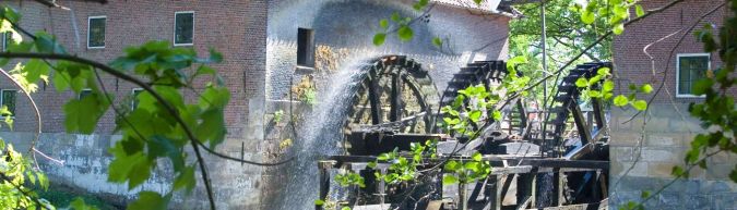
Besides attending the workshops, delegates can also visit the exhibition where various companies will be presenting their latest products and providing demonstrations. I would also like to mention the two conference dinners, and in particular the one on Tuesday which will be held in a beautiful riverside setting. The venue is the Singraven country estate, home to several historic buildings including an ancient three-wheel watermill that dates back to 1448 but is still in operation today as a sawmill and flour mill.
ISPRS was founded more than a hundred years ago, during which time both technology and the wider world have changed quite a lot. How do you see the future role of ISPRS in today’s dynamic society?
A century ago, photogrammetry was mainly related to civil engineering applications. Over time it has become increasingly clear that geographic information (and metric information in general) is useful for many more applications. Currently, geoinformation is the linking pin between many different communities (computer science, robotics, civil engineering, navigation, urban planning, etc.). As the leading scientific community for geoinformation, ISPRS is at the crossroads of these different domains. This makes it well-positioned to connect new technologies to a wide range of applications by integrating those new technologies in its own domain and adapting them to meet application-specific demands.
Zooming in on geospatial technology, UAVs have become an important tool for photogrammetry mapping and are also gaining ground as a platform for Lidar. Is this reflected in the event programme?
Yes, for sure! In fact, the International Conference on Unmanned Aerial Vehicles in Geomatics (UAV-g) will actually be part of the ISPRS Geospatial Week for the first time this year. UAV-g 2019 will be the fifth edition in a successful series, and it has attracted a record number of 120 submissions which once again confirms the huge interest in unmanned applications. Running for three full days and with presentations from all continents, UAV-g 2019 will be the largest workshop in Enschede. Besides the ‘classical’ photogrammetry and remote sensing sessions, there will also be presentations closely related to robotics and computer vision as well as natural resources domains. The presence of several sponsoring companies involved in the UAV domain underlines the importance of this event for the geoinformation community.
The trend in satellite imagery is towards ever-higher resolution. Is it finally becoming a serious challenger to aerial photogrammetry?
With satellites like WorldView 3 and 4 imaging with a 30cm ground sample distance (GSD), today’s high-resolution satellite images are indeed starting to resemble traditional aerial images. But the resolution of images used for aerial photogrammetry is increasing as well! In the Netherlands, the national aerial images have been acquired with a 10cm GSD for quite a few years now. In fact, due to restrictions on flying in the terminal manoeuvring area around Amsterdam Airport Schiphol, cities like The Hague have even started to acquire aerial imagery with a 2.5cm GSD and now very much appreciate the extremely high resolution. The 2.5cm GSD is approaching the resolution level we’re used to for UAV images, but it can also be acquired over larger areas from an aircraft. So I expect there will continue to be a market for imaging on all types of platforms.
Which technological advancements do you currently see as having the most impact in the field of photogrammetry and remote sensing?
Clearly, deep learning has to be mentioned here. Whether for 3D reconstruction or semantic segmentation of images and point clouds, algorithms based on the latest machine learning approaches are leading all main benchmark charts. This trend will certainly be reflected in the papers presented at the ISPRS Geospatial Week, in particular in the Semantics3D workshop. Another important development is the miniaturization of sensors. A few years ago, only very large drones were robust enough to carry a laser scanner. Nowadays a large number of small Lidar-equipped UAVs are on the market. About a dozen contributions to the UAV-g workshop will report on investigations related to such UAVs. Sensor miniaturization also paves the way for the creation of low-cost indoor mapping systems and the general integration of sensors in all kinds of objects. This will lead to an explosion of imagery available to map the world at the very high resolution needed for applications such as high-density maps in self-driving cars, for example. We’re looking forward to welcoming delegates to Geospatial Week 2019 in Enschede to discuss this and many other future scenarios!

Value staying current with geomatics?
Stay on the map with our expertly curated newsletters.
We provide educational insights, industry updates, and inspiring stories to help you learn, grow, and reach your full potential in your field. Don't miss out - subscribe today and ensure you're always informed, educated, and inspired.
Choose your newsletter(s)


