Corridor Mapping Solution
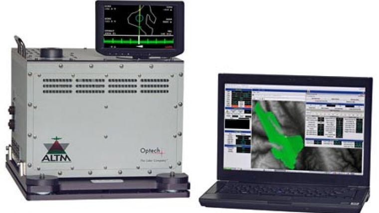
The ALTM Orion C200 isased on the Orion platform, and the first in a series of ALTMs designed specifically for the corridor market. This low-altitude mapping solution addresses the needs of a burgeoning industry demanding a turn-key solution which is fully supported, upgradeable and cost-effective.
Ideally suited for smaller aircraft with minimal payload and power capability, the ALTM Orion C200 incorporates an eye-safe, 1.5 micron high-precision laser with an effective repetition rate of 200 kHz, and a variable field of view for those requiring maximum available density in a robust and flexible package. Standard design features include variable roll compensation, plug-and-play ports for integrated imaging sensor options, and real-time GPS differential correction capability. A streamlined Flight Management System with fully integrated peripheral sensor planning and control capability enables in-air mission planning and graphical real-time data coverage estimation for increased collection confidence. An unmanned, remotely-operated version is also available for non-commercial requirements.

Value staying current with geomatics?
Stay on the map with our expertly curated newsletters.
We provide educational insights, industry updates, and inspiring stories to help you learn, grow, and reach your full potential in your field. Don't miss out - subscribe today and ensure you're always informed, educated, and inspired.
Choose your newsletter(s)


