DSS RapidOrtho 2.0 for High-Speed Orthophoto Production
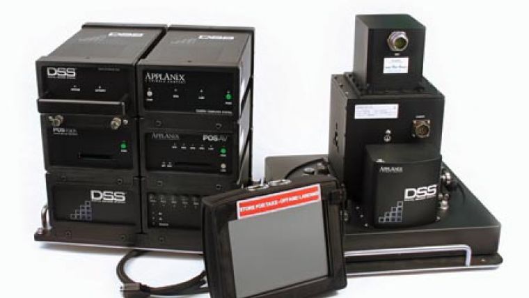
RapidOrtho 2.0 is a software enhancement for Applanix\' Digital Sensor System (DSS). DSS RapidOrtho is a complete airborne digital imaging system for first responders and geospatial professionals who need to deliver rapid, highly-accurate ortho-rectified imagery without time-consuming and expensive ground surveys. The system is used for rapid response for emergency mapping operations, change detection and more; it has even been adopted as a productivity tool for commercial mapping projects.
Images can be developed and ortho-rectified as much as three times faster than the previous version. For example, images from the DSS 439 (39 megapixel) camera can be delivered in as little as 12 seconds per orthophoto, using a standard quad-core desktop computer. This means a typical mapping mission of 3 hours flight time can be taken to full orthophoto product in as little as three hours after landing.
Released as part of POSPac MMS software update 5.3, the new RapidOrtho also offers better Digital Elevation Model (DEM) management. A new utility allows users to import and convert readily available DEM datasets - including Lidar data - into the RapidOrtho format; this means first responders can utilize any locally-available elevation data for rapid delivery of orthophotos.

Value staying current with geomatics?
Stay on the map with our expertly curated newsletters.
We provide educational insights, industry updates, and inspiring stories to help you learn, grow, and reach your full potential in your field. Don't miss out - subscribe today and ensure you're always informed, educated, and inspired.
Choose your newsletter(s)


