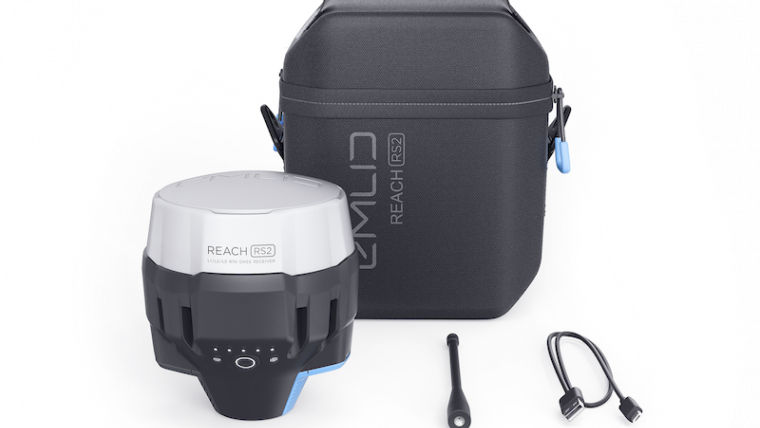
Emlid Lauches Affordable Multi-band RTK GNSS Receiver
Emlid, the creators of Reach, a centimetre-accurate RTK GNSS receiver, recently launched their multi-band GNSS receiver Reach RS2. The new receiver features built-in LoRa radio, 3.5G modem and a survey app for iOS and Android. The Reach RS2 gets fixed solution in seconds and provides positional accuracy down to several millimeters. The receiver tracks GPS/QZSS (L1, L2), GLONASS (L1, L2), BeiDou (B1, B2), Galileo (E1, E5), and SBAS (L1C/A) and reliably works in RTK mode on distances up to 60 km, and 100km in PPK mode.
Multi-feed antenna with multipath rejection offers robust performance, also in challenging conditions. RINEX raw data logs are compatible with OPUS, CSRS-PPP, AUSPOS, and other PPP services so it is possible to get centimetre-precise results in any place on Earth.
The Reach RS2 features a power-efficient 3.5G HSPA modem with 2G fallback and global coverage. The corrections can be accessed or broadcasted over NTRIP independently, without relying on internet connection on the smartphone. For remote areas, Reach RS2 has built-in LoRa radio that has proven to be a reliable link for RTK corrections on distances up to 8km.
Tough conditions
Reach RS2 is engineered to be waterproof and impact-resistant. Its body is manufactured in a two-step injection process and is made out of shockproof polycarbonate covered in a special elastomer for extra protection. The receiver has an industry-standard 5/8'’ mounting thread.
The LiFePO4 battery of the GNSS receiver is designed for 16 hours work as 3.5G RTK rover on one charge regardless of weather conditions. No more need to carry spare batteries. Reach RS2 can charge from a USB wall charger or a power bank over USB-C. RS232 interface allows to connect the Reach RS2 directly to external hardware and output position in NMEA.
The Reach RS2 comes with a mobile app ReachView for iOS and Android, that is used to control all the features of the device. Create projects, collect and stakeout points. Import and export geodata in industry standard formats such as CSV, DXF, and Esri Shapefile.

Value staying current with geomatics?
Stay on the map with our expertly curated newsletters.
We provide educational insights, industry updates, and inspiring stories to help you learn, grow, and reach your full potential in your field. Don't miss out - subscribe today and ensure you're always informed, educated, and inspired.
Choose your newsletter(s)


