Esri and United Nations Create COVID-19 Population Vulnerability Dashboard
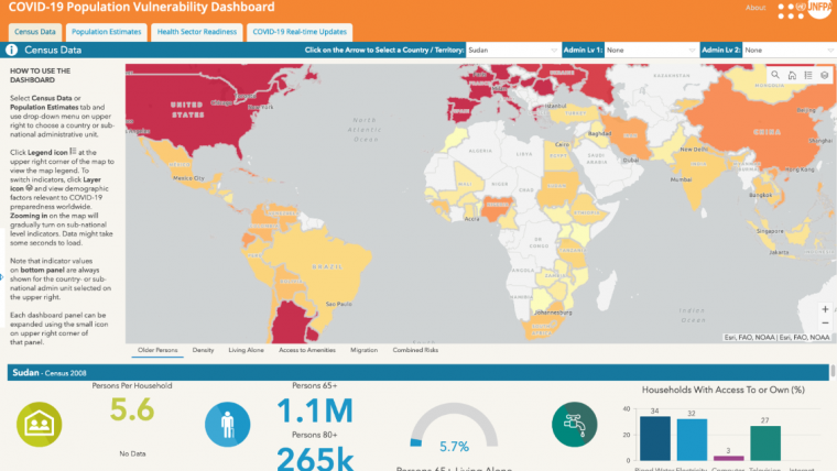
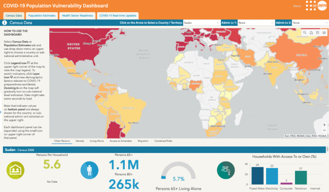
Esri has been collaborating with the United Nations Population Fund (UNFPA) to create a COVID-19 Population Vulnerability Dashboard. This new interactive tool will provide public health workers, policymakers and the general public with access to useful information on populations vulnerable to coronavirus disease 2019 (COVID-19) in order to target preparedness and response and to help save lives.
The dashboard highlights population vulnerabilities at the national and subnational levels, using data from the latest Integrated Public Use Microdata Series (IPUMS) census samples for 94 countries. It identifies populations at older ages, including those living alone, and includes risk factors for COVID-19 transmission such as residential density (household size and persons per room) and access to piped water and other amenities.
Daily updates on COVID-19 cases and deaths are embedded in the dashboard, as is global data on health sector readiness. This includes the density of available health care workers, hospital beds, and intensive care units (ICUs).
Geographic comparisons to anticipate potential risks
“National and subnational disparities in vulnerability can be striking,” said Linda Peters, Esri global business development manager. “How these differences will affect overall transmission and health risk will be shaped by critical factors such as the scale and timing of government lockdowns. But geographic comparisons help us anticipate potential risks, and remind us of the huge differences in underlying development needs and health sector readiness between countries.”
Since the census data included is in the public domain—and therefore from the 2010 census samples—the dashboard also provides WorldPop projections of the 2020 population numbers among older age groups, organized by sex and population density, for more than 200 countries.
To learn more about vulnerable-population data for addressing COVID-19 and to view the dashboard, see here.

Value staying current with geomatics?
Stay on the map with our expertly curated newsletters.
We provide educational insights, industry updates, and inspiring stories to help you learn, grow, and reach your full potential in your field. Don't miss out - subscribe today and ensure you're always informed, educated, and inspired.
Choose your newsletter(s)


