Hexagon Announces Updates for the 2018 Airborne Imagery Collection Plans
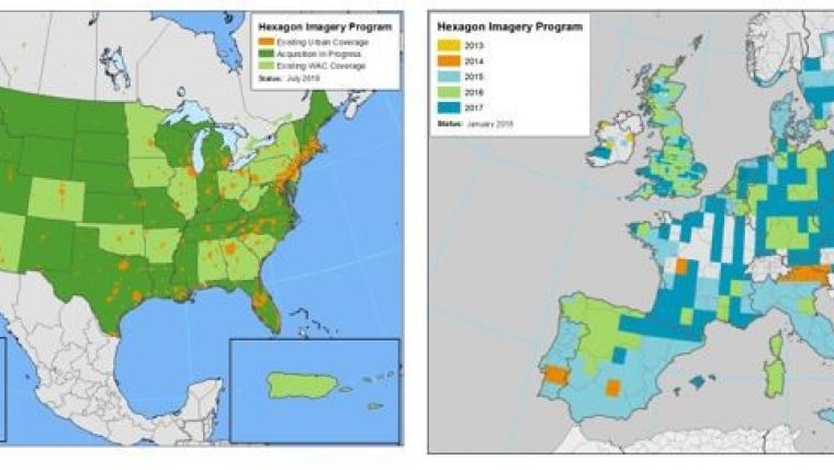
Hexagon’s Geosystems Division has presented updates for the 2018 airborne imagery collection plans of the Hexagon Imagery Program (HxIP), the premier source for professional airborne imagery provided through the cloud. In North America, the HxIP will update its coverage by more than 4.5 million square kilometres by the end of 2018. This includes a refresh of 24 previously captured US states. In addition to the 30cm programme, the HxIP is refreshing 15cm coverage for more than 260 cities in 2018.
In Europe, more than 900,000km² of newly collected and updated areas will join the existing 30cm coverage bringing more than 2.6 million km² in total available. This additional coverage places the HxIP as one of the most comprehensive imagery programmes in Europe and in the world.
“We are constantly expanding our reach of the Hexagon Imagery Program, and we are excited to see the program grow again in 2018,” said John Welter, Hexagon’s Geospatial Content Solutions president. “We are also expanding our efforts to get HxIP to even more end users - from a new website to adding additional products and support resources to ensure continued growth. Online usage has increased substantially in the last 12 months, so we’ve also deployed infrastructure to Frankfurt, Germany, and into the Amazon Web Service cloud to ensure we can continue to deliver our customers an overall excellent experience.”
Quality control by experts
Launched in June 2014, the HxIP, one part of the Hexagon Content Program, provides valuable geospatial content and delivers professional-grade airborne images captured with Leica Geosystems’ airborne sensors, including enhanced-resolution, four-band orthos, rasterised point clouds, and stereo imagery.
The imagery data is processed by experienced photogrammetry professionals who ortho rectify, and correct colours and seam lines. Using the latest processing technology, these experts clean the data to be used in various applications, such as corridor mapping, real estate assessments and flood planning.
To view the most current status of the HxIP’s data availability and acquisition, see here.

Value staying current with geomatics?
Stay on the map with our expertly curated newsletters.
We provide educational insights, industry updates, and inspiring stories to help you learn, grow, and reach your full potential in your field. Don't miss out - subscribe today and ensure you're always informed, educated, and inspired.
Choose your newsletter(s)


