Hexagon Launches V2018.0 Release of Luciad
Hexagon’s Geospatial Division announced full details of its Luciad V2018.0 release at HxGN LIVE 2018, which took place in Las Vegas in June. The release empowers users to create a smart digital reality by enabling the streaming of highly detailed point cloud data to both the desktop and the browser, and by giving users the ability to develop and utilise intricately detailed 3D reality meshes.
These features will be available in LuciadLightspeed and LuciadRIA, Luciad’s modular and customisable solutions for geospatial awareness on the desktop and in the browser. LucadFusion, the all-in-one server solution for geospatial data publication and management can now manage vast amounts of point cloud and 3D reality mesh files, index them and stream them using open standards.
As organisations, cities and countries race to make use of the deluge of IoT sensor data in order to become more flexible and responsive, visualising and analysing this data efficiently and effectively has become a significant challenge. In light of this, Hexagon recognises that geospatial applications need to be able to provide highly detailed models of reality where this data can be visualised by users to power the decision-making process.
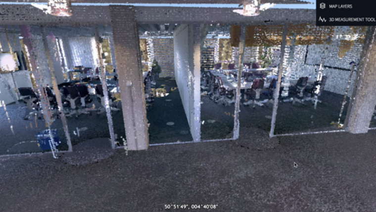
Streaming of point cloud datasets from laser scans
In V2018, LuciadLightspeed, LuciadRIA and LuciadFusion will now support the streaming of point cloud datasets from laser scans at sub-cm accuracy, as well as city or country-wide 3D reality meshes which use high-res imagery. By using Hexagon’s existing support for high velocity data, these digital realities can then be combined with dynamic data feeds that track and sense everything from air and noise pollution created by traffic to people flow through cities.
V2018 will also allow more data types to be integrated into LuciadLightspeed applications, along with enhanced data-driven styling and filtering options. New out-of-the-box functionality in LuciadLightspeed’s application component Lucy will allow users to drag and drop geo-referenced, delimited files describing geospatial features This will mean that location data from a CSV file could, for example, be loaded into a Lucy map and transformed into a heatmap in as few as five clicks.
Responding to the announcement, Hexagon’s Geospatial division president, Mladen Stojic said that Luciad V2018 will enable customers to create Smart Digital Realities by providing the vital situational intelligence that powers critical decision making across the board in smart organisations, sites, cities and nations alike.

Value staying current with geomatics?
Stay on the map with our expertly curated newsletters.
We provide educational insights, industry updates, and inspiring stories to help you learn, grow, and reach your full potential in your field. Don't miss out - subscribe today and ensure you're always informed, educated, and inspired.
Choose your newsletter(s)


