High-accuracy GNSS RTK System
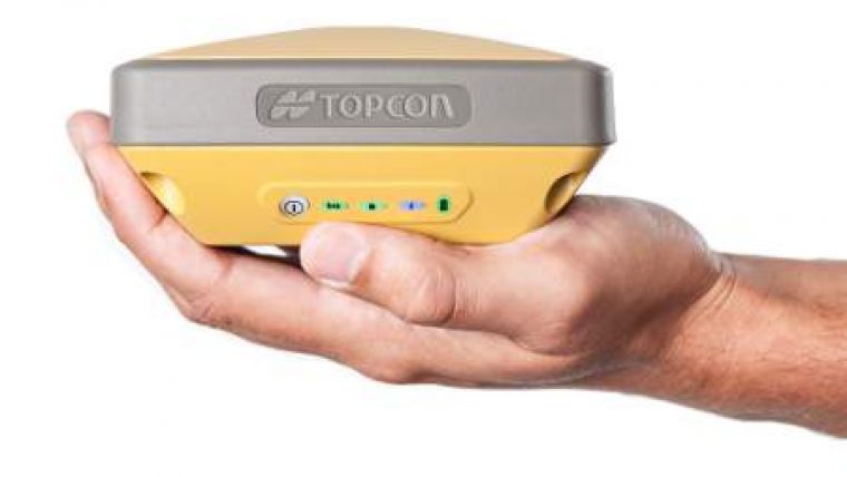
Topcon Europe Positioning (TEP, The Netherlands) announces the HiPer SR – a GNSS RTK receiver with a compact and lightweight design for a fully integrated precision receiver. A variety of users will be using this device, from surveyors who need a tool for small boundary or stakeout work, to non-traditional users such as landscape architects who need a low-cost mapping solution, or law enforcement or any others requiring high-accuracy 3D positioning.
Cable-free and simple to operate, the HiPer SR is a compact professional-grade base and rover RTK system. The field-rugged and fully-integrated design delivers a 300 metres (1,000 foot) working radius through Topcon’s new LongLink technology. This wireless data link was developed specifically for this device to work with reliable and interference-free RTK base-to-rover communications without needing an FCC license to operate. Base and rover units can be used interchangeably.
The HiPer SR is also offered as a dedicated network rover, and at only 0.8kg (1.8 pounds). All standard RTK correction formats and network protocols are supported, and a comprehensive range of field workflows are realised with the Magnet family of cloud-enabled software solutions. Topcon’s Universal Tracking Channel technology combined with the HiPer SR’s 226-channel Vanguard GNSS chip provides the ultimate platform for network RTK performance, both for today and in the future.
Topcon’s Vanguard GNSS chip offers precision measurement and advanced multipath rejection, supports all modernised GNSS constellations and incorporates Topcon’s Universal Tracking Channel technology. While other GNSS receiver designs must dedicate channels to a specific satellite system or signal requiring more and more channels as additional GNSS signals become available, using Universal Tracking Channels, any channel can track any available signal.
This powerful capability enables the multi-constellation tracking that professionals expect but with lower power consumption and system weight. Additionally, as more GNSS signals come online, this flexibility enables the 226 channel Vanguard design to ‘scale-up’ and track more signals than other GNSS systems.

Value staying current with geomatics?
Stay on the map with our expertly curated newsletters.
We provide educational insights, industry updates, and inspiring stories to help you learn, grow, and reach your full potential in your field. Don't miss out - subscribe today and ensure you're always informed, educated, and inspired.
Choose your newsletter(s)


