How Computer Vision and Artificial Intelligence Boost Mapping
Reflecting the migration of people from rural areas to cities, the need to monitor and maintain urban spaces and corridors – both outdoors and in – is expanding. Automation of (3D) mapping of such spaces from overlapping digital images and Lidar point clouds has heavily benefited from fundamental research in the realms of computer vision and artificial intelligence.
Recently, robotics has been added to this series as a powerful engine for driving further new developments in automatic mapping. In robotics, one is faced with the problem of determining the path of a robot through a room, shopping mall or other indoor space and simultaneously acquiring a 3D representation of that space to prevent the robot colliding with walls or other obstacles. The path could be easily determined using GNSS, except that concrete, soil and other materials block the signals, thus impeding GNSS use indoors to inspect pipelines, subways or other underground corridors for instance.
Since in many cases no adequate map of the space is available, determining the robot’s location and creating a map are both done using on-board sensor data. At first glance this seems an impossible task, a chicken-or-egg dilemma: the robot’s location and orientation are essential for generating the map, yet a map is needed to pinpoint the robot’s position. The solution lies in ‘guessing’ the position and representing the space based on sensor data and prior knowledge. Next, these guesses are iteratively refined using data collected while the robot is moving. This approach uses smart algorithms, based on what is known as the iterative closest point (ICP) algorithm aimed at minimising the difference between successive point clouds and the extended Kalman filter.
SLAM
Central is the use of landmarks; these are objects which are distinct from the background. Simultaneous localisation and mapping (SLAM) solutions are also beneficial for mapping indoor and subsurface spaces. The main positioning sensors useful for indoor localisation and orientation are odometers, inertial navigation sensors and lasers. Odometers count wheel spins enabling speed and distance travelled to be computed. When they are mounted on the two wheels either at the front or at the rear, odometers also provide data about directional changes.
Inertial navigation provides directional and displacement information and lasers detect obstacles in front of the robot. SLAM does not consist of a particular algorithm but is rather an approach in which a diversity of solutions are employed depending on on-board sensors, the nature of the environment and possibilities to connect the trajectories with ground control points. SLAM has been one of the most prominent successes of robotic research in the past 30 years. It has found its way into unmanned aerial vehicles and autonomous underwater vehicles, and will certainly contribute to mapping indoor spaces, either in 2D or 3D, in the near future.
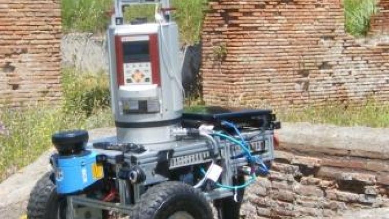
The image shows Irma 3D (Intelligent Robot for Mapping Applications in 3D), a robotic mobile laser scanning system for automating terrestrial laser scanning and miniaturising mobile mapping.
This article, written by Mathias Lemmens, senior editor, appeared as Endpoint column in GIM International, number 2, 2014.

Value staying current with geomatics?
Stay on the map with our expertly curated newsletters.
We provide educational insights, industry updates, and inspiring stories to help you learn, grow, and reach your full potential in your field. Don't miss out - subscribe today and ensure you're always informed, educated, and inspired.
Choose your newsletter(s)


