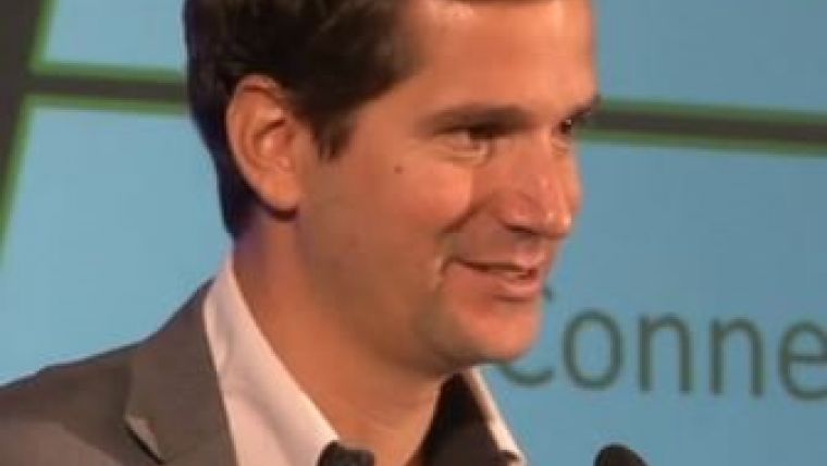
Interview with Edward Anderson, the World Bank: You Cannot Manage What You Don’t Measure
Inclusive Geospatial Information Technologies for Sustainable African Cities
The opening keynote of the Geospatial Week 2019 in Enschede, the Netherlands, will be presented by Edward Anderson, senior disaster risk management and ICT specialist for the World Bank. He will present how the Tanzanian Urban Resilience Programme in Dar es Salaam, Tanzania, is combining wide-scale in situ geospatial data collection with unmanned aerial vehicles (UAVs or ‘drones’) and machine learning for disaster risk management. In this interview, he shares his vision regarding the role of inclusive geospatial information technologies in supporting the development of sustainable African cities.
How are you currently using geoinformatics in your work?
Primarily in the process of risk assessment. We are collecting, analysing and curating datasets to characterize socioeconomic exposure of buildings, people, assets and services to natural hazards as well as the geophysical nature of those hazards (meaning the hydrology, terrain, land use and land cover). So spatial data is critical to our work. To do this, we’re using a variety of techniques – from household data collection and bathymetric and land surveys to drone topographic surveys and satellite imaging.
What are the current and upcoming opportunities and bottlenecks?
Well, the upcoming opportunity is to leverage young people in situ in the fast-changing cities to be a part of the production process. A lot of new simplification and reduction in costs of tools – such as low-cost drones, open-source software and data that can be collected by smartphone – means that in situ data collectors can now gather increasingly large volumes of data labelling information and they can participate in the digitization process. So our Resilience Academy uses university students to do field surveys: from soil maps and solid waste maps to drainage maps. The other upcoming opportunity is artificial intelligence and machine learning. This can work and complement the in situ data collectors who can act as training dataset producers or validation. The bottlenecks would be understanding the fitness for use transferability of these tools and our ability to produce enough training data to feed these machine learning algorithms.
The acceleration of urbanization worldwide is placing high demands on spatial planning. What is the geoinformatics community’s role?
The role is really to help cities shift from a corrective risk management or retroactive planning type of situation where master plans are out of date, where the picture of what you manage is consistently falling behind, to a more current and even forward-looking understanding of spatial growth, spatial dynamics and spatial planning. So we do need to work with predictive models. We do need to have faster, better, cheaper means of mapping and measuring the fast-changing communities – especially in view of Africa’s breakneck speed of (largely unplanned) urbanization.
In which parts of the world do you envisage substantial growth in geoinformatics technologies? And what are the untapped opportunities?
I think substantial growth will happen all over the world – but especially African cities there’s a huge demand to digitize rapidly urbanizing and unplanned communities. So the opportunity is how to involve the communities in the spatial production and consumption, and how to deploy methodologies that are sustainable and scalable which will focus on low cost and low complexity. And it may likely be a combination of working between in situ data collection and satellite-based services or drone data collection, but working through simplified tools such as through mobile. But this is the African urban context, which I think is a very important part of a much larger development narrative in our efforts to meet the Sustainable Development Goals.
Which opportunities and synergies exist between research institutions and development institutions such as the World Bank?
I would like to highlight the Resilience Academy, which is a partnership between World Bank lending operations and projects in African cities. It particularly looks to develop digital information services around planning, risk assessment, risk mitigation and sustainable development, and to help universities that are engaged with geographical science, town planning, computer science, spatial studies and social studies to become involved in real-world projects – to have practical experience developing products for the cities through mapping and surveying campaigns, through data analysis and application, and to transfer a lot of know-how to these universities in these more agile methodologies that I think will have huge demand across African cities.
In 2015 the 17 Sustainable Development Goals (SDGs) were set by the United Nations General Assembly. How would you define the role of geospatial information in accomplishing these goals?
That’s a very broad question, but if we just pick SDG 11 as an example – which is that sustainable cities need to be inclusive, safe, resilient and sustainable – spatial growth patterns, spatial change, inequality, vulnerability and risk are clearly all critical to this goal. And you cannot manage what you don’t measure. So if the growth in cities is largely (between 70 and 80%) unplanned and the accumulation densification of these cities is happening on hazardous land, in vulnerable conditions and in informal conditions, then we need to rapidly update this picture and find a way to sustain those updates. So I think the role of geospatial information is essential in helping us shift our management from a reactive approach to a more proactive, forward-looking one.
It has been said that UAVs are democratizing geoinformation and turning citizens into data collectors. Is this a hype, or the new reality of a changing geospatial landscape?
Well, certainly UAVs are democratizing information in the sense that they are creating a bottom-up production model. You have in situ flight campaigns that really engage communities if done well. That develops awareness amongst citizens and local government authorities. The production of data emerges at the local scale first. So it allows you to share products as you go along the mapping campaign. This is typically quite different to manned aerial campaigns, where you produce the map in phases and the final output arrives months or sometimes years after the project is started. So there is an opportunity to develop engagement and awareness at local levels, and to transfer know-how. Whether that democratizes information depends on how it’s done. But certainly, I think drones are part of a changing geospatial landscape.
Open data is becoming increasingly available all over the world. How are you making use of this and what are the challenges?
We’re using as many open datasets as we can in our information services including satellite imagery, such as through Copernicus. But we’re also releasing data as much as we can and we bias towards an open licence by default if we can. This is important to ensure sustainability of both the datasets and the skills allowing students to use the data and be part of the process. So we publish to OpenStreetMap and to OpenAerialMap. We licensed the orthomosaic imagery from Zanzibar as open data. We see the benefits not only in local access to the data, but also internationally. We are able to support an artificial intelligence challenge using this data. The classifier that was selected was also released openly and contributes back to the community as a building image classification algorithm that has become available. So we see the open data feeding an ecosystem of users and giving back to the community.
About Edward Anderson
Edward Anderson has 15 years’ experience focused on science, technology and innovation for sustainable development. He is currently the World Bank’s senior DRM and ICT specialist stationed in Dar es Salaam, Tanzania. His work is at the nexus of urbanization and climate risks, and leverages emerging technologies and methods to integrate resilience into urban planning systems. Edward also participates on the advisory boards of European Commission smart city projects including City SDK, Krypto Labs’ Drone X Challenge, the European Space Agency’s Open Science Committee and EU’s Drones in Humanitarian Action Expert Working Group.

Value staying current with geomatics?
Stay on the map with our expertly curated newsletters.
We provide educational insights, industry updates, and inspiring stories to help you learn, grow, and reach your full potential in your field. Don't miss out - subscribe today and ensure you're always informed, educated, and inspired.
Choose your newsletter(s)


