Kinematic laser scanning in assessing urban land use and utility infrastructure
Fast site visits and accurate 3D mapping
How can kinematic laser scanning support urban planning and infrastructure management? Urbanization and the development of megacities is posing critical challenges for sustainable but efficient land use globally. Power lines, pipelines for water, district heating, gas and oil, and other technological systems are critical yet often hidden assets facilitating today’s lifestyles. Meanwhile, there is an ever-important need to preserve natural environments and recreational spaces in the world’s cities, despite the pressure to spread more concrete and asphalt to accommodate the people and businesses flocking to them. This article examines the role of kinematic laser scanning.
There is an ever-increasing need to use the limited urban land area more efficiently. That is boosting the development and use of information systems in 3D, e.g. in cadastre, land use planning and utilities management, and of surveying and documenting technologies to allow high-quality 3D and image data to support such needs. To ensure undisturbed functions, it is essential to know the exact location of infrastructure assets to be able to plan and manage the construction of new pipelines, data and power cables and suchlike, to renovate old systems and to maintain and expand urban green spaces. If such data and information systems are accurate and up to date, operations can be performed faster, minimizing or eliminating unnecessary disruptions, and the urban space can be used more efficiently to support the various utilities, traffic and living-related needs.
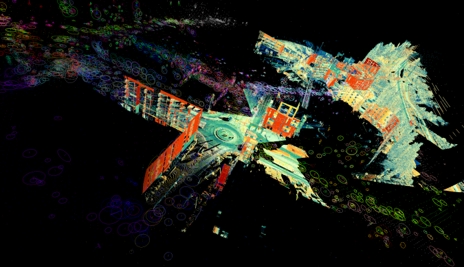
Multimodal laser scanning data is increasingly used for surveying and mapping thanks to the development and availability of capable sensor technologies. Small but capable laser scanning and imaging systems provide applications using virtually any platform for operating laser scanning for 3D reconstruction tasks. Airborne systems and kinematic laser scanning units on vehicles, backpacks and handheld mapping systems can all serve as a means to gather complementary data for diverse user needs and specifications.
3D point clouds provide a common starting point for automated modelling workflows and direct visualization and measurement applications, forming the future topographic core data. They are a significant asset for business and administration in improved forestry, infrastructure management and urban planning. They also provide a platform for developing several future applications.
Kinematic laser scanning
Developments in laser scanning and point cloud processing could provide significant cost savings via automation of mapping processed with improved output and quality of data. Kinematic data collection is permitted mainly by two distinctive technologies: GNSS-IMU positioning and simultaneous localization and mapping (SLAM), both of which are means to track the movements of the surveying laser scanning devices during operation. The former provides the data inherently in the global geographic coordinate system, while the latter typically provides local project coordinates for the data.
What makes the use of laser scanning in mapping so effective is the capability to direct 3D measurements for the targets in the line of sight of the beam. To yield such information, certain principles of laser ranging have been deployed. The way to gain range measurements is to transmit short but powerful laser pulses at a fast rate towards the target area and collect the backscattering signal. The signal is then processed to detect objects at distinct ranges within the beam illumination area. With the positioning trajectory, data synchronization and system boresight calibration, the data is then processed into a usable 3D data. The prominent end product of such surveys is a point cloud, where each point location is known in 3D in a project or geographical coordinate system. Such data provides instant visualization and measurement capability, but generalized virtual and terrain models are often desired for compressed data volumes and distribution.
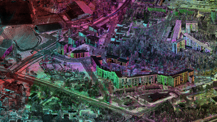
Assessing urban land use
Urban land use management is increasingly critical to ensure sustainable development and to facilitate safe and thriving communities and environments in ever-growing urbanizations and megacities. In principle, the urban space is divided into use for living, business and public functions, traffic, parks, recreational and natural environments and utilities. All of this needs to be managed somehow.
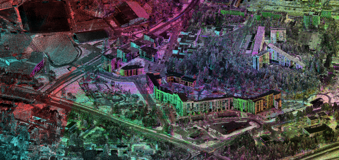
Modern laser scanning technologies make it possible to map the complex urban space using various approaches, from the air and the ground. For a general view airborne laser scanning, often supported by aerial imagery, provides a versatile data source for assessing terrain and building-related data at large scale. This allows powerful tools for detecting new buildings and roads and monitoring landfill sites, earthworks, illegal constructions, deforestation and other such low-detail indicators, typically at an accuracy level of 10-50cm.
For more detailed management and especially for planning purposes, a higher accuracy and resolution is desired. For example, a more accurate assessment of the earth fill/removal volume before constructing a road or building could enable the contractors to save costs, and even more so if they could monitor the progress of the excavation/earthworks in near real time to control the excavation and manage the fleet of dumper trucks. It could also allow for adjustment of the design for superficial structures after the fact, if needed.
High-resolution laser scanning data could be acquired from the air using unmanned aerial vehicles (UAVs or ‘drones’). Airborne scanning permits easy access over sites with obstacles such as fences, excavations and construction sites, and enables images to be captured of the roof structure of buildings, power lines and so on. Typically the instruments also provide more precise measurements than those from higher-altitude applications, and data density typically ranges from 50 to hundreds of points per square metre. From such data, different aspects of urban land use could be resolved in high detail: streets, kerbs, ramps, building outlines and heights, urban green spaces and ground cover, playgrounds, bridges and culverts, to name but a few.
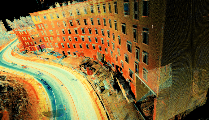
The drone data can be complemented or substituted from the ground perspective using mobile laser scanning (MLS) systems. These systems could be operated using wheeled vehicles, and that data typically provides street perspectives of the areas of interest. In certain cases smaller vehicles could be used to access limited urban spaces. Alternatively backpack or handheld instruments could be used to obtain the data that is needed for the task at hand. Such data typically could cover block interiors, recreational areas, playgrounds and parks and provide a high level of detail of the building mass, passages and street layout and utilities.
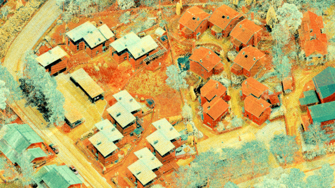
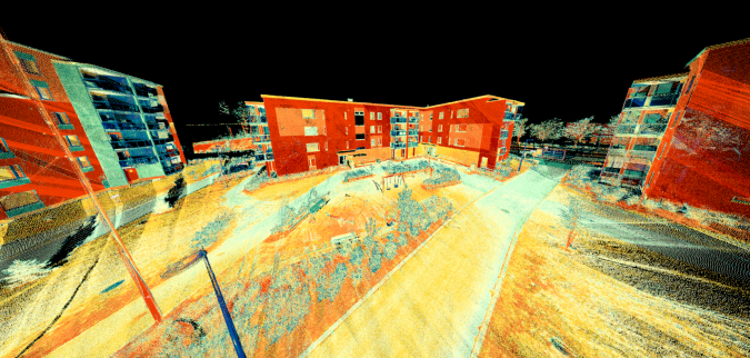
Monitoring construction
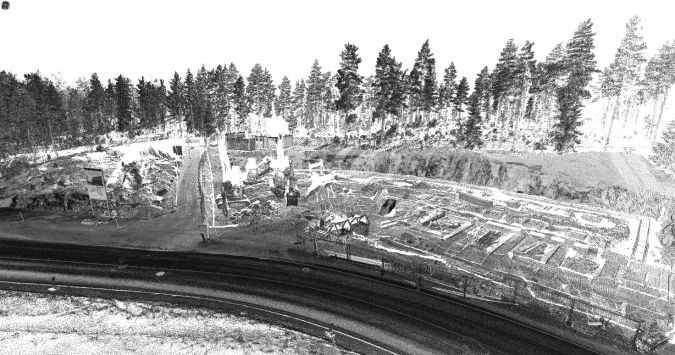
Monitoring construction activity is one of the key areas of interests in city administration. Kinematic laser scanning data allows for a complete understanding of the construction placement, foundation levels related to the surrounding terrain, streets and water runoff drains.
From the land developer and contractor vantage points, laser scanning provides a great tool for documenting the progress of the construction work and placement of the foundations or technical installations prior to proceeding to the next phase in the process for qualification approval and documentation. Accurate data allows dimensional checks and the possibility to adapt the design of prefabricated elements if needed to save costs and delays.
From a safety and accessibility point of view, the accurate 3D data allows planning and managing the use of the space on the site to design areas for lifting, storage and traffic. The data also permits documentation of the site safety installations such as fences and diversion of roads and traffic past the site. Such data can then be distributed to the city management or road administration to report the arrangements for public announcements and traffic control.
Documenting infrastructure
Public and private infrastructure serves the communities with everyday commodities that are often taken for granted in urban living, such as electric power, water and heating, let alone functional traffic systems with roads and streets and associated assets. To maintain this infrastructure for undisturbed delivery takes effort and cost, both of which could be minimized by exploiting modern asset-management technologies. Up-to-date and accurate 3D asset databases supported by surveying technologies providing accurate 3D data help prevent collateral damage when excavating, and could be used to share asset information between contractors and other parties involved in any particular construction.
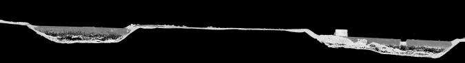
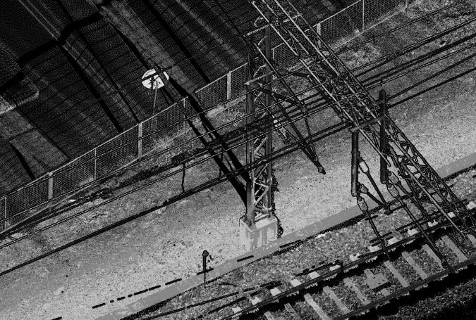
Overhead cables are a prominent feature present in any urban landscape and also in electric railways. They occupy the low skies of urban areas, hanging across streets and cutting through parks and forests. Kinematic laser scanning is particularly suitable for corridor-type applications, and power lines are well-defined corridor-type objects of interest. Kinematic laser scanning provides ease of deployment and data collection with good precision and level of detail for asset modelling and monitoring. The mapping is not limited to the power line itself, but can also generate accurate information on the terrain and vegetation in close proximity to the line. Beyond the roads, the mobility within the corridor can be achieved by using an all-terrain vehicle or deploying a specific backpack laser scanning system for the mapping task. The main advantages of MLS over airborne laser scanning (ALS) are higher detail from close to the objects of interest, less need for experienced operating personnel, and general operability in challenging weather conditions (e.g. in high winds or rain).
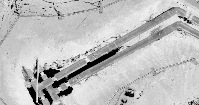
Underground installations – such as power cables, water and gas pipes, sewers, drain and district heating pipelines – are usually buried underground to increase the efficiency of the use of space, but often also to improve safety and guarantee undisturbed delivery. However, this poses a risk of damage and disruption when the exact location and depth of the installations is not well documented and new construction needs to be done in the area, or there is a leak in a pipeline, for instance. With kinematic laser scanning such documentation is possible, plus the reach of the laser beam reduces the need to climb into the excavation area, which increases crew safety and speeds up the process. In a single pass, the surveyor can assess the installation, surrounding earthworks and overall geometry of the objects of interest at a high level of detail. Later, back in the office, the current state of the installation, location of technical components and the main pipeline can be transferred into a database for distribution and future use. A similar application is often found in industrial facilities with complex pipeline and power distribution installations.
Conclusion
The application of kinematic laser scanning in urban settings provides detailed information for many purposes related to the management, development and documentation of human activity and interaction with nature and the terrain. Kinematic data collection using laser scanning, whether GNSS-IMU or SLAM-based, allows fast site visits without disturbing the operations, and captures accurate dimensions of and relationships between objects that are not necessarily available using conventional surveying tools. With kinematic laser scanning data, the actual condition, construction phase and component locations of the installation could be digitalized, or the whole site could be conveniently surveyed and documented in 3D. Mapping and documenting different uses of urban environments, land cover and terrain features and vegetation are prominent applications of kinematic laser scanning in an urban setting. This helps future usage and appropriate planning of the urban space and land use.

Value staying current with geomatics?
Stay on the map with our expertly curated newsletters.
We provide educational insights, industry updates, and inspiring stories to help you learn, grow, and reach your full potential in your field. Don't miss out - subscribe today and ensure you're always informed, educated, and inspired.
Choose your newsletter(s)


