Large-scale UAV Data Collection in Ohio
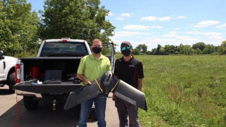
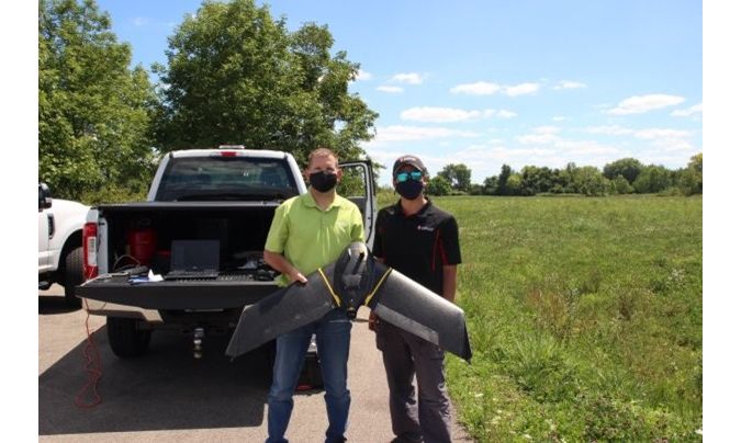
Ohio-based energy provider Dayton Power & Light is employing a fleet of senseFly eBee X fixed-wing drones to improve its large-scale data collection and mapping capacity in partnership with Sinclair College’s National UAS Training and Certification Center. Over a nine-month period, unmanned aerial systems (UASs) will be used to inspect almost 6,500 kilometres of power transmission lines, supporting electricity delivery for the 1.25 million residents of the Dayton, Ohio, region.
Under the collaboration, Dayton Power & Light (DP&L) and Sinclair will employ four senseFly eBee X drones to gain visual insights that will help address the diverse challenges facing the energy industry, when conducting equipment inspections – such as vegetation encroachment near power lines or damage caused by storms that can lead to electricity delivery disruptions. The resulting high-resolution imagery will be used to build accurate assessments of affected areas through the generation of maps, digital elevation models (DEM) and other products. The technology will also aid in day-to-day essential maintenance, creating long-term efficiencies and streamlining energy management.
To support its team in deploying and integrating the eBee X drones and to generate quality and accurate data, DP&L is partnering with Sinclair College to spearhead the drone training efforts – leveraging the State of Ohio’s TechCred programme to train multiple operators and equip the DP&L team with the knowledge needed to execute drone mapping and inspection projects.
Gilles Labossière, CEO at senseFly, commented: “This is an excellent example of how organizations can use multiple drones on a project to help increase capacity and improve efficiencies. The adoption of drone technology has important benefits across the energy industry."

Value staying current with geomatics?
Stay on the map with our expertly curated newsletters.
We provide educational insights, industry updates, and inspiring stories to help you learn, grow, and reach your full potential in your field. Don't miss out - subscribe today and ensure you're always informed, educated, and inspired.
Choose your newsletter(s)


