Large Update of HxGN’s Content Program in 2020
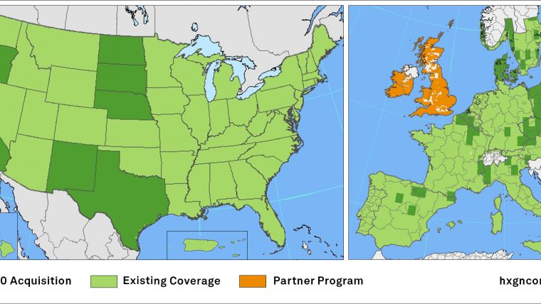
Hexagon Geosystems is updating three million square kilometres' worth of high-accuracy orthophotos, digital surface models (DSM) and stereo imagery of the USA and Europe in its Content Program library.
Hexagon will upload 2.5 million square kilometres' worth of US aerial data to its Content Program, the largest library of high-accuracy airborne data. In Europe, 500,000 square kilometres' worth of data will be collected and added to the library.
For the US, Hexagon is refreshing the data of previously captured states like California, Texas, Oregon, the Dakota’s, Nebraska and New Mexico. Accuracy is being improved up from 30cm resolution in wide areas and 15cm resolution in urban areas to 15cm accuracy in both wide areas and urban areas. Danish aerial data provider DDO will become part of the HxGN Content Program for the first time and will cover the country at 12.5cm resolution on a biennial refresh schedule.

Value staying current with geomatics?
Stay on the map with our expertly curated newsletters.
We provide educational insights, industry updates, and inspiring stories to help you learn, grow, and reach your full potential in your field. Don't miss out - subscribe today and ensure you're always informed, educated, and inspired.
Choose your newsletter(s)


