Leading 4 Decades of Innovation in Lidar Technology
GIM International interviews the RIEGL Team
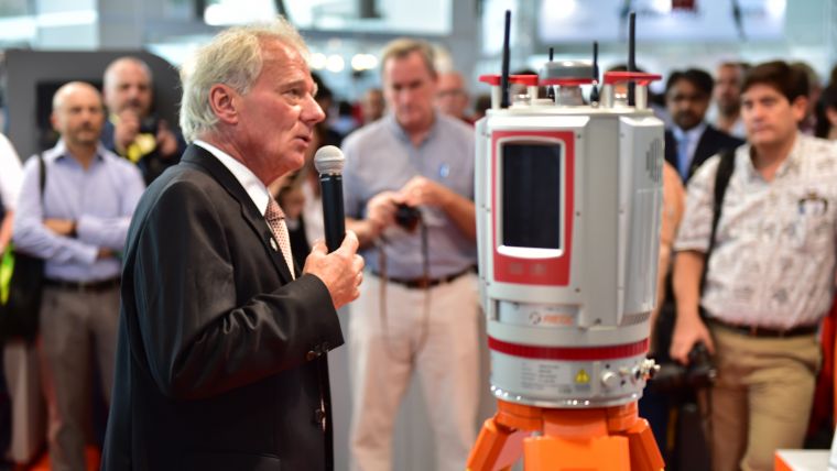
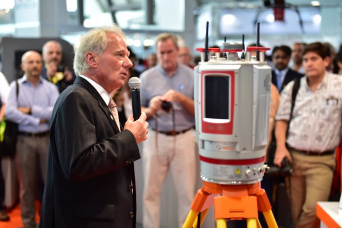
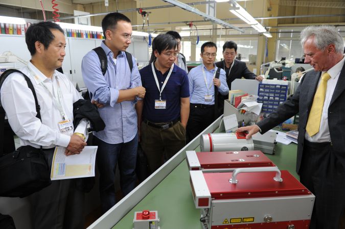
Whenever anyone talks about Lidar technology in the geospatial sector, it is only a matter of time before the name RIEGL is mentioned. Thanks to its renowned R&D department, the Austrian provider of innovative Waveform Lidar technology has a rich history of proven innovations in 3D. Today, RIEGL provides mapping and surveying professionals with airborne, mobile, terrestrial, industrial and unmanned laser scanning solutions. To tie in with the company’s 40th anniversary, 'GIM International' interviewed founder Dr Johannes Riegl and three of his staff members.
Dr Riegl, your company is celebrating its 40th anniversary this year, congratulations! How did it all start back in 1978? And what were your main reasons for starting your own company?
Dr Riegl: The true idea behind starting the company, after ten years of research and development activity at Technical University Vienna, was my desire to find a tangible, practical use for the fruits of those research activities. Another thing that motivated me were the comments of some of my colleagues back in 1978, such as “Yes, Johannes, it’s probably best that you’ve founded your own company, as the topic has no real scientific future,” or my professor, who literally said “Of course you can try it, Dr Riegl, but it won’t work out, you’ll see”. Of course, this was 40 years ago, but it all served as an excellent additional motivator for me to succeed.
The first working laser was built in 1960 by Maiman. What stage had the technology reached when you founded RIEGL Laser Measurement Systems?
Dr Riegl: When I started working with lasers in 1968, ten years before founding RIEGL, there were only a few types of lasers available and they were in a very embryonic stage. In the visible range, for instance, the helium-neon (HeNe) laser was the latest state of the art, but it wasn’t yet commercially available. For us to build our own HeNe lasers, we first had to learn the science of glass blowing so that we could fabricate the long tubes – with the additional glass bodies for anode and cathode –ourselves. Meanwhile, semiconductor lasers had to be cooled down by liquid nitrogen to -77°C, which is certainly not the ideal situation for developing handy, lightweight laser distance meters. It wasn’t possible to gain access to uncooled semiconductor lasers, the indispensable key transmitter component for portable devices, until at least 1970.
How has the application of your company’s measurement and surveying systems changed over the past decades?
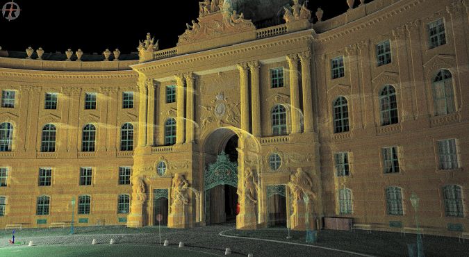
Dr Riegl: In our early years, the main field of application for our single point laser products was short-range distance measurement and rangefinding over long distances. Then in the late 1990s we started producing our 2D and 3D laser scanners, and a wide range of new application areas emerged. Applications for these sensors and systems truly cover the entire spectrum: archaeology, agriculture, corridor mapping, glacier and snowfield mapping, forestry, mapping of complex urban environments, mining, topography, road surface measurements, surveying, monitoring, civil engineering, ulta-wide- area/high-altitude mapping, power-line mapping, railway inspection, crash-scene investigation, GIS mapping, BIM, asset management, emergency management planning, pipeline inspection, coastline mapping, transportation infrastructure mapping, cultural heritage documentation and so much more. It is incredible and makes me really proud to see RIEGL products used in so many different fields.
What do you regard as the key milestones in your company’s history so far?
Dr Riegl: Achieving many milestones and industry innovations is of the utmost importance for our success. To keep things brief, I’d like to mention just a few product-related ones here. In 1982, for example, we developed the first handheld laser binoculars for hydrography. Then, in the 1980s and 1990s, we introduced ever-evolving distance and speed meters. 1996 saw the market launch of our first 2D airborne scanner, and in 1998 came the first 3D laser scanner for terrestrial (static) applications. The year 2004 marked the introduction of the world’s first compact airborne laser scanner, LMS-Q560, with purely digital signal processing. In 2008 we introduced the VZ-400, the first 3D laser scanner using purely digital signal processing, which was a remarkable breakthrough – we were miles ahead of the competition at that time. In 2014, as one of the established Lidar developers and producers, RIEGL was an early visionary in recognising and accepting the rising importance of unmanned aerial vehicles (UAVs) in surveying. We designed and developed the first surveying-grade laser scanners for UAV applications, and even our own UAV platform, the RiCOPTER, as the basis for complete turnkey UAV Lidar systems from a single source.
With regards to research & development (R&D), what is your strategy to stay on top in this field and how do you handle your intellectual property (IP)?
Martin Pfennigbauer: As a technology-driven company from the very beginning, it has always been the mindset of RIEGL to rely on in-house know-how as a solid ground to stand on. Thus we have the capability to push the state of the art in Lidar technology on many levels. Another important asset to us is the strong interaction with our partners in both academia and industry. Many of our innovations have stemmed from the inspiring work with a network of specialists. Fostering these relationships and having an open mind for new and novel requirements and applications helps to shape our developments and motivates us to further push the boundaries.
What are the key factors that help your company to remain a frontrunner in Lidar technology?
Dr Ullrich: There are a lot of factors that go into our company being at the cutting edge of Lidar technology. We have a highly motivated team of engineers from various disciplines with impressive backgrounds, striving to contribute everyone’s excellence into the progression of Waveform Lidar. In addition there is constant vigilance on our side in monitoring the rapid development in fields of technology such as electronics, signal processing, IT and laser technology, and in utilising valuable achievements to further Lidar progress. Our customer base and partner base have also played a large role in optimising our portfolio. With their input and feedback, we are able to fine-tune the sensors and systems to their needs to meet both their requirements and those of the market.
Numerous customers from all over the world rely on the high performance of RIEGL’s Lidar products, including for large-scale aerial measurements. Which inspiring examples are you particularly proud of?
Dr Riegl: We are proud and excited about each and every one of our customers. Every RIEGL user is working on unique and exciting projects throughout the world, for applications that we would not have thought possible when we first started the company. I can’t mention all of our customers here, of course, but one exciting example is NOAA in North America – a long-time user of RIEGL airborne sensors and systems – which utilises airborne Lidar for a multitude of purposes. One of those purposes is the use of RIEGL topo-bathymetric Lidar to extend the survey into the water, capturing data from both land and sea with shallow-water bathymetry, and to lay the foundation for sound decision-making. The data NOAA uses helps it to view potential impacts of sea-level rise along the coast, see flood forecasts in a visual format, and see pre- and post-effects of natural occurrences along coastlines. There are many prestigious names in the geospatial world we are proud to call our customers, such as Fugro in The Netherlands, Quantum Spatial in the USA, Alibaba in China, Nakanihon in Japan, and Land Survey in Australia, to name but a few.
How do you expect Lidar technology to develop over the coming years?
Dr Ullrich: Lidar is a prominent technology in such a broad spectrum of applications, ranging from autonomously driving and flying vehicles to atmospheric applications like global wind measurements, surveillance and reconnaissance, precision farming and, of course, surveying. I’m sure that the technology will develop in different directions in these distinct applications, and in others too. There is still plenty of room for further improvement in the technology we believe in: Waveform Lidar. We expect to make considerable progress in the future in acquisition speed, range accuracy, size and weight, and for smoothing the data processing workflow.
In view of the current wave of mergers and acquisitions, and the increasing concentration of power amongst a handful of industry giants, how is RIEGL managing to remain an independent family business?
Johannes Riegl Jr: RIEGL has positioned itself over the years as one of the key innovation drivers in the industry, and I believe we have the necessary recognition in the market to sustain our strong position. As a main innovation leader we are also striving to support industry growth overall. Along with 20 other companies such as Esri, Oracle, Trimble and Autodesk, we have recently been a founding member of the new WGIC World Geospatial Industry Council – an organisation aimed at helping improve industry collaboration and raising awareness of the need for global geospatial data availability.
You have long-standing relationships with Esri and a number of other companies in the geospatial industry. What are they built on?
Johannes Riegl Jr: Within each of our partnerships with other companies in the geospatial industry, we focus on fostering bonds that offer substantial benefits for our mutual customers. Using our partnership with Esri as an example, it enables our customers to deploy a more complete solution, which improves efficiencies and productivity. Through partnering with another industry leader such as Esri, RIEGL is able to provide mutual customers with additional options to improve their results and advance their use of Lidar technology in their GIS applications. Earlier this year we received the 3D Impact Award at the Esri User Conference, which is extra recognition that we are on the right path in terms of collaboration. Industry partnerships are critical to our success.
Lidar technology for drones is sometimes described as ‘the next geospatial frontier’. What is your view on the current status of UAS-Lidar?
Dr Riegl: The availability of both high-performance UAV carrier platforms and matching sensors for challenging professional surveying tasks has increased considerably over the last few years. At first, UAVs were considered a nice-to-have gap filler between high-altitude airborne sensing for large-area mapping and terrestrial scanning. In fact, UAV-Lidar has proved to be a real solution for those areas that would be difficult, dangerous or impossible to access by traditional means of surveying. But maybe even more importantly, new applications have emerged that initially seemed very exotic to established surveying. It became evident that UAV-borne sensors also permitted a new class of data quality thanks to the unrivalled perspective from which they can capture the surface or object of interest and the closeness that provides very high resolution, accuracy and completeness of the data.
Today, the importance of the UAV surveying market and its future growth potential are undisputed. Currently, we’re seeing both the further miniaturisation of all kinds of sensors for integration on small UAVs or multi-system-setups, and at the same time the endeavour to make UAVs more efficient with regard to both payload capability and airworthiness. These developments go hand in hand with the layout of a legal context regulating step-by-step integration of professional UAVs into non-segregated airspace.
It is exciting to have been an active participant in the rise of the UAV sector, from the so-called hype of commercial professional UAVs to the broad acceptance that we have reached nowadays. We’re continuously improving and enlarging our product range in this area, since we are convinced that the field of remotely piloted systems is not yet fully explored.
Lastly, is there anything else you would like to say to our readers – mapping and surveying professionals around the world?
Dr Riegl: We would like to thank our customers and partners worldwide who have not only trusted in us but have also encouraged us, from the earliest beginnings to the present day. Through their feedback and positive criticism, they have spurred us on to persist with our hard work to fine-tune our products and services and pursue new developments. We would also like to assure them all that we will always strive to best satisfy their needs, now and in the future. We want to not only maintain our position in the market but also continue to fortify and expand upon it. You can count on that, for sure! And, last but not least, we should also take a moment to thank our highly regarded competitors who have not allowed us to take a breather for a second. With their own hard work and dedication to the industry, they have helped to ensure that our ever-lasting quest for innovation must never stop and that we must always strive for more.
BIOGRAPHIES
Dr Johannes Riegl founded RIEGL Laser Measurement Systems GmbH in 1978 (originally called Dr. Johannes Riegl, Radartechnik und Elektrooptik until 1989) and has been the company’s CEO and managing director ever since. He holds a Dipl-Ing degree in communications engineering and a PhD from Vienna University of Technology, and wrote his thesis on ‘Optical Short Distance Measurement’. From 1972 to 2002 Dr Riegl served as a lecturer at the Vienna University of Technology’s Institute of Communications and Radio-Frequency Engineering on topics covering radar technology and optoelectronics.
Johannes Riegl, Jr has been a member of the RIEGL executive team since 2012. He serves as the president of the company’s US operations based in Orlando, Florida, handling the company’s North American market. He is also president of RIEGL International, the division responsible for worldwide marketing activities and the development, support and expansion of the global RIEGL Distribution Partner Network. His position reflects a unique role within the company: to coordinate strategic business development and marketing between the international RIEGL locations. He holds a master’s degree in business management from the University of Applied Sciences in Vienna.
Dr Andreas Ullrich holds a Phd in electrical engineering from Vienna University of Technology and is author of the thesis on ‘High-Resolution Optical Doppler Radar’ (1987-1990). Since 2001 he has been a lecturer on radar technology at the Vienna University of Technology’s Institute of Communications and Radio-Frequency Engineering. In 2004 he was awarded with the Wilhelm Exner Medal for excellence in research and science. From 1984 to 1991 Dr Ullrich was an assistant professor at the Vienna University of Technology’s Institute of Communications and Radio-Frequency Engineering. Having held various positions since joining RIEGL Laser Measurement Systems in 1991, he has been CTO and managing director of RIEGL since 2006.
Dr Martin Pfennigbauer holds a PhD in engineering from Vienna University of Technology. He has been with RIEGL Laser Measurement Systems since 2005, presently as the director of research and intellectual property. He manages research projects funded by the European Space Agency, the European Union and Austrian national funds. He is the product manager for hydrographic airborne laser scanning systems. His area of special interest is the design and development of Lidar instruments for surveying applications, with a focus on rangefinder design, waveform processing and point cloud analysis.

Value staying current with geomatics?
Stay on the map with our expertly curated newsletters.
We provide educational insights, industry updates, and inspiring stories to help you learn, grow, and reach your full potential in your field. Don't miss out - subscribe today and ensure you're always informed, educated, and inspired.
Choose your newsletter(s)


