Leica ALS70 and RCD30 as First Digital Sensors
ORTHOSHOP Geomatics, Canada, has purchased the Leica ALS70 Lidar and Leica RCD30 imaging camera as its first digital airborne sensors. ORTHOSHOP is to use the sensors in their integrated and stand-alone configurations to serve its existing clients more effectively and expand its business into new markets.
One of the application areas that ORTHOSHOP plans to service with the Leica ALS70 and Leica RCD30 is vegetation monitoring in utility power line corridors. The firm will integrate the two sensors into a single aircraft for simultaneous collection of Lidar point cloud data and metric quality RGB/NIR imagery. The Leica ALS70's waveform digitisation option adds another data dimension for vegetation analysis. The combined data sets will provide utilities with all of the information they need to ensure that tree canopies are not encroaching on high-voltage electric lines, in accordance with increasingly stringent North American utility regulations.
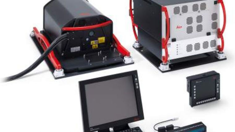
The Leica ALS70 is an airborne laser scanner with a 500kHz pulse rate capability from a single laser scanner, which is designed specifically for high-density point collection in diverse environments. The Leica ALS70-CM version, purchased by ORTHOSHOP, was developed specifically for city and corridor mapping at lower altitudes and features plug-and-play compatibility with Leica Geosystems' medium-format digital camera solutions, such as the RCD30.
The Leica RCD30 is a medium-format digital imaging system developed for a variety of photogrammetric and remote sensing applications. The 60MP single-camera-head design delivers co-registered, multispectral imagery in the Red, Green, Blue and Near IR portions of the spectrum. The sleek modular design allows the camera to fit easily in aircraft previously outfitted with film cameras, and the Leica RCD30 integrates with many Lidar sensors, including the Leica ALS series.
Established in 1980 and based in Calgary, Alberta, ORTHOSHOP is a provider of geospatial services across Canada and around the world. In the 1980s, the firm became the only company in Canada to own the Leica OR1, the first computer-controlled orthophoto workstation. With a strong foundation in engineering, surveying and photogrammetry, ORTHOSHOP serves private and public-sector clientele in many disciplines including energy, transportation and utilities.

Value staying current with geomatics?
Stay on the map with our expertly curated newsletters.
We provide educational insights, industry updates, and inspiring stories to help you learn, grow, and reach your full potential in your field. Don't miss out - subscribe today and ensure you're always informed, educated, and inspired.
Choose your newsletter(s)


