Lidar Reveals Oldest and Largest Maya Monument
This article was originally published in Geomatics World.
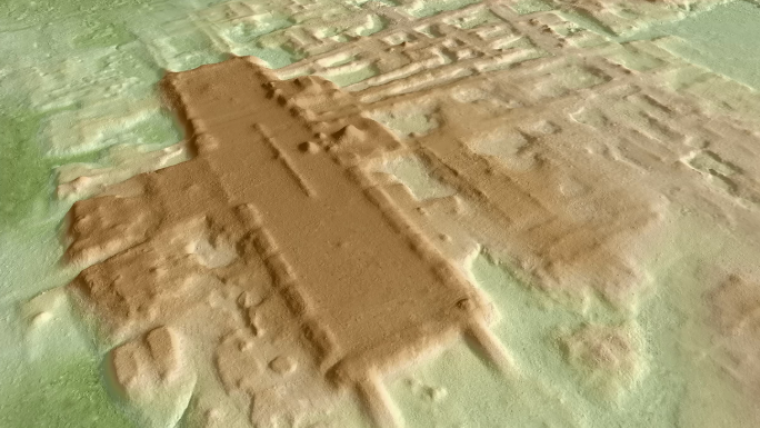
Archaeologists have discovered the oldest and probably largest structure of the Maya in Mexico. A research group led by Takeshi Inomata (University of Arizona) found the structure using Lidar technology, which creates images of the Earth's surface from the air through vegetation and reveals the three-dimensional forms of archaeological features. The discovery suggests that the Maya civilization developed more rapidly than archaeologists once thought and hints at less social inequality than in later periods.
Located in Tabasco, Mexico, near the north-western border of Guatemala, the newly discovered site of Aguada Fénix lurked beneath the surface, hidden by its size and low profile, until 2017. The monument measures nearly 1,400 metres long, ranges from 9 to 15 metres high and includes 9 wide causeways. In total volume, it exceeds ancient Egypt’s Great Pyramid of Giza, which was built 1,500 years earlier.
The monument was discovered by an international team led by Takeshi Inomata and Daniela Triadan, professors in the University of Arizona School of Anthropology in the College of Social and Behavioral Sciences, with support from the university's Agnese Nelms Haury programme and under the authorization of the National Institute of Anthropology and History of Mexico.
High-resolution Lidar for Confirmation
Lidar technology revealed the three-dimensional forms of archaeological features. The team then excavated the site and radiocarbon-dated 69 samples of charcoal to determine that it was constructed sometime between 1,000 to 800 B.C. Until now, the Maya site of Ceibal, built 950 B.C., was the oldest confirmed ceremonial centre. This oldest monumental building at Aguada Fénix is also the largest known in the entire Maya history, far exceeding pyramids and palaces of later periods.
The team's findings have been published in the journal Nature.
Thanks to the laser system, the scientists were able to achieve results in a few years that would have otherwise taken decades to complete.
"Using low-resolution Lidar collected by the Mexican government, we noticed this huge platform. Then we did high-resolution Lidar and confirmed the presence of a big building," Inomata said. "This area is developed – it's not the jungle; people live there – but this site was not known because it is so flat and huge. It just looks like a natural landscape. But with Lidar, it pops up as a very well-planned shape."
Lidar also revealed other structures around the human-built plateau, including rectangular buildings, plazas and several reservoirs.
This story is partly based on an article written by Mikayla Mace, University of Arizona.

Value staying current with geomatics?
Stay on the map with our expertly curated newsletters.
We provide educational insights, industry updates, and inspiring stories to help you learn, grow, and reach your full potential in your field. Don't miss out - subscribe today and ensure you're always informed, educated, and inspired.
Choose your newsletter(s)


