Lidar Survey over Ancient Maya City
Improving Archaeological Maps and Identifying Hidden Structures
The ancient Maya site of Copan, Honduras, was captured during an airborne Lidar survey in May 2013. The resulting products are accessible through 2D and 3D WebGIS tools and enable archaeologists to collaborate online. This interdisciplinary project, named MayaArch3D, showed that Lidar data can improve archaeological maps, identify hidden structures as laser pulses partly penetrate jungle canopy, and facilitate collaborative research.
(By Jennifer von Schwerin, Germany, Heather Richards-Rissetto, USA, and Fabio Remondino, Italy)
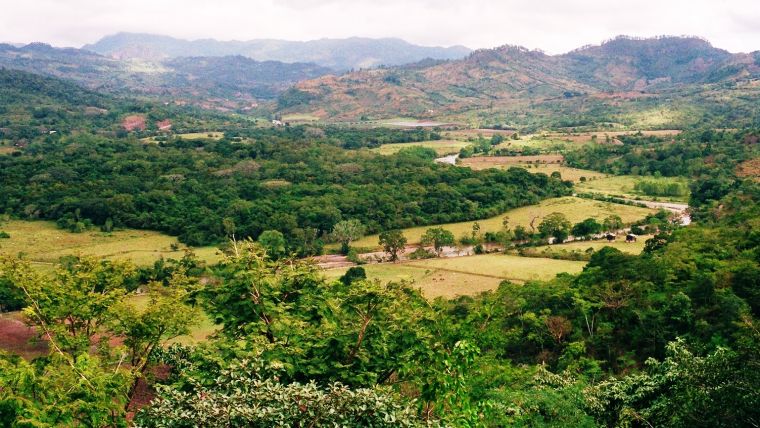
Copan, which is on the UNESCO World Heritage list, was once an important cultural and commercial centre on the south-eastern periphery of the Maya world. The landscape consists of alluvial terraces and foothills. The vegetation ranges from sub-tropical coverage in the valley to pine forests in the mountains. The environmental diversity within such a small area presents challenges in terms of locating and surveying archaeological structures (Figure 1).
Pedestrian Surveys
Since the late 19th century, many pedestrian surveys and excavations have given archaeologists an insight into 4,000 years of human occupation at Copan. Between 426 and 822 CE, a powerful Maya kingdom emerged during which the 17 kings that reigned in that period continually reshaped the city. Early investigations focused on the city’s main civic ceremonial zone – the Principal Group – comprising large temples and pyramids (Figure 2). From 1978 to 1980 the Copan Archaeological Project (PAC 1), led by French archaeologist Claude Baudez, surveyed and mapped an area of 24km2 surrounding the Principal Group. In the 1983 project report, archaeologists William Fash and Kurt Long published 24 maps at scale 1:2,000 showing over 3,000 archaeological structures. From 2006 to 2008, the PAC 1 maps were digitised, georeferenced and enriched with attributes to create GIS data for studying accessibility and visibility.
Lidar Surveys
In 2000, the first Lidar survey over Copan was flown by the US Geological Survey (USGS) to assess flood and landslide damage following Hurricane Mitch. The data only captured the Principal Group. Within the present project Watershed Sciences Inc. (WSI) from Oregon, USA, collected Lidar data during four days in May 2013 using a Leica ALS50 Phase II system mounted in a Piper Aztec aircraft. This Lidar survey was aimed at: (1) identifying new archaeological sites, (2) evaluating site degradation/loss over time by comparing the Lidar data with existing maps, (3) assessing the pros and cons of Lidar for locating and mapping archaeological sites in an ecologically and topographically diverse environment, and (4) developing new datasets to be combined with other archaeological data and hosted in a 3D WebGIS. The targeted point density was at least 15 points/m2. This could be achieved through an across-track overlap of over 50%, effectively resulting in capturing the area twice. The average first-return density was 21.57 points/m2, and for ground return the number was 2.91 points/m2 on average, locally depending on topography and vegetation density. Where vegetation was dense, the point density of ground returns reduced to less than one point/m2. Another challenge was that collapsed structures – mounds – are difficult to distinguish from natural topography in Lidar point clouds. At Copan, the distinction is even more difficult as constructions are incorporated into natural topography; mounds less than 0.25m in height proved particularly difficult to identify.
Filtering
WSI delivered raw 3D points (LAS and ASCII), classified LAS data and raster data. Using proprietary automated and manual methods the 3D points were classified into bare earth, modern buildings and archaeological ruins. From these classified points, a bare earth model (DTM) and a DTM plus archaeological structures (DEM) were created (Figure 3). The filters distinguished bare earth from vegetation (DTM) but not bare earth from archaeological structures. The semi-automatic filters separated mounds from topographic features such as natural hills, but were not able to distinguish mounds lower than 80 centimetres from the natural terrain. The filters also removed This is typical of many Lidar filters that are customised ad-hoc to segment out vegetation and man-made structures. FBK refined and applied other filters based on landform and vegetation cover to extract a DTM without mounds and archaeological structures. Comparison between WSI’s classified data and PAC 1 data showed that 14% of the features originally classified as bare earth were actually mounds. A classification workflow based on plane identification, seed points and region growing enabled three classes to be identified: ground, building and vegetation (Figure 4). Points classified as structures were then compared with PAC 1 data and WSI data, revealing several new mounds ranging in height from 0.5m to 1m and some positional and orientation shifts in structures. Of the 521 sites mapped in the PAC 1 maps, 468 sites were relocated. The new filtering strategy resulted in new DTMs, DEMs and contour lines with 0.2m, 1m and 5m intervals. Next, these products were employed for field work and archaeological analysis. Added to the above products, terrestrial laser scans and photogrammetric 3D models of selected structures, architectural sculptures and monuments were produced and merged for online access. Methods used to identify unmapped features included hill shading, principal component analysis, slope gradient computation, modelling local relief and applying sky view factors (SVFs) which were calculated as the fraction of sky visible when viewed from the ground up. Slope and SVF worked best to delineate low-lying mounds, and SVF was best for identifying terraces.
Results
The products derived from the Lidar data using standard and newly developed methods allowed archaeologists to update the PAC 1 maps. In particular, five key differences were found between the PAC 1 maps and the Lidar products: internal composition, location, structure orientation, structure size and/or mound height. These differences demonstrate the usefulness of Lidar data, not only for locating archaeological sites but also for cost-efficient and time-efficient mapping, particularly across vast landscapes. The PAC 1 survey passed over some archaeological sites as there was no permission from the landowners to cut down vegetation and some areas were too steep to access safely. These unmapped sites were identified from the Lidar data. While some sites identified from the Lidar data as potentially ancient were actually modern, such as piles of stones cleared from agricultural fields or historic house foundations, the field work confirmed the identification of 18 new archaeological mounds and these were mapped too. The Lidar data also allowed for the identification of unmapped agricultural terraces, and further investigation may help to expand knowledge about ancient agricultural systems in the valley. Heavily overgrown, hilly terrain can reduce the accuracy of Lidar products. Ground-checking enables archaeologists to assess their accuracy, but it is impossible to visit every nook and cranny of vast landscapes. So, calculations of accuracy linked to specific criteria, such as topography and vegetation, can help archaeologists to refine post-processing methods and develop new filters to increase accuracy.
Concluding Remarks
Various institutions have excavated at Copan since 1850. As a result, archaeological objects and documents are dispersed all around the world. Thanks to the MayaArch3D efforts, archaeologists can now use 2D and 3D WebGIS tools to bring distributed archaeological data together and collaborate online (Figure 5).
Authors
Dr Jennifer von Schwerin coordinated the Copan Lidar project as a research fellow at the Commission for the Archaeology of Non-European Cultures of the German Archaeological Institute (DAI) in Bonn, Germany.
Email: Jennifer.vonschwerin@dainst.de
Dr Heather Richards-Rissetto is an assistant professor in anthropology and faculty fellow at the Center for Digital Research in the Humanities at the University of Nebraska-Lincoln, USA.
Email: richards-rissetto@unl.edu
Dr Fabio Remondino leads the 3D Optical Metrology unit at FBK in Trento, Italy. He is currently president of ISPRS Technical Commission II “Photogrammetry”, president of EuroSDR Commission I “Data Acquisition” and vice-president of CIPA Heritage Documentation.
Email: remondino@fbk.eu
MayaArch3D
Funded by the German government, MayaArch3D is a collaborative and interdisciplinary project led by the Commission for the Archaeology of Non-European Cultures at the German Archaeological Institute (DAI). The project involves the Institute of Geography at the University of Heidelberg (Germany), the Department of Anthropology and Center for Digital Research in the Humanities at the University of Nebraska-Lincoln (USA), the 3D Optical Metrology Unit at the Bruno Kessler Foundation (FBK) of Trento (Italy) and the Honduran Institute of Anthropology and History (IHAH). The project is aimed at capturing the Maya site of Copan and developing 2D and 3D WebGIS tools. These tools help archaeologists to integrate, visualise and query complex archaeological data online.

Value staying current with geomatics?
Stay on the map with our expertly curated newsletters.
We provide educational insights, industry updates, and inspiring stories to help you learn, grow, and reach your full potential in your field. Don't miss out - subscribe today and ensure you're always informed, educated, and inspired.
Choose your newsletter(s)


