Linking Space Technology and User Needs
GIM International interviews Carlo des Dorides, Executive Director, GSA
Space technology has a big influence on the transformation of the way we live, work and play. The core mission of the European Global Navigation Satellite Systems Agency (GSA) is to ensure that European Union citizens get the most out of Europe’s satellite navigation programmes. In this in-depth interview GSA’s executive director, Mr Carlo des Dorides, talks about Galileo, EGNOS, Copernicus, UAVs, location-based services and much more.
The developments in the GNSS industry are continuing at a steady pace. Where do we stand now?
As our GNSS Market Report shows, the global GNSS market remains dynamic. GNSS is used around the globe, with 3.6 billion GNSS devices in use in 2014. By 2019, this is forecasted to increase to over seven billion – an average of one device per person on the planet. Smartphones continue to dominate, being the most popular platform for accessing location-based services, followed by devices used for road applications. Other devices may be less numerous, but billions of passengers, professionals, consumers and citizens worldwide benefit from their application for efficient and safe transport networks, in productive and sustainable agriculture, surveying and critical infrastructures.
While all these numbers and forecasts are exciting, I believe the real development – and the most important one, as it allows all of these devices to work better – is the shift towards a true multi-constellation environment. As Galileo joins GPS and other global and regional GNSS systems, the multi-constellation concept is becoming a reality. With 18 Galileo satellites working together with GPS, there are more satellites in the sky, meaning more accurate positioning for the end user. Those using navigation devices in cities, where satellite signals can often be blocked by tall buildings, will particularly notice an increase in positioning accuracy.
Zooming in on Galileo, a long-term project, what will be the potential of Europe’s own global navigation satellite system?
On 15 December 2016, we officially declared the start of Galileo Initial Services. Now, for the first time ever, users around the world are being guided using the positioning, navigation and timing information provided by Galileo’s global satellite constellation. 20 years ago, with some foresight, the European Union (EU) recognised the need for a European-controlled satellite navigation system, and the result is unique. Whereas the United States’ GPS, Russia’s GLONASS and China’s Beidou systems – among others – are all operated by their respective militaries, Europe’s Galileo programme stands alone as the world’s only option for GNSS under civil control. This is an important distinction, especially as the world’s dependence on GNSS continues to increase. From individuals to private businesses, the public sector and academia, as more and more services become dependent on the availability of an accurate GNSS signal, the implications of a possible signal failure becomes increasingly dangerous.
But Galileo’s real potential isn’t found in the satellites, but rather in the services and benefits those satellites create for European citizens and businesses. In terms of economic benefits, the additional accuracy and availability provided by Galileo is expected to enable a range of new applications and services that will benefit from increased positioning reliability, thus further driving economic growth in Europe and beyond. Another benefit already available with Galileo Initial Services is the Search and Rescue service. This service has reduced the time it takes to detect a person lost at sea, for example, or in the mountains from three hours to just ten minutes after a distress beacon is activated. Furthermore, the localisation of the distress beacon has improved from 10km to less than 5km. As a result, lives are being saved. A further Galileo-enabled safety benefit is the EU eCall emergency response system. A new regulation means that all new vehicle models sold in the EU must be compatible with this system as of April 2018, so Galileo-enabled navigation devices will start coming to market this year in preparation for this. On top of this, numerous sectors are set to benefit from Galileo in their own unique ways, including aviation, rail, road transport, mapping and surveying, location-based services, agriculture and the maritime industry.
EGNOS and Copernicus are the two other European Union space programmes. How are they connected with Galileo?
The GSA has been responsible for the EGNOS service provision since 2014, during which time we have supported the uptake of EGNOS to benefit a wide range of users including airports, farmers and surveyors. Needless to say, we plan to build from this experience as we take up responsibility for the Galileo service provision. As Europe’s regional satellite-based augmentation system (SBAS), EGNOS is used to improve the performance of GNSS. EGNOS uses GNSS measurements taken by accurately located reference stations deployed across Europe. All measured GNSS errors are transferred to a central computing centre, where differential corrections and integrity messages are calculated. These calculations are then broadcast over the covered area using geostationary satellites that serve as an augmentation, or overlay, to the original GNSS message.
As a result of this, EGNOS improves the accuracy and reliability of GNSS positioning information, while also providing a crucial integrity message regarding the continuity and availability of a signal. This is essential for applications where accuracy and integrity are critical, such as aviation, where GNSS alone does not satisfy the strict operational requirements set by the International Civil Aviation Organisation (ICAO) for use in such critical flight stages as final approaches. However, with the addition of EGNOS, which has been certified for civil aviation since 2011, systems such as GPS and Galileo can/will be able to satisfy ICAO standards.
In terms of Copernicus, Europe’s Earth observation system, although there is already a wealth of applications for both European systems, their open data policies will enable the creation of many new services, applications and businesses. Galileo determines a precise position anytime, anywhere around the globe, while Copernicus provides information on the Earth’s surface, its atmosphere and marine systems. The joint use of both systems in applications will unleash synergies and result in multiple benefits for users. We are already seeing the benefits of combining these programmes to create sustainable solutions to climate change. For example, both Galileo and Copernicus use satellite signals and data to help develop a better understanding of climate change and environmental issues via the accurate observation and measurement of, for instance, the state of the oceans or the chemical composition of the atmosphere.
How does the GSA cooperate with the GNSS industry?
I like to say that the Galileo equation is made up of four parts: the European Commission, the European Space Agency (ESA), the GSA and the industry. After all, it is ultimately the industrial sector that is developing and operating the Galileo system. But thanks to prior collaboration between the GSA and this sector, Galileo arrives onto the market ready and able for immediate use. In fact, today 17 companies, representing more than 95% of the global satellite navigation supply market, already produce Galileo-ready chips. An up-to-date listing of all available Galileo-compatible products can be found at www.useGalileo.eu.
To further increase the level of Galileo integration, the GSA continues to work directly with chipset and receiver manufacturers. Through technology workshops, sharing Galileo updates, co-marketing efforts and dedicated funding for receiver development projects and studies, the GSA is working with manufacturers to build an even better navigation experience. As to testing, the GSA coordinated a comprehensive testing programme in cooperation with the European Commission’s Joint Research Centre and the ESA. More than 460 hours of tests and 91 hours of live in-field testing have been conducted to verify how different models integrate Galileo signals. This information allows manufacturers to update their technology and get the most out of the system’s increased accuracy and reliability within a multi-constellation environment.
What does the GSA do to support mapping and surveying professionals?
As an efficient tool for mapping, EGNOS is widely used by organisations such as utility companies and regional and local authorities for GIS and many mapping applications where the metre-level accuracy is adequate. Specifically as to the GSA’s contribution to this market segment, for several years now EGNOS has been contributing to the growing use of GNSS in real-time mapping solutions by providing metre-level accuracy that is widely available for free. In a nutshell, EGNOS eliminates the need for complex and costly equipment and software solutions and the investment in the required infrastructure of augmentation service providers. EGNOS is available on more than 70% of receivers and has become a de facto standard for European surveying receivers.
The Galileo constellation is most often being employed by high-precision users demanding positioning services with sub-decimetre-level accuracy that can only be achieved using augmentation services (e.g. real time kinematic (RTK), precise point positioning (PPP), etc.). The Galileo Open Service is free of charge and offers either single (E1) or dual (E1/E5) frequency, which further improves such augmentation services as RTK/DGNSS or PPP solutions. The resulting benefits to surveyors, especially in multi-constellation environments, are many. For example, surveyors will enjoy easier mitigation of multipath errors, higher signal-to-noise ratio, increased availability, continuity and reliability, and better operation in such harsh environments as urban/natural canyons or under tree canopies. The Galileo Open Service also provides enhanced protection against spoofing attacks.
In addition, we have Galileo’s Commercial Service High Accuracy (CS-HA), which is a dedicated PPP-based service to high-precision applications. CS-HA is planned to directly deliver corrections around the world via Galileo satellites and without the need for an additional communication channel. This will allow for the development of many high-accuracy applications across all segments. Furthermore, CS-HA offers triple frequency with faster convergence time for surveying applications and with an achievable accuracy comparable to RTK.
But of course, all these benefits can only be achieved if the geodetic community is ‘Galileo-ready’. According to a recent GSA survey, 77% of responding reference networks indicated that they have enough information to integrate Galileo into their systems, while 41% say they are already fully prepared to use Galileo signals. In total, 78% of reference networks have plans to upgrade to Galileo in 2017.
To facilitate this uptake, the GSA is also heavily involved in several funding initiatives, most notably the Horizon 2020 framework programme for research and innovation. Of particular interest is the current Galileo-3-2017: EGNSS professional applications (IA) call, which focuses on maximising European GNSS differentiators in such professional segments as surveying and mapping. In addition, we regularly sponsor the Council of European Geodetic Surveyors’ (CLGE) Young Surveyors Award for applications using Galileo, EGNOS or Copernicus signals.
The geomatics field has seen the rise of unmanned aerial vehicles (UAVs) over the last couple of years. How can the navigation industry contribute to this development?
According to a Business Insider report on drones, UAV sales are expected to surpass EUR11 billion by 2021. Playing a prominent role in this growth will be commercial UAVs, sales of which are projected to quadruple over the next five years. This growing market for UAVs is accompanied by growing concerns about their safety, especially as reports of crashes and UAVs encroaching on security-critical spaces continue to make headlines. Luckily, GNSS contributes to a solution. In order to operate safely, UAVs are becoming increasingly dependent on satellite navigation signals, including EGNOS and Galileo, for their precise positioning and orientation information. As a result, UAVs represent a promising growth market for GNSS.
With the recent declaration of Galileo Initial Services, UAVs can now benefit from enhanced levels of precise positioning and orientation. In fact, the winner of last year’s GSA Galileo Special Prize, part of the annual European Satellite Navigation Competition (ESNC), was a UAV-based project called UAVs2GNSS. The project utilises Galileo Initial Services to provide surveying engineers with positioning accuracy in urban canyons and vegetated areas. As GNSS signals are often degraded in obstructed environments by skyscrapers, vegetation and geomorphology, the project uses UAVs as intermediate carriers of high-precision GNSS signals that can then transfer the geolocation accuracy to the ground.
Location-based services (LBS) is another important segment for your organisation. Can you give us an update?
Absolutely, LBS really is the future of GNSS. Almost three billion mobile applications already rely on positioning information, and European GNSS applications are supported by several categories of devices – mainly smartphones and tablets, but also specific equipment such as tracking devices, digital cameras, portable computers and fitness gear. Growth in this sector will continue. By 2020, more than two billion units will be shipped every year, rising to more than 2.5 billion units by 2023. By then, the installed base of GNSS devices will reach almost nine billion units. The Asia-Pacific region will play a major role in driving growth in smartphone shipments and, to support the uptake of European GNSS within this region, the GSA is involved in several EU-funded projects, including the BELS project and GNSS.asia.
Two areas in particular where positioning information will play a vital role are the Internet of Things (IoT) and the driverless car. IoT is already everywhere, connecting smartphones, tablets and industrial and home appliances and making roads, cities, factories and appliances smarter. The vast integrated network of connected objects and services is expected to surpass a volume of 50 billion by 2020. Of course GNSS, including Galileo, will play a key role in providing the positioning, velocity and timing information required by an increasing number of context-aware applications. Specifically, Galileo brings IoT better accuracy and availability due to its signal strength in such difficult environments as in the city, as well as an authenticated open signal.
As to driverless cars, momentum is now building for autonomous vehicles, with GNSS as a key component. And here, the EU is delivering the policy support to back up this movement. Last April, for example, the transport ministers of all 28 EU Member States signed the ‘Amsterdam Declaration’. With this, the European Commission and its Member States, along with the transport industry, have pledged to develop rules and regulations for autonomous vehicles – meaning Europe has a shared strategy on connected and autonomous driving. This clear commitment on the part of the EU also means the GSA can move forward with confidence in its support for research in this exciting new area. In fact, several ongoing research projects are already being funded by the GSA under the Horizon 2020 programme. These include the Indrive, Inlane and Escape projects, many of which involve such European big-name players as TomTom, Fiat and Renault.
What will be the main challenges for the GNSS industry in the coming years?
With the declaration of Galileo Initial Services, Galileo officially moved from the testing phase to the provision of live services. The first services offered by Galileo include the Open Service, Public Regulated Service (PRS) and Search and Rescue Service (SAR) – all of which are available free of charge. Initial Services is the first step towards full operational capability, which will occur when the Galileo constellation is complete by 2020. Between the declaration of Initial Services and full operational capability, additional satellites will be added to the constellation, allowing new services to become available. And here lies one of the key challenges we face, namely the need to balance the development of the Galileo service provision with the need for continued deployment as the programme moves towards full service capability. As the GSA continues to work to maximise adoption across user market segments and to foster EU economic and industrial benefits, we expect that – by the time the system reaches full operational capability – Galileo will be positioned as the second GNSS constellation of choice in multi-GNSS receivers.
Is there anything else you would like to share with our readers?
With the launch of Galileo Initial Services, the GSA officially took over responsibility for Galileo operations and service provision. Now, our main job is to ensure a return on investment from Galileo in the form of clear, across-the-board services and applications for end users. As Europe’s link between space technology and user needs, and in line with Europe’s new space strategy, the job of the GSA is to keep end-user needs at the centre of Galileo. The GSA is a unique EU body created to ensure that this vital link is established across all user groups. To support this, we must continue to invest in the research, technology and applications needed to bring the benefits of space to all EU citizens. Although it is an exciting time for Europe and space, we are keenly aware that it is also a challenging time. However, I am confident and enthusiastic about the opportunities ahead. By building on our experience and successes with the EGNOS service provision, and backed by a committed team of experts, I have no doubt that we will succeed. As a result, European citizens, businesses and entrepreneurs will benefit from the many innovative opportunities created by European GNSS as Galileo gets to work!
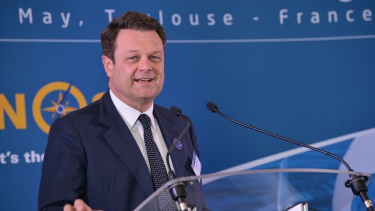
Carlo des Dorides
Carlo des Dorides has almost three decades of experience of managing space-service-focused teams. Before joining the GSA as executive director, he held key management responsibilities at the European Commission, where he was responsible for the definition of the Galileo/EGNOS exploitation phase and the EGNOS operational phase. Prior to that, Des Dorides served as chief negotiator of the Galileo PPP/Concession contract at the Galileo Joint Undertaking. In general, his career has been focused on programme management and the operation of advanced satellite systems. As director of programmes and engineering at ENAV, the Italian air navigation service provider, Des Dorides was responsible for updating the technology of Italian airports and area control centres. Before that, he worked in various management positions in the aerospace private sector, including as head of advanced telecommunication programmes for major satellite telecommunications at Alenia Spazio. Carlo des Dorides holds a degree in engineering from the University of Rome and an MBA from CUOA, Vicenza, Italy.
Fundamental Elements Programme
The GSA launched its Fundamental Elements programme, a research and development (R&D) funding mechanism supporting the development of chipsets and receivers. The programme will run until the end of 2020 and has a projected budget of EUR100 million. The main objective of the initiative is to facilitate the development of applications across different sectors of the economy and promote the development of such fundamental elements as Galileo-enabled chipsets and receivers.
The programme offers two types of financing: grants and procurement. Grants are provided with financing currently foreseen for up to 70% of the total value of the grant agreement, with intellectual property rights staying with the beneficiary (with conditions). 100%-financed procurement, on the other hand, is used only in cases where keeping intellectual property rights allows for the better fulfilment of the programme’s objectives.
Fundamental Elements is in addition to, and complements, the European Union’s Horizon 2020 research programme, which aims to foster adoption of Galileo via content and application development, and thus focuses on the integration of services provided by Galileo into devices and their commercialisation.
Market Reports
The GSA regularly publishes in-depth market research, including the GNSS Market Report, which has established itself as the go-to resource for global GNSS market intelligence, and the GNSS User Technology Report.

Value staying current with geomatics?
Stay on the map with our expertly curated newsletters.
We provide educational insights, industry updates, and inspiring stories to help you learn, grow, and reach your full potential in your field. Don't miss out - subscribe today and ensure you're always informed, educated, and inspired.
Choose your newsletter(s)


