Monitoring Czech Floods with a UAV
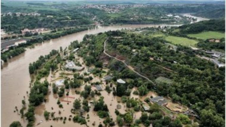
Heavy rainfall in late May and early June 2013 caused severe floods in the Czech Republic. Geodis, a leading Czech company in the fields of geodesy, photogrammetry and remote sensing, used an unmanned aerial vehicle (UAV) to monitor the impact of flooding by the River Vltava in the Czech capital of Prague as well as in the evacuated village of Hrensko on the River Elbe and the village of Kamenice on a tributary of the Elbe.
Hřensko is located between the rocks and was only accessible by water or by air. Using the UAV made it possible to carry out low flights in this terrain, which would have been impossible with a classic helicopter. In addition to the UAV, Geodis monitored the floods by classic aircrafts and a mobile mapping system to obtain comprehensive data bases for emergency crews, administrator rivers, regions and municipalities.
In late spring 2013, central Europe was hit by major flooding that spread across a large area covering parts of the Czech Republic, Germany, Austria and Switzerland following heavy rainfall. For the Czech Republic, this caused the most severe flooding since 2002. Authorities closed the famous Charles Bridge in Prague, where the Vltava River was flowing at 10 times its normal volume.

Value staying current with geomatics?
Stay on the map with our expertly curated newsletters.
We provide educational insights, industry updates, and inspiring stories to help you learn, grow, and reach your full potential in your field. Don't miss out - subscribe today and ensure you're always informed, educated, and inspired.
Choose your newsletter(s)


