Nava Asset Data Capture
CHC has introduced the Nava GPS Handheld series designed for any metre-level GPS mapping applications such as in forestry, agriculture, utilities, and local government, which mainly capture aset data. The devices are affordable, easy-to-use and provide the necessary features for data collection and mapping including point, line and area data capture, import and export to MIF and SHP format.
“The Nava GPS series is a clear sign of our commitment to further address the GIS market by offering cost effective data collection solutions to our customers,” says George Zhao, CEO of CHC. “In addition, the Nava GPS are perfectly fitting our Survey and GIS dealers’ product portfolio in combination to traditional survey-grade equipment.”
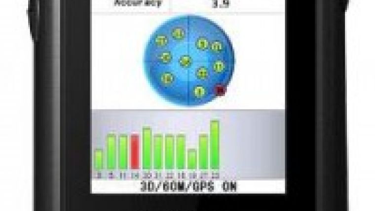
The Nava Series has an embedded 20 channels high sensitivity SIRF III chipset featuring fast satellite acquisition and reliable positioning even in harsh environment. Nava GPS provides 3-5 metres accuracy in GPS mode and up to 1-3 metres when receiving SBAS satellites corrections.

Value staying current with geomatics?
Stay on the map with our expertly curated newsletters.
We provide educational insights, industry updates, and inspiring stories to help you learn, grow, and reach your full potential in your field. Don't miss out - subscribe today and ensure you're always informed, educated, and inspired.
Choose your newsletter(s)


