New Aerial System to Capture Accurate Aerial Imagery
Draganfly Innovations, Canada, has partnered with Pix4D, Switzerland, to combine the value of a Draganflyer sUAS (small Unmanned Aerial System) with the Pix4D software package. This results in a system capable of capturing highly accurate aerial imagery for mapping, surveying and creating 3D models.
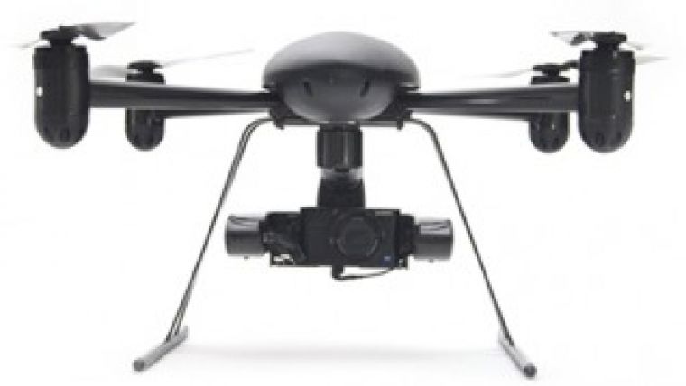
The Draganflyer Mapping Solution is a “Pro Solution Pack” from Draganfly Innovations. Included is a Draganflyer Guardian or Draganflyer X4-ES aerial platform with a high resolution 20MP 1″ sensor payload or Tetracam multispectral payload and Pix4Dmapper software.
The Draganflyer GCS (Ground Control Station) software generates pre-flight grid pattern flight plans which provide automated image overlap optimised for the Pix4Dmapper software. The system performs an automated grid search and stays within the confines of the grid to create square corners and eliminate over-flight of bordering property. The resulting images are processed by Pix4Dmapper to create first class results.
Lidar-like 3D Precision
Pix4D software converts thousands of aerial images, taken by the Draganflyer platform, into geo-referenced 2D mosaics and 3D surface models and point clouds. This processing solution combines ideas from computer vision with the accuracy of traditional photogrammetry, achieving results with survey-grade accuracy and up to centimetre-grade, Lidar-like 3D precision. Pix4Dmapper features advanced support of GCPs (Ground Control Points) for optimal geo-location and proposes both a “Full Processing” mode as well as a “Rapid Check” mode that lets you assess the quality of your acquired data while still on site. Output results can be imported seamlessly into any GIS, CAD, or traditional photogrammetry software suite.
Pix4Dmapper includes the “rayCloud”, an innovative concept that combines the 3D point cloud generated by Pix4Dmapper with the original still images for easy viewing. The rayCloud editor lets users assess, edit, interpret, and improve their results directly in the software and allows for highly accurate object annotation and project accuracy improvement.
Pro Solution Packs will be offered by Draganfly in the second quarter of 2014, with the Draganflyer Guardian system or Draganflyer X4-ES system as the platform. A customer supplied Windows laptop is required to run Pix4D software at the job site and to perform preflight planning.

Value staying current with geomatics?
Stay on the map with our expertly curated newsletters.
We provide educational insights, industry updates, and inspiring stories to help you learn, grow, and reach your full potential in your field. Don't miss out - subscribe today and ensure you're always informed, educated, and inspired.
Choose your newsletter(s)


