New FIG Publication on 3D Cadastres
Two recent publications on ‘Best Practices 3D Cadastres’ give a comprehensive overview of research, developments and implementations relating to 3D cadastres. Professor Peter van Oosterom, an authority and expert in this field, has been working in this domain for two decades. The first International Workshop on 3D was organized under his chairmanship in 2001, and the sixth edition of that workshop was held last year. Prof Van Oosterom has also chaired the FIG (International Federation of Surveyors) Working Group on 3D Cadastres – a joint Working Group of FIG Commissions 3 ‘Spatial Information Management’ and 7 ‘Cadastre and Land Management’ – for many years.
At the end of the two most recent 4-year terms (2010-2014 and 2014-2018) of the Working Group, it was decided to collect the best known practices in a single FIG publication. Key authors were invited to produce a chapter on a specific topic, as follows:
- Chapter 1: Legal foundations (Dimitrios Kitsakis)
- Chapter 2: Initial Registration of 3D Parcels (Efi Dimopoulou)
- Chapter 3: 3D Cadastral Information Modelling (Peter van Oosterom)
- Chapter 4: 3D Spatial DBMS for 3D Cadastres (Karel Janečka)
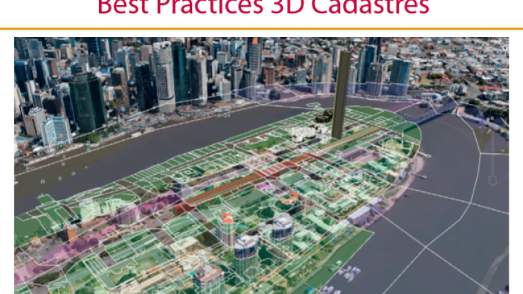
- Chapter 5: Visualization and New Opportunities (Jacynthe Pouliot)
The lead authors each teamed up with a group of authors to produce their chapters. A lot of inspiration was found in FIG’s earlier 3D cadastre activities. Based on the long version, a shorter version of about 80 pages has also been produced and published. The short version is available as a FIG publication both as a hard copy (paper) and soft copy (online PDF). The long version is published in soft-copy format and in the style of the FIG proceedings.
In the preface, Chryssy Potsiou, FIG president 2015-18, writes: “This publication is a further contribution of FIG in this ongoing process of improving land administration systems. It responds to the need for international research in building effective land administration infrastructures with modern information technology that will support the 2030 global policy goals for sustainable development. This study takes into account the recent developments that have taken place, and I hope that it will lead to a better understanding of the concept of a 3D cadastre”.
More Information
FIG Publication No. 72, Best Practices 3D Cadastres, is available here.
The extended version is available here.

Value staying current with geomatics?
Stay on the map with our expertly curated newsletters.
We provide educational insights, industry updates, and inspiring stories to help you learn, grow, and reach your full potential in your field. Don't miss out - subscribe today and ensure you're always informed, educated, and inspired.
Choose your newsletter(s)


