New Leica Sensor Brings Efficiency to Airborne Lidar Mapping
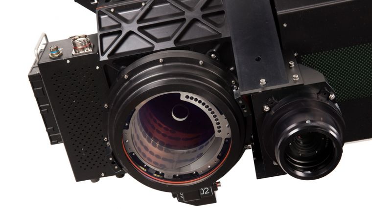
Leica Geosystems has announced the release of the Leica SPL100 as part of the RealTerrain reality capture solution. It enables airborne professionals to more efficiently collect and process Lidar data of large areas, day or night and in leaf-on or leaf-off conditions.
Combining the SPL100 single photon Lidar (SPL) and imaging sensor with Leica HxMap, the scalable post-processing workflow software, RealTerrain enables the efficient collection and rapid processing of large-area Lidar datasets. the SPL100 is able to collect 6 million points per second with 100 output beams, and HxMap provides a complete single-interface post-processing platform to create industry standard Lidar and image data products. The efficiency gained by SPL100 acquisition and HxMap data processing enables larger and more frequent Lidar data acquisition for applications such as dense vegetation mapping and change detection.
From Space to Earth
SPL100 is the first sensor to be released by Leica Geosystems using Sigma Space technology since its acquisition by Hexagon last year. This new and innovative technology was originally developed in collaboration with NASA. Single Photon Lidar technology will launch on its first space application, the Ice, Cloud and land Elevation Satellite-2 (ICESat-2), used to measure the elevation of Earth’s ice, in 2018.
The SPL100 is the ideal sensor for the Hexagon Elevation Program (HxEP). Announced in 2016 using SPL technology, the HxEP is the partnering programme democratising high precision elevation data for a wider audience, such as those working in disaster planning, precision agriculture and infrastructure design.
SPL technology brings up to 10 times the efficiency of prior offerings to Leica’s flying partners and customers. It is now possible to deliver extremely high point densities over large areas, enabling the digitisation of the world around us in detail previously not possible, said John Welter, Leica Geosystems Content and Engineering Services and Geospatial Solutions Division president. Leica RealTerrain is the next evolution in providing high quality airborne information; both advancing the field and shaping the future of digital realities, he added.
For more information about Leica SPL100, please visit leica-geosystems.com/spl100
For more information about Leica RealTerrain, please visit leica-geosystems.com/realterrain

Value staying current with geomatics?
Stay on the map with our expertly curated newsletters.
We provide educational insights, industry updates, and inspiring stories to help you learn, grow, and reach your full potential in your field. Don't miss out - subscribe today and ensure you're always informed, educated, and inspired.
Choose your newsletter(s)


