New Tasmanian Digital Elevation Model
This article was originally published in Geomatics World.
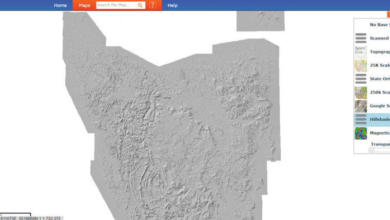
A beta version Digital Elevation Model (DEM) has been constructed for Tasmania (Australia) by MRT geoscientists Dr Claire Kain and Colin Mazengarb, including the most recent Lidar imagery captured during the 2018-19 flying season. With nearly 60% of the state now covered by Lidar, the new dataset provides an increasingly clear view of the landscape that has many applications.
The dataset was compiled initially to support two major projects being undertaken by MRT (Mineral Resources Tasmania) and other government agencies. However, as with the previous elevation model (created by the former Forestry Tasmania and shown as a hillshade image on the LIST website), the new hillshade alone provides powerful insights into the nature and origin of the landscape that is proving to be a very popular basemap.
Computational challenge
There are many geological features that are now exposed with the benefit of Lidar, such as geological structures, glacial moraines and landslides that were previously hidden under forest canopy. As indicated above, the DEM (bare earth model) is a beta version. However, it is anticipated that regular updates will follow as further elevation data becomes available. Creating the layer has been a massive computational challenge as each iteration requires considerable processing time to produce.
The Hillshade model is now available as a basemap on the MRT map viewer and serves as a WMS layer (see instructions on the website) that can be freely consumed by a GIS. Users are kindly asked to notify the MRT geoscientists of any issues that may have been missed to help them improve the next version. The current DEM has been compiled at 10m resolution and is a combination of Lidar and, where absent, conventional photogrammetric data. All the Lidar is freely available as 1km tiles (in native LAS and as bare earth DEM formats) from the ELVIS website maintained by Geoscience Australia. A 1m resolution DEM will be created in the near future.

Value staying current with geomatics?
Stay on the map with our expertly curated newsletters.
We provide educational insights, industry updates, and inspiring stories to help you learn, grow, and reach your full potential in your field. Don't miss out - subscribe today and ensure you're always informed, educated, and inspired.
Choose your newsletter(s)


